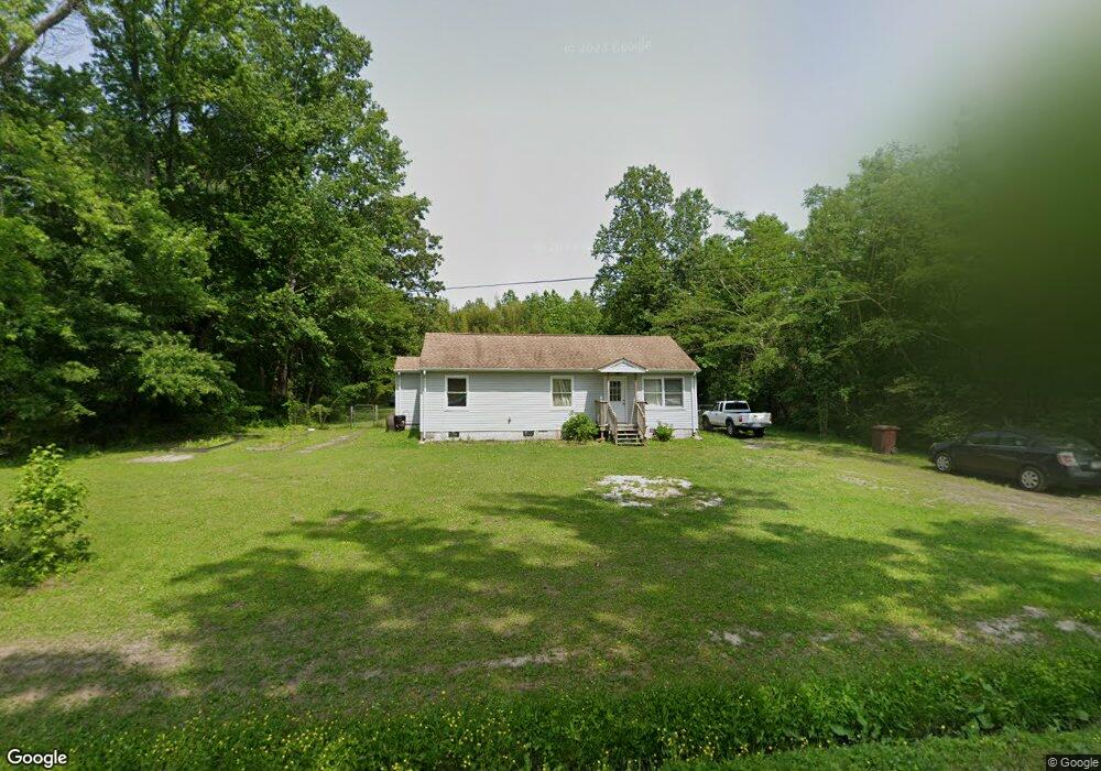
2617 Seven Eleven Rd Chesapeake, VA 23322
Pleasant Grove West NeighborhoodEstimated Value: $337,000 - $447,000
2
Beds
2
Baths
992
Sq Ft
$386/Sq Ft
Est. Value
About This Home
This home is located at 2617 Seven Eleven Rd, Chesapeake, VA 23322 and is currently estimated at $383,379, approximately $386 per square foot. 2617 Seven Eleven Rd is a home located in Chesapeake City with nearby schools including Grassfield Elementary School, Hugo a Owens Middle, and Grassfield High School.
Ownership History
Date
Name
Owned For
Owner Type
Purchase Details
Closed on
Mar 16, 2022
Sold by
Wood Denise D
Bought by
Williams Clinton
Current Estimated Value
Home Financials for this Owner
Home Financials are based on the most recent Mortgage that was taken out on this home.
Original Mortgage
$306,900
Outstanding Balance
$286,516
Interest Rate
3.85%
Mortgage Type
VA
Estimated Equity
$96,863
Purchase Details
Closed on
Sep 3, 2015
Sold by
Kuzmich Trustee John Nathaniel
Bought by
Wood Denise D
Home Financials for this Owner
Home Financials are based on the most recent Mortgage that was taken out on this home.
Original Mortgage
$207,636
Interest Rate
4.5%
Mortgage Type
FHA
Create a Home Valuation Report for This Property
The Home Valuation Report is an in-depth analysis detailing your home's value as well as a comparison with similar homes in the area
Home Values in the Area
Average Home Value in this Area
Purchase History
| Date | Buyer | Sale Price | Title Company |
|---|---|---|---|
| Williams Clinton | $300,000 | Fidelity National Title | |
| Wood Denise D | $121,500 | None Available |
Source: Public Records
Mortgage History
| Date | Status | Borrower | Loan Amount |
|---|---|---|---|
| Open | Williams Clinton | $306,900 | |
| Previous Owner | Wood Denise D | $207,636 |
Source: Public Records
Tax History Compared to Growth
Tax History
| Year | Tax Paid | Tax Assessment Tax Assessment Total Assessment is a certain percentage of the fair market value that is determined by local assessors to be the total taxable value of land and additions on the property. | Land | Improvement |
|---|---|---|---|---|
| 2025 | $3,470 | $362,600 | $235,000 | $127,600 |
| 2024 | $3,470 | $343,600 | $215,000 | $128,600 |
| 2023 | $2,790 | $300,400 | $185,000 | $115,400 |
| 2022 | $2,842 | $281,400 | $165,000 | $116,400 |
| 2021 | $2,440 | $232,400 | $135,000 | $97,400 |
| 2020 | $2,384 | $227,000 | $135,000 | $92,000 |
| 2019 | $2,243 | $213,600 | $120,000 | $93,600 |
| 2018 | $2,064 | $196,600 | $120,000 | $76,600 |
| 2017 | $2,012 | $191,600 | $120,000 | $71,600 |
| 2016 | $2,012 | $191,600 | $120,000 | $71,600 |
| 2015 | $1,967 | $187,300 | $120,000 | $67,300 |
| 2014 | $1,967 | $187,300 | $120,000 | $67,300 |
Source: Public Records
Map
Nearby Homes
- 3 AC Seven Eleven Rd
- parcel Seven Eleven Rd
- 2701 Seven Eleven Rd
- 3725 Cornland Rd
- Par B George Washington Hwy S
- 2532 Wild Horse Ridge
- 2913 Lake Drummond Causeway
- 2652 Benefit Rd
- MM Bellhaven-Multi-gen
- 2.5AC George Washington Hwy S
- 2068 Shillelagh Rd
- 2237 Shillelagh Rd
- 4792 Ballahack Rd
- 2321 Shillelagh Rd
- 1917 Hallmark Way
- 10 AC Millville Rd
- MM Magnolia
- Lots Moses Grandy ( Par B C D) Trail
- 1436 West Rd
- 1517 Lookout Ct
- 2616 Seven Eleven Rd
- 2605 Seven Eleven Rd
- 2633 Seven Eleven Rd
- 2632 Seven Eleven Rd
- 5 AC Seven Eleven Rd
- Lot 1 Seven Eleven Rd
- 0 Seven Eleven Rd
- 5AC Seven Eleven Rd
- MM Seven Eleven Rd
- MM Dogwood at Seven Eleven Rd
- MM Birch @ Seven Eleven Rd
- 2.97AC Seven Eleven Rd
- 2640 Seven Eleven Rd
- 2645 Seven Eleven Rd
- 2626 Seven Eleven Rd
- 2536 Seven Eleven Rd
- 2534 Seven Eleven Rd
- 2608 Seven Eleven Rd
- 2312 Woodhurst Ln
- 2525 Seven Eleven Rd