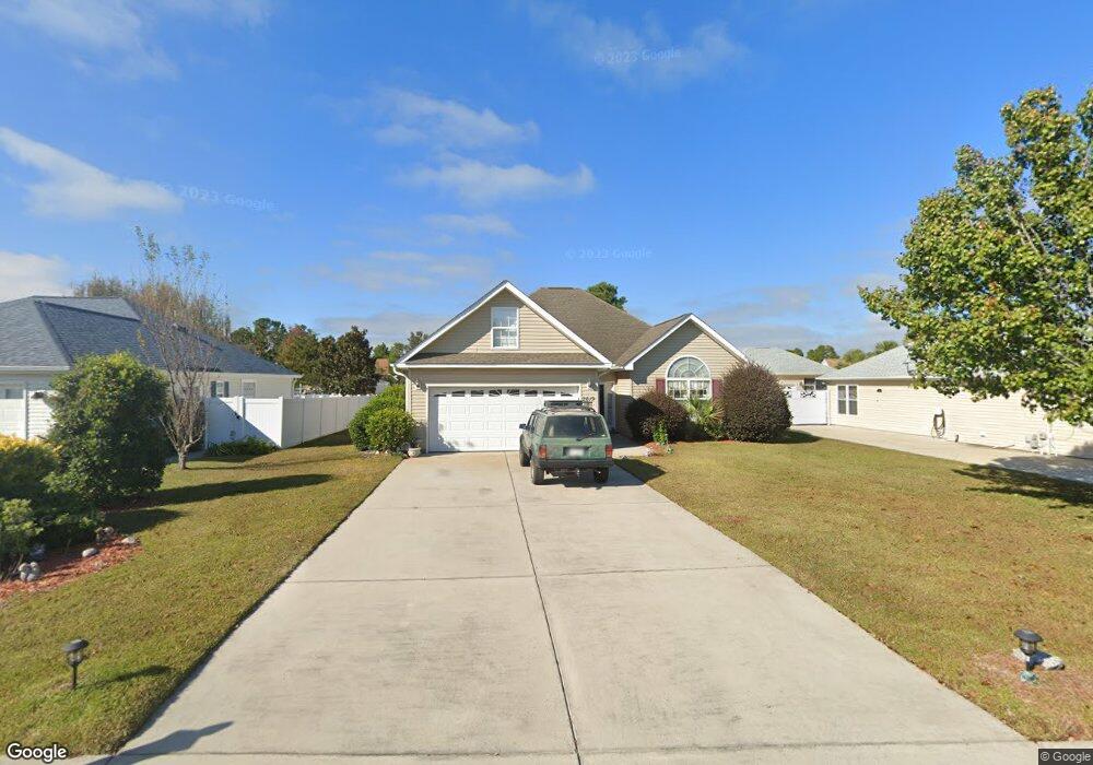
2619 Corn Pile Rd Myrtle Beach, SC 29588
Estimated Value: $327,407 - $354,000
3
Beds
2
Baths
1,887
Sq Ft
$179/Sq Ft
Est. Value
About This Home
This home is located at 2619 Corn Pile Rd, Myrtle Beach, SC 29588 and is currently estimated at $337,852, approximately $179 per square foot. 2619 Corn Pile Rd is a home located in Horry County with nearby schools including Forestbrook Elementary School, Forestbrook Middle School, and Socastee High School.
Ownership History
Date
Name
Owned For
Owner Type
Purchase Details
Closed on
May 16, 2006
Sold by
Martino James M and Martino Nicole M
Bought by
Monroe William and Monroe Susan
Current Estimated Value
Purchase Details
Closed on
Oct 10, 2003
Sold by
Hunters Ridge Of Myrtle Beach Inc
Bought by
Martino James M and Martino Nicole M
Home Financials for this Owner
Home Financials are based on the most recent Mortgage that was taken out on this home.
Original Mortgage
$23,120
Interest Rate
6.16%
Mortgage Type
Purchase Money Mortgage
Create a Home Valuation Report for This Property
The Home Valuation Report is an in-depth analysis detailing your home's value as well as a comparison with similar homes in the area
Home Values in the Area
Average Home Value in this Area
Purchase History
| Date | Buyer | Sale Price | Title Company |
|---|---|---|---|
| Monroe William | $238,000 | None Available | |
| Martino James M | $28,900 | -- |
Source: Public Records
Mortgage History
| Date | Status | Borrower | Loan Amount |
|---|---|---|---|
| Previous Owner | Martino James M | $23,120 |
Source: Public Records
Tax History
| Year | Tax Paid | Tax Assessment Tax Assessment Total Assessment is a certain percentage of the fair market value that is determined by local assessors to be the total taxable value of land and additions on the property. | Land | Improvement |
|---|---|---|---|---|
| 2025 | $2,554 | $0 | $0 | $0 |
| 2024 | $2,554 | $12,893 | $4,000 | $8,893 |
| 2023 | $2,554 | $10,659 | $1,569 | $9,090 |
| 2021 | $2,357 | $7,325 | $1,185 | $6,140 |
| 2020 | $2,231 | $7,325 | $1,185 | $6,140 |
| 2019 | $2,231 | $7,325 | $1,185 | $6,140 |
| 2018 | $2,016 | $6,179 | $895 | $5,284 |
| 2017 | $2,001 | $6,179 | $895 | $5,284 |
| 2016 | -- | $6,179 | $895 | $5,284 |
| 2015 | $2,001 | $6,180 | $896 | $5,284 |
| 2014 | $1,934 | $6,180 | $896 | $5,284 |
Source: Public Records
Map
Nearby Homes
- 2540 Bearstand Trail
- 2463 Hunters Trail
- 2459 Hunters Trail
- 2560 Wild Game Trail Unit Hunters Ridge
- 281 La Patos Dr
- 2425 Hunters Trail
- 3845 Camden Dr
- 4121 Whatuthink Rd
- 780 Harrison Mill St
- 3007 Visionary Dr
- 2410 Hunters Trail
- 3312 Piney Woods Way
- 621 Cottontail Trail
- 629 Cottontail Trail Unit Hunters Ridge Crossi
- 6096 Zoe Way Unit 819
- 6108 Zoe Way Unit 822
- 6100 Zoe Way Unit 820
- 837 Harrison Mill St
- 3217 Shadowpine Ct
- 125 Marsh Rabbit Dr
- 2617 Corn Pile Rd
- 2615 Corn Pile Rd
- 2717 Canvasback Trail
- 2719 Canvasback Trail
- 2715 Canvasback Trail
- 2618 Corn Pile Rd
- 2620 Corn Pile Rd
- 2721 Canvasback Trail
- 2713 Canvasback Trail
- 2625 Corn Pile Rd
- 2625 Corn Pile Rd
- 2616 Corn Pile Rd
- 2622 Corn Pile Rd
- 2613 Corn Pile Rd
- 2711 Canvasback Trail
- 2624 Corn Pile Rd
- LOT 182 Canvasback Trail
- 2614 Corn Pile Rd
- 2627 Corn Pile Rd
- 2725 Canvasback Trail