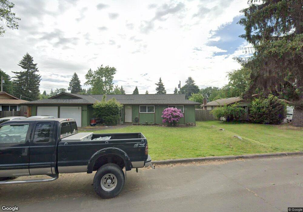
2619 York St Eugene, OR 97404
Santa Clara NeighborhoodEstimated Value: $348,000 - $423,000
3
Beds
1
Bath
1,132
Sq Ft
$337/Sq Ft
Est. Value
About This Home
This home is located at 2619 York St, Eugene, OR 97404 and is currently estimated at $381,919, approximately $337 per square foot. 2619 York St is a home located in Lane County with nearby schools including Spring Creek Elementary School, Madison Middle School, and North Eugene High School.
Ownership History
Date
Name
Owned For
Owner Type
Purchase Details
Closed on
Sep 26, 2025
Sold by
Cannard William
Bought by
Cannard Living Trust and Cannard
Current Estimated Value
Purchase Details
Closed on
May 21, 1999
Sold by
Robinson Mark B and Neske Robinson Dana S
Bought by
Cannard William and Cannard Joan
Create a Home Valuation Report for This Property
The Home Valuation Report is an in-depth analysis detailing your home's value as well as a comparison with similar homes in the area
Home Values in the Area
Average Home Value in this Area
Purchase History
| Date | Buyer | Sale Price | Title Company |
|---|---|---|---|
| Cannard Living Trust | -- | None Listed On Document | |
| Cannard William | -- | None Listed On Document | |
| Cannard William | $115,000 | Cascade Title Co |
Source: Public Records
Tax History
| Year | Tax Paid | Tax Assessment Tax Assessment Total Assessment is a certain percentage of the fair market value that is determined by local assessors to be the total taxable value of land and additions on the property. | Land | Improvement |
|---|---|---|---|---|
| 2025 | $2,528 | $197,546 | -- | -- |
| 2024 | $2,515 | $191,793 | -- | -- |
| 2023 | $2,515 | $186,207 | $0 | $0 |
| 2022 | $2,364 | $180,784 | $0 | $0 |
| 2021 | $2,169 | $175,519 | $0 | $0 |
| 2020 | $2,210 | $170,407 | $0 | $0 |
| 2019 | $2,111 | $165,444 | $0 | $0 |
| 2018 | $1,906 | $155,948 | $0 | $0 |
| 2017 | $1,747 | $155,948 | $0 | $0 |
| 2016 | $1,631 | $151,406 | $0 | $0 |
| 2015 | $1,571 | $146,996 | $0 | $0 |
| 2014 | $1,468 | $142,715 | $0 | $0 |
Source: Public Records
Map
Nearby Homes
- 2563 York St
- 541 Durham Ave
- 2721 La Darrah St
- 805 Impala Ave
- 349 Irving Rd
- 303 Lenore Loop
- 2488 Northampton
- 200 Irving Rd
- 215 Jonquil Ave
- 2439 Quince St
- 401 Sterling Dr
- 193 Santa Clara Ave
- 2987 Dry Creek Rd
- 2965 Teal Place
- 2610 Crowther Dr
- 2580 Crowther Dr
- 2931 Shelby Way
- 3256 Marvin Dr
- 1307 Bramblewood Ln
- 1755 Brentwood Ave
Your Personal Tour Guide
Ask me questions while you tour the home.