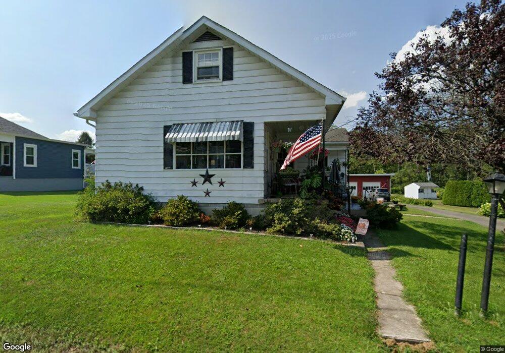
262 Ashtown Dr Lehighton, PA 18235
Estimated Value: $278,000 - $336,000
About This Home
This home is located at 262 Ashtown Dr, Lehighton, PA 18235 and is currently estimated at $306,313, approximately $179 per square foot. 262 Ashtown Dr is a home located in Carbon County with nearby schools including Lehighton Area High School, Sts. Peter & Paul School, and Valley Ridge Academy.
Ownership History
We collect this data history from publicly available records. To have your information removed, we recommend requesting removal directly through your county’s website.
Purchase Details
Purchase Details
Purchase Details
Purchase Details
Home Values in the Area
Average Home Value in this Area
Purchase History
We collect this data history from publicly available records. To have your information removed, we recommend requesting removal directly through your county’s website.
| Date | Buyer | Sale Price | Title Company |
|---|---|---|---|
| $33,078 | Attorney | ||
| $13,078 | None Available | ||
| -- | None Available | ||
| -- | -- |
Tax History
We collect this data history from publicly available records. To have your information removed, we recommend requesting removal directly through your county’s website.
| Year | Tax Paid | Tax Assessment Tax Assessment Total Assessment is a certain percentage of the fair market value that is determined by local assessors to be the total taxable value of land and additions on the property. | Land | Improvement |
|---|---|---|---|---|
| 2026 | $4,243 | $55,450 | $7,800 | $47,650 |
| 2025 | $4,243 | $55,450 | $7,800 | $47,650 |
| 2024 | $4,076 | $55,450 | $7,800 | $47,650 |
| 2023 | $4,035 | $55,450 | $7,800 | $47,650 |
| 2022 | $3,979 | $55,450 | $7,800 | $47,650 |
| 2021 | $3,862 | $55,450 | $7,800 | $47,650 |
| 2020 | $3,764 | $55,450 | $7,800 | $47,650 |
| 2019 | $3,570 | $55,450 | $7,800 | $47,650 |
| 2018 | $3,528 | $55,450 | $7,800 | $47,650 |
| 2017 | $3,528 | $55,450 | $7,800 | $47,650 |
| 2016 | -- | $55,450 | $7,800 | $47,650 |
| 2015 | -- | $55,450 | $7,800 | $47,650 |
| 2014 | -- | $55,450 | $7,800 | $47,650 |
Map
- 0 Ashtown Dr Unit PM-142335
- 0 Ashtown Dr Unit PACC2007782
- 0 Ashtown Dr Unit 779241
- 0 Fredericks Grove Rd Unit 777926
- 0 Fredericks Grove Rd Unit PACC2007682
- 0 Fredericks Grove Rd Unit PACC2007778
- 130 S 7th St
- 417 S 3rd St
- 929 Coal St
- 154 156 S Fourth St
- 154 S 4th St Unit 156
- 122 N 4th St
- 1158 Upper Nis Hollow Dr
- 1145 Upper Nis Hollow Dr
- 429 Coal St
- 438 Coal St
- 135 S 2nd St
- 0 Pine Hollow Dr Unit PM-141730
- 0 Pine Hollow Dr Unit 777906
- 137 N 3rd St
Ask me questions while you tour the home.