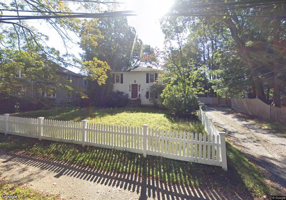
262 Brookline St Needham, MA 02492
Estimated Value: $1,259,000 - $1,696,000
4
Beds
2
Baths
2,800
Sq Ft
$504/Sq Ft
Est. Value
About This Home
This home is located at 262 Brookline St, Needham, MA 02492 and is currently estimated at $1,411,820, approximately $504 per square foot. 262 Brookline St is a home located in Norfolk County with nearby schools including Mitchell Elementary School, High Rock Middle School, and Pollard Middle School.
Ownership History
Date
Name
Owned For
Owner Type
Purchase Details
Closed on
Apr 23, 2009
Sold by
Patel Avignat S and Patel Purvi A
Bought by
Sangar Ismail M and Altug-Sangar Hande
Current Estimated Value
Home Financials for this Owner
Home Financials are based on the most recent Mortgage that was taken out on this home.
Original Mortgage
$400,000
Outstanding Balance
$252,728
Interest Rate
4.93%
Mortgage Type
Purchase Money Mortgage
Estimated Equity
$1,159,092
Purchase Details
Closed on
Mar 26, 2004
Sold by
Rlt Rockwood Colonials and Curatola Robert
Bought by
Patel Avignat S and Patel Purvi A
Home Financials for this Owner
Home Financials are based on the most recent Mortgage that was taken out on this home.
Original Mortgage
$422,400
Interest Rate
5.65%
Mortgage Type
Purchase Money Mortgage
Purchase Details
Closed on
Nov 1, 2002
Sold by
New Beginnings Irt
Bought by
Rockwood Colonials Rt
Home Financials for this Owner
Home Financials are based on the most recent Mortgage that was taken out on this home.
Original Mortgage
$400,000
Interest Rate
6.09%
Mortgage Type
Purchase Money Mortgage
Create a Home Valuation Report for This Property
The Home Valuation Report is an in-depth analysis detailing your home's value as well as a comparison with similar homes in the area
Home Values in the Area
Average Home Value in this Area
Purchase History
| Date | Buyer | Sale Price | Title Company |
|---|---|---|---|
| Sangar Ismail M | $604,000 | -- | |
| Patel Avignat S | $528,000 | -- | |
| Rockwood Colonials Rt | $417,000 | -- |
Source: Public Records
Mortgage History
| Date | Status | Borrower | Loan Amount |
|---|---|---|---|
| Open | Sangar Ismail M | $400,000 | |
| Previous Owner | Patel Avignat S | $422,400 | |
| Previous Owner | Rockwood Colonials Rt | $400,000 |
Source: Public Records
Tax History
| Year | Tax Paid | Tax Assessment Tax Assessment Total Assessment is a certain percentage of the fair market value that is determined by local assessors to be the total taxable value of land and additions on the property. | Land | Improvement |
|---|---|---|---|---|
| 2025 | $11,236 | $1,060,000 | $786,700 | $273,300 |
| 2024 | $10,369 | $828,200 | $579,100 | $249,100 |
| 2023 | $10,553 | $809,300 | $579,100 | $230,200 |
| 2022 | $9,807 | $733,500 | $512,500 | $221,000 |
| 2021 | $9,558 | $733,500 | $512,500 | $221,000 |
| 2020 | $9,271 | $742,300 | $512,800 | $229,500 |
| 2019 | $8,586 | $693,000 | $466,200 | $226,800 |
| 2018 | $8,216 | $691,600 | $466,200 | $225,400 |
| 2017 | $7,880 | $662,700 | $466,200 | $196,500 |
| 2016 | $7,672 | $664,800 | $466,200 | $198,600 |
| 2015 | $7,506 | $664,800 | $466,200 | $198,600 |
| 2014 | $6,774 | $582,000 | $388,500 | $193,500 |
Source: Public Records
Map
Nearby Homes
- 11 Holmes St
- 14 Melrose Ave
- 66 Upland Rd
- 190 Brookline St
- 638 Webster St
- 638 Webster St Unit 638
- 674 Webster St
- 17 Lindbergh Ave
- 510 Webster St
- 36 Otis St Unit 36
- 68 Brookline St
- 383 Manning St
- 55 Burnside Rd
- 176 Highgate St
- 24 Mellen St
- 19 Oakland Ave Unit 19
- 58 Morton St
- 7 West St
- 31 Birds Hill Ave
- 78 Birds Hill Ave
- 256 Brookline St
- 268 Brookline St
- 3 Holmes St
- 7 Upland Rd
- 7 Upland Rd Unit 7
- 7 Upland Terrace
- 7 Upland Terrace Unit 7
- 7 Upland Terrace
- 7 Upland Terrace Unit 1
- 3 Upland Rd
- 276 Brookline St
- 21 Upland Rd
- 251 Brookline St
- 29 Upland Rd
- 277 Brookline St
- 245 Brookline St
- 35 Upland Rd
- 288 Brookline St
- 30 Upland Rd
- 234 Brookline St
Your Personal Tour Guide
Ask me questions while you tour the home.