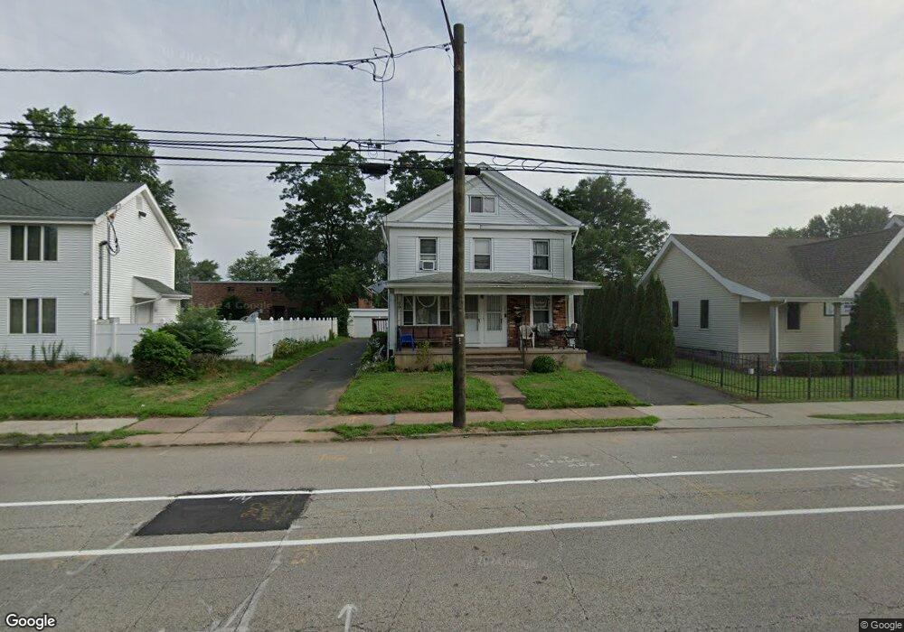
262 Burnside Ave East Hartford, CT 06108
Estimated Value: $346,824 - $400,000
--
Bed
3
Baths
2,488
Sq Ft
$153/Sq Ft
Est. Value
About This Home
This home is located at 262 Burnside Ave, East Hartford, CT 06108 and is currently estimated at $379,956, approximately $152 per square foot. 262 Burnside Ave is a home located in Hartford County with nearby schools including Dr. John A. Langford School, East Hartford Middle School, and East Hartford High School.
Ownership History
Date
Name
Owned For
Owner Type
Purchase Details
Closed on
May 10, 2005
Sold by
Nguyen Thuong T
Bought by
Nguyen Nhan D
Current Estimated Value
Home Financials for this Owner
Home Financials are based on the most recent Mortgage that was taken out on this home.
Original Mortgage
$65,000
Interest Rate
5%
Mortgage Type
Commercial
Purchase Details
Closed on
Jul 31, 2002
Sold by
Gurciullo Mario
Bought by
Nguyen Thuong T
Create a Home Valuation Report for This Property
The Home Valuation Report is an in-depth analysis detailing your home's value as well as a comparison with similar homes in the area
Home Values in the Area
Average Home Value in this Area
Purchase History
| Date | Buyer | Sale Price | Title Company |
|---|---|---|---|
| Nguyen Nhan D | $111,000 | -- | |
| Nguyen Thuong T | $101,000 | -- |
Source: Public Records
Mortgage History
| Date | Status | Borrower | Loan Amount |
|---|---|---|---|
| Closed | Nguyen Thuong T | $65,000 |
Source: Public Records
Tax History Compared to Growth
Tax History
| Year | Tax Paid | Tax Assessment Tax Assessment Total Assessment is a certain percentage of the fair market value that is determined by local assessors to be the total taxable value of land and additions on the property. | Land | Improvement |
|---|---|---|---|---|
| 2025 | $9,969 | $217,180 | $35,420 | $181,760 |
| 2024 | $9,556 | $217,180 | $35,420 | $181,760 |
| 2023 | $9,239 | $217,180 | $35,420 | $181,760 |
| 2022 | $8,904 | $217,180 | $35,420 | $181,760 |
| 2021 | $6,346 | $128,590 | $26,830 | $101,760 |
| 2020 | $6,419 | $128,590 | $26,830 | $101,760 |
| 2019 | $6,315 | $128,590 | $26,830 | $101,760 |
| 2018 | $6,129 | $128,590 | $26,830 | $101,760 |
| 2017 | $6,050 | $128,590 | $26,830 | $101,760 |
| 2016 | $5,891 | $128,460 | $26,830 | $101,630 |
| 2015 | $5,891 | $128,460 | $26,830 | $101,630 |
| 2014 | $5,832 | $128,460 | $26,830 | $101,630 |
Source: Public Records
Map
Nearby Homes
- 265 Burnside Ave
- 10 Kenyon Place
- 30 Oakwood St
- 181 Burnside Ave
- 85R Olmsted St
- 98 Olmsted St
- 453 Burnside Ave
- 51 Daniel St
- 506 Burnside Ave
- 509 Burnside Ave Unit A18
- 52 Burnside Ave
- 67 Laurel St
- 1589 Main St
- 47 Elm St
- 15 Michael Ave
- 41 Bissell St
- 421 Tolland St
- 421 Tolland St Unit 209
- 89 Henderson Dr
- 22 Matthew Rd
- 11 Ann St
- 251 Burnside Ave
- 254 Burnside Ave
- 255 Burnside Ave
- 261 Burnside Ave
- 15 Ann St
- 18 Signor St
- 269 Burnside Ave
- 244 Burnside Ave
- 236 Burnside Ave
- 247 Burnside Ave
- 274 Burnside Ave Unit 276
- 21 Ann St
- 9 Signor St Unit 5
- 9 Signor St Unit 12
- 275 Burnside Ave
- 12 Ann St
- 25 Ann St
- 18 Ann St Unit 20
- 14 Ann St