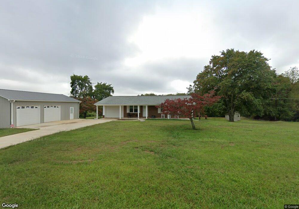
262 Cleo Cain Rd Pilot Mountain, NC 27041
Estimated Value: $271,000 - $396,000
About This Home
This home is located at 262 Cleo Cain Rd, Pilot Mountain, NC 27041 and is currently estimated at $319,850, approximately $312 per square foot. 262 Cleo Cain Rd is a home with nearby schools including Westfield Elementary School, Pilot Mountain Middle School, and East Surry High School.
Ownership History
We collect this data history from publicly available records. To have your information removed, we recommend requesting removal directly through your county’s website.
Purchase Details
Home Financials for this Owner
Home Financials are based on the most recent Mortgage that was taken out on this home.Purchase Details
Purchase History
We collect this data history from publicly available records. To have your information removed, we recommend requesting removal directly through your county’s website.
| Date | Buyer | Sale Price | Title Company |
|---|---|---|---|
| $375,000 | None Listed On Document | ||
| $195,000 | Rovster And Ro Ster Pllc |
Mortgage History
We collect this data history from publicly available records. To have your information removed, we recommend requesting removal directly through your county’s website.
| Date | Status | Borrower | Loan Amount |
|---|---|---|---|
| Open | $335,000 |
Tax History
We collect this data history from publicly available records. To have your information removed, we recommend requesting removal directly through your county’s website.
| Year | Tax Paid | Tax Assessment Tax Assessment Total Assessment is a certain percentage of the fair market value that is determined by local assessors to be the total taxable value of land and additions on the property. | Land | Improvement |
|---|---|---|---|---|
| 2025 | $1,595 | $257,810 | $131,980 | $125,830 |
| 2024 | $1,374 | $203,750 | $108,820 | $94,930 |
| 2023 | $1,279 | $203,750 | $108,820 | $94,930 |
| 2022 | $1,279 | $192,300 | $108,820 | $83,480 |
| 2021 | $1,164 | $171,390 | $108,820 | $62,570 |
| 2020 | $1,075 | $152,870 | $92,620 | $60,250 |
| 2019 | $1,072 | $152,870 | $0 | $0 |
| 2018 | $1,032 | $152,870 | $0 | $0 |
| 2017 | $1,016 | $152,870 | $0 | $0 |
| 2016 | $1,016 | $152,870 | $0 | $0 |
| 2013 | -- | $146,990 | $0 | $0 |
Map
- 310 Jessup Grove Church Rd
- 100-186 Jessup Grove Church Rd Unit 3.9 +/- AC tract
- 552 Tom Hunter Rd
- 1096-1238 Cook School Rd Unit 97+/- AC Tract
- 446 Gilley Rd
- 2093 Cook School Rd
- 2101 Cook School Rd
- 378 Bright Hill Ln
- TBD Ingleside Way
- TBD Ingleside Way
- 254 Toms Creek Church Rd
- 383 Simmons Rd
- TBD Eddington Ln
- TBD Eddington Ln
- 274 Echo Hollar Rd
- 6618 Westfield Rd
- 00 Brickhaven Ln
- 000 Echo Hollar Rd
- 00 Holly Springs Rd
- TBD Marbury Trail
- 241 Cleo Cain Rd
- 302 Cleo Cain Rd
- 215 Cleo Cain Rd
- 403 Jessup Grove Church Rd
- 137 Oak Tree Trail
- 355 Cleo Cain Rd
- 185 Cleo Cain Rd
- 113 Oak Tree Trail
- 141 Cleo Cain Rd
- 479 Jessup Grove Church Rd
- 411 Cleo Cain Rd
- 503 Jessup Grove Church Rd
- 133 Cleo Cain Rd
- 437 Cleo Cain Rd
- 414 Cleo Cain Rd
- 113 Cleo Cain Rd
- TBD Jessup Grove Church Rd
- 400 Jessup Grove
- 1.22 Ac Jessup Grove Church Rd
- 400 Jessup Grove Church Rd
Ask me questions while you tour the home.