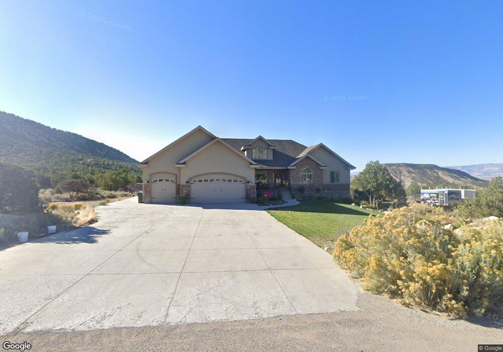
262 E Kestrel Ln Kenilworth, UT 84529
Estimated Value: $641,000 - $767,258
6
Beds
5
Baths
4,346
Sq Ft
$162/Sq Ft
Est. Value
About This Home
This home is located at 262 E Kestrel Ln, Kenilworth, UT 84529 and is currently estimated at $704,129, approximately $162 per square foot. 262 E Kestrel Ln is a home located in Carbon County with nearby schools including Castle Heights School, Mont Harmon Junior High School, and Carbon High School.
Ownership History
Date
Name
Owned For
Owner Type
Purchase Details
Closed on
Sep 7, 2021
Sold by
Rondinelli Vincent R and Rondinelli Vincent Robert
Bought by
Ware Nikki
Current Estimated Value
Purchase Details
Closed on
Mar 25, 2019
Sold by
Rondinelli Vincent Robert
Bought by
Rondinelli Nikki Diane
Purchase Details
Closed on
Mar 13, 2015
Sold by
Kulow Kyle and Kulow Micah
Bought by
Federal Home Loan Mortgage Corporation
Purchase Details
Closed on
Jul 5, 2006
Sold by
Kenilworth Development Co Llc
Bought by
Kulow Kyle and Kulow Micah
Create a Home Valuation Report for This Property
The Home Valuation Report is an in-depth analysis detailing your home's value as well as a comparison with similar homes in the area
Home Values in the Area
Average Home Value in this Area
Purchase History
| Date | Buyer | Sale Price | Title Company |
|---|---|---|---|
| Ware Nikki | -- | South Eastern Utah Title Co | |
| Ware Nikki | -- | South Eastern Utah Title Co | |
| Rondinelli Nikki Diane | -- | None Available | |
| Federal Home Loan Mortgage Corporation | $311,702 | None Available | |
| Kulow Kyle | -- | Proffessional Title Services |
Source: Public Records
Tax History Compared to Growth
Tax History
| Year | Tax Paid | Tax Assessment Tax Assessment Total Assessment is a certain percentage of the fair market value that is determined by local assessors to be the total taxable value of land and additions on the property. | Land | Improvement |
|---|---|---|---|---|
| 2025 | $7,083 | $515,994 | $79,062 | $436,932 |
| 2024 | $5,067 | $391,919 | $55,550 | $336,369 |
| 2023 | $5,582 | $458,022 | $56,283 | $401,739 |
| 2022 | $4,873 | $361,952 | $48,122 | $313,831 |
| 2021 | $4,504 | $530,722 | $70,560 | $460,162 |
| 2020 | $3,952 | $236,751 | $0 | $0 |
| 2019 | $2,889 | $211,643 | $0 | $0 |
| 2018 | $2,810 | $213,275 | $0 | $0 |
| 2017 | $3,189 | $243,868 | $0 | $0 |
| 2016 | $2,829 | $241,748 | $0 | $0 |
| 2015 | $2,829 | $241,748 | $0 | $0 |
| 2014 | $2,786 | $241,748 | $0 | $0 |
| 2013 | $2,810 | $241,748 | $0 | $0 |
Source: Public Records
Map
Nearby Homes
- 5441 N Eagle Dr
- 5931 N 550 E
- 451 E 6000 N
- 455 E 6100 N
- 135 Aspen Dr Unit 135
- 109 Aspen Cove Dr Unit 109
- 5350 Dry Valley Rd Unit 61
- 1 See Directions
- 24 N Dry Valley Rd Unit 24
- 124 Aspen Cove Dr
- 32 N Dry Valley Rd
- 1630 W 4200 N Unit 5
- 2350 N 1075 W
- 50 N Main St
- 47 B St
- 57 C St
- 79 Garden St
- 73 Garden St
- 261 Hill St
- 279 Hill St