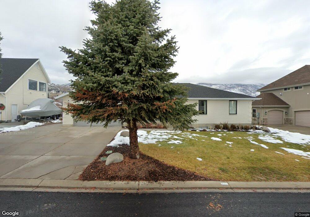
262 Hillside Cir Alpine, UT 84004
Estimated Value: $769,000 - $1,183,000
5
Beds
3
Baths
3,444
Sq Ft
$286/Sq Ft
Est. Value
About This Home
This home is located at 262 Hillside Cir, Alpine, UT 84004 and is currently estimated at $986,663, approximately $286 per square foot. 262 Hillside Cir is a home located in Utah County with nearby schools including Westfield School, Timberline Middle School, and Lone Peak High School.
Ownership History
Date
Name
Owned For
Owner Type
Purchase Details
Closed on
Jun 7, 2022
Sold by
Hubbard Kristi L and Hubbard Ronald L
Bought by
Suazo Emilio and Suazo Natalie
Current Estimated Value
Home Financials for this Owner
Home Financials are based on the most recent Mortgage that was taken out on this home.
Original Mortgage
$959,200
Outstanding Balance
$914,478
Interest Rate
5.5%
Mortgage Type
New Conventional
Estimated Equity
$72,185
Purchase Details
Closed on
Mar 25, 2021
Sold by
Cluff Mark
Bought by
Hubbard Kristi L and Hubbard Ronald L
Home Financials for this Owner
Home Financials are based on the most recent Mortgage that was taken out on this home.
Original Mortgage
$480,000
Interest Rate
2.9%
Mortgage Type
New Conventional
Purchase Details
Closed on
Jul 5, 2012
Sold by
Empey Adrienne
Bought by
Cluf Mark
Purchase Details
Closed on
Apr 4, 2005
Sold by
Federal National Mortgage Association
Bought by
Empey Adrienne
Home Financials for this Owner
Home Financials are based on the most recent Mortgage that was taken out on this home.
Original Mortgage
$208,000
Interest Rate
7.99%
Mortgage Type
Fannie Mae Freddie Mac
Purchase Details
Closed on
Feb 11, 2005
Sold by
Washington Mutual Bank Fa
Bought by
Federal National Mortgage Association
Home Financials for this Owner
Home Financials are based on the most recent Mortgage that was taken out on this home.
Original Mortgage
$208,000
Interest Rate
7.99%
Mortgage Type
Fannie Mae Freddie Mac
Purchase Details
Closed on
Feb 8, 2005
Sold by
Mattson John
Bought by
Washington Mutual Bank Fa
Home Financials for this Owner
Home Financials are based on the most recent Mortgage that was taken out on this home.
Original Mortgage
$208,000
Interest Rate
7.99%
Mortgage Type
Fannie Mae Freddie Mac
Purchase Details
Closed on
Nov 29, 1999
Sold by
Mattson John
Bought by
Mattson John and Mattson Beverly
Home Financials for this Owner
Home Financials are based on the most recent Mortgage that was taken out on this home.
Original Mortgage
$228,750
Interest Rate
7.95%
Purchase Details
Closed on
Dec 16, 1996
Sold by
Roberts David J and Roberts Ann Marie
Bought by
Mattson John and Mattson Beverly
Home Financials for this Owner
Home Financials are based on the most recent Mortgage that was taken out on this home.
Original Mortgage
$197,000
Interest Rate
7.76%
Mortgage Type
Seller Take Back
Create a Home Valuation Report for This Property
The Home Valuation Report is an in-depth analysis detailing your home's value as well as a comparison with similar homes in the area
Home Values in the Area
Average Home Value in this Area
Purchase History
| Date | Buyer | Sale Price | Title Company |
|---|---|---|---|
| Suazo Emilio | -- | Cottonwood Title | |
| Hubbard Kristi L | -- | Meridian Title Co | |
| Cluf Mark | -- | Cornerstone Title Insurance | |
| Empey Adrienne | -- | -- | |
| Federal National Mortgage Association | -- | First Southwestern Title Ag | |
| Washington Mutual Bank Fa | $220,525 | First Southwestern Title Ag | |
| Mattson John | -- | Empire Land Title Company | |
| Mattson John | -- | Empire Land Title Company | |
| Mattson John | -- | Mountain West Title Company |
Source: Public Records
Mortgage History
| Date | Status | Borrower | Loan Amount |
|---|---|---|---|
| Open | Suazo Emilio | $959,200 | |
| Previous Owner | Hubbard Kristi L | $480,000 | |
| Previous Owner | Empey Adrienne | $208,000 | |
| Previous Owner | Mattson John | $228,750 | |
| Previous Owner | Mattson John | $45,750 | |
| Previous Owner | Mattson John | $197,000 | |
| Closed | Mattson John | $31,500 |
Source: Public Records
Tax History
| Year | Tax Paid | Tax Assessment Tax Assessment Total Assessment is a certain percentage of the fair market value that is determined by local assessors to be the total taxable value of land and additions on the property. | Land | Improvement |
|---|---|---|---|---|
| 2025 | $3,878 | $436,205 | -- | -- |
| 2024 | $3,878 | $451,935 | $0 | $0 |
| 2023 | $3,864 | $483,505 | $0 | $0 |
| 2022 | $2,809 | $341,385 | $0 | $0 |
| 2021 | $2,455 | $463,500 | $187,300 | $276,200 |
| 2020 | $2,305 | $425,900 | $162,900 | $263,000 |
| 2019 | $2,133 | $411,300 | $162,900 | $248,400 |
| 2018 | $2,073 | $395,000 | $149,900 | $245,100 |
| 2017 | $1,863 | $188,870 | $0 | $0 |
| 2016 | $1,751 | $165,495 | $0 | $0 |
| 2015 | $1,627 | $145,530 | $0 | $0 |
| 2014 | $1,430 | $126,555 | $0 | $0 |
Source: Public Records
Map
Nearby Homes
- 353 International Way
- 820 Eagleview Dr
- 151 Glacier Lily Dr
- 501 W Devey Dr
- 684 N Summit Way
- 248 Deerfield Dr
- 475 Grove Dr
- 19 E Elk Ct
- 48 N 100 E
- 30 S Main St
- 128 E Deer Crest Ln Unit 304
- 512 Eastridge Cir
- 522 N Pfeifferhorn Dr
- 591 N Pfeifferhorn Dr
- 287 Heritage Hills Dr
- 381 E Watkins Cir Unit 28
- 102 E Deer Crest Ln
- 499 E 300 N
- 382 E Heritage Hills Dr
- 259 Twin River Loop
- 276 Hillside Cir
- 278 Hillside Cir
- 246 Hillside Cir
- 251 Hillside Cir
- 292 Hillside Cir
- 232 Hillside Cir
- 269 Hillside Cir
- 283 Hillside Cir
- 233 Hillside Cir
- 649 Hillside Cir
- 297 Hillside Cir
- 216 Hillside Cir
- 308 Hillside Cir
- 631 Hillside Cir
- 631 N Hillside Dr
- 315 Hillside Cir
- 311 International Way
- 311 International Way Unit 16
- 326 Hillside Cir
- 327 International Way
Your Personal Tour Guide
Ask me questions while you tour the home.