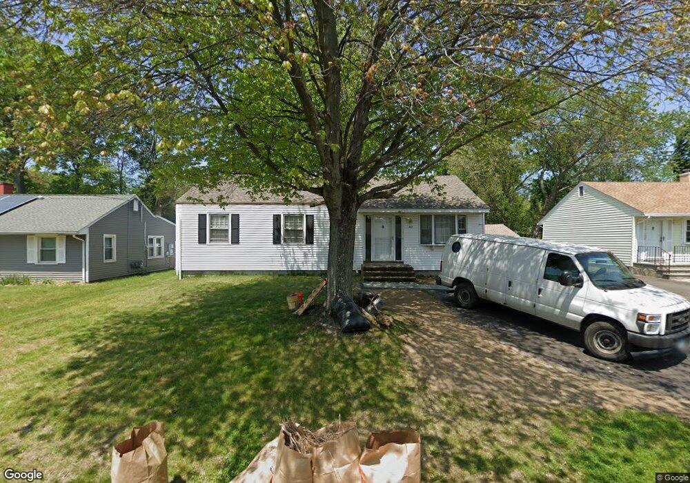
262 Indian Field Rd Bridgeport, CT 06606
North End NeighborhoodEstimated Value: $384,000 - $449,000
3
Beds
1
Bath
1,309
Sq Ft
$325/Sq Ft
Est. Value
About This Home
This home is located at 262 Indian Field Rd, Bridgeport, CT 06606 and is currently estimated at $425,811, approximately $325 per square foot. 262 Indian Field Rd is a home located in Fairfield County with nearby schools including John Winthrop School, Central High School, and St Andrew School.
Ownership History
Date
Name
Owned For
Owner Type
Purchase Details
Closed on
Oct 6, 2005
Sold by
Diorio Mary and Mcbride Anita
Bought by
Machado Rauni and Reggiane Geani
Current Estimated Value
Home Financials for this Owner
Home Financials are based on the most recent Mortgage that was taken out on this home.
Original Mortgage
$193,600
Outstanding Balance
$103,950
Interest Rate
5.81%
Estimated Equity
$321,861
Create a Home Valuation Report for This Property
The Home Valuation Report is an in-depth analysis detailing your home's value as well as a comparison with similar homes in the area
Home Values in the Area
Average Home Value in this Area
Purchase History
| Date | Buyer | Sale Price | Title Company |
|---|---|---|---|
| Machado Rauni | $242,000 | -- | |
| Machado Rauni | $242,000 | -- |
Source: Public Records
Mortgage History
| Date | Status | Borrower | Loan Amount |
|---|---|---|---|
| Open | Machado Rauni | $193,600 | |
| Closed | Machado Rauni | $193,600 |
Source: Public Records
Tax History Compared to Growth
Tax History
| Year | Tax Paid | Tax Assessment Tax Assessment Total Assessment is a certain percentage of the fair market value that is determined by local assessors to be the total taxable value of land and additions on the property. | Land | Improvement |
|---|---|---|---|---|
| 2025 | $7,042 | $162,070 | $79,700 | $82,370 |
| 2024 | $7,042 | $162,070 | $79,700 | $82,370 |
| 2023 | $7,042 | $162,070 | $79,700 | $82,370 |
| 2022 | $7,042 | $162,070 | $79,700 | $82,370 |
| 2021 | $7,042 | $162,070 | $79,700 | $82,370 |
| 2020 | $7,229 | $133,900 | $62,430 | $71,470 |
| 2019 | $7,229 | $133,900 | $62,430 | $71,470 |
| 2018 | $7,280 | $133,900 | $62,430 | $71,470 |
| 2017 | $7,280 | $133,900 | $62,430 | $71,470 |
| 2016 | $7,280 | $133,900 | $62,430 | $71,470 |
| 2015 | $6,699 | $158,740 | $61,440 | $97,300 |
| 2014 | $6,699 | $158,740 | $61,440 | $97,300 |
Source: Public Records
Map
Nearby Homes
- 64 Dobson St
- 65 Dobson St
- 50 Greenhouse Rd Unit 65D
- 50 Greenhouse Rd Unit 42C
- 394 Anton Dr
- 173 Anton Dr
- 236 Edgemoor Rd Unit D
- 9 Patricia Rd Unit C
- 2851 Old Town Rd
- 153 Seaver Cir
- 2998 Madison Ave Unit C
- 87 Oliver St
- 66 Loftus Cir
- 72 Herald Ave
- 15 Cherry Hill Dr Unit 2A
- 230 Cherry Hill Dr Unit 2B
- 2955 Madison Ave Unit 40
- 2800 Madison Ave Unit 1B
- 81 Lance Cir
- 114 Oxford St
- 248 Indian Field Rd
- 274 Indian Field Rd
- 80 Ralph St
- 94 Ralph St
- 284 Indian Field Rd
- 278 Bear Paw Rd
- 266 Bear Paw Rd
- 252 Bear Paw Rd
- 277 Indian Field Rd
- 257 Indian Field Rd
- 241 Indian Field Rd
- 3484 Madison Ave
- 238 Bear Paw Rd
- 157 Corn Tassel Rd
- 3456 Madison Ave
- 3496 Madison Ave
- 60 Ralph St
- 253 Bear Paw Rd
- 3440 Madison Ave
- 145 Corn Tassel Rd