Estimated Value: $108,000 - $137,000
--
Bed
1
Bath
1,428
Sq Ft
$87/Sq Ft
Est. Value
About This Home
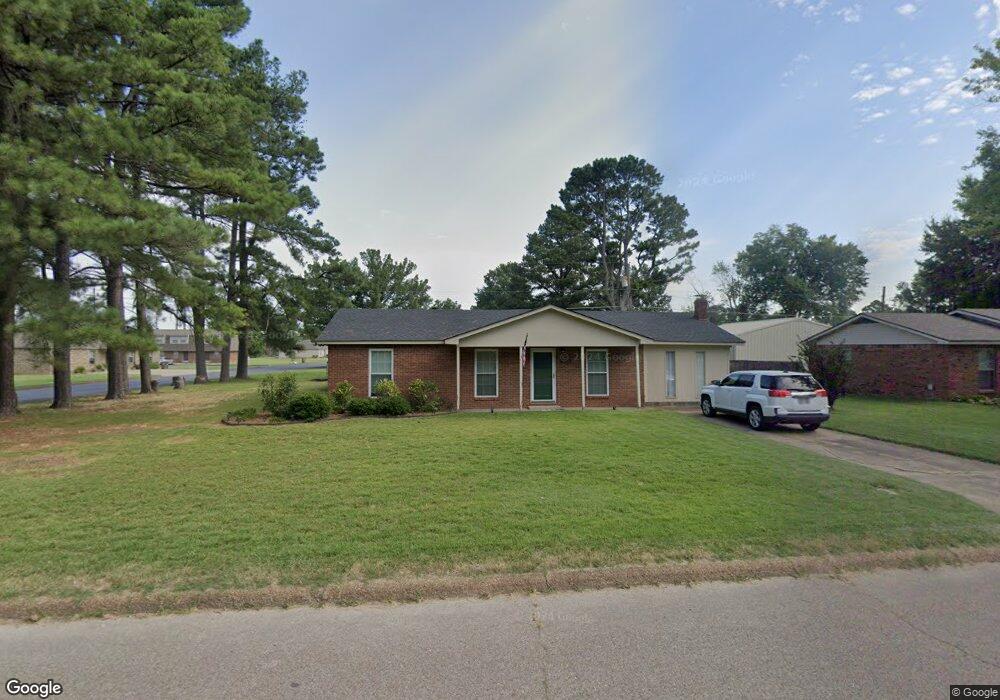
This home is located at 262 Mona Ln, Wynne, AR 72396 and is currently estimated at $123,859, approximately $86 per square foot. 262 Mona Ln is a home located in Cross County with nearby schools including Wynne Primary School, Wynne Intermediate School, and Wynne Junior High School.
Ownership History
Date
Name
Owned For
Owner Type
Purchase Details
Closed on
Jan 21, 2022
Sold by
Owens Kenneth W
Bought by
Turner Noel W
Current Estimated Value
Home Financials for this Owner
Home Financials are based on the most recent Mortgage that was taken out on this home.
Original Mortgage
$108,989
Outstanding Balance
$100,447
Interest Rate
3.11%
Mortgage Type
FHA
Estimated Equity
$23,412
Purchase Details
Closed on
Jun 4, 2021
Sold by
Owens Kenneth W
Bought by
Owens Kenneth W and Owens Jason Dean
Purchase Details
Closed on
Dec 19, 2002
Bought by
Owens Kenneth
Create a Home Valuation Report for This Property
The Home Valuation Report is an in-depth analysis detailing your home's value as well as a comparison with similar homes in the area
Home Values in the Area
Average Home Value in this Area
Purchase History
| Date | Buyer | Sale Price | Title Company |
|---|---|---|---|
| Turner Noel W | $111,000 | Janus Title | |
| Owens Kenneth W | -- | None Listed On Document | |
| Owens Kenneth | -- | -- |
Source: Public Records
Mortgage History
| Date | Status | Borrower | Loan Amount |
|---|---|---|---|
| Open | Turner Noel W | $108,989 |
Source: Public Records
Tax History Compared to Growth
Tax History
| Year | Tax Paid | Tax Assessment Tax Assessment Total Assessment is a certain percentage of the fair market value that is determined by local assessors to be the total taxable value of land and additions on the property. | Land | Improvement |
|---|---|---|---|---|
| 2024 | $155 | $13,260 | $2,800 | $10,460 |
| 2023 | $231 | $13,260 | $2,800 | $10,460 |
| 2022 | $281 | $13,260 | $2,800 | $10,460 |
| 2021 | $656 | $13,260 | $2,800 | $10,460 |
| 2020 | $656 | $13,260 | $2,800 | $10,460 |
| 2019 | $648 | $13,090 | $1,820 | $11,270 |
| 2018 | $648 | $13,090 | $1,820 | $11,270 |
| 2017 | $648 | $13,090 | $1,820 | $11,270 |
| 2016 | $298 | $13,090 | $1,820 | $11,270 |
| 2015 | $298 | $13,090 | $1,820 | $11,270 |
| 2014 | $294 | $13,010 | $2,240 | $10,770 |
Source: Public Records
Map
Nearby Homes
- 203 Crystal Ave E
- 323 Clifton Dr
- 205 Ce Brawner Rd
- 311 Ce Brawner Rd
- 314 Mildred Dr E
- 908 Block St S
- 704 Front St S
- 704 Mockingbird Ln
- 712 Mockingbird Ln
- 733 Martin Dr E
- 362 Barry St E
- 0 0 Unit 24023180
- 701 Wren St
- 1829 Cindy Ln
- 903 Levesque Ave E
- 104 Shawnee
- 1002 Brittney Cir
- 105 Chickasaw
- 0 Brittney Cir Unit 43670
- 0 Brittney Cir Unit 25030957