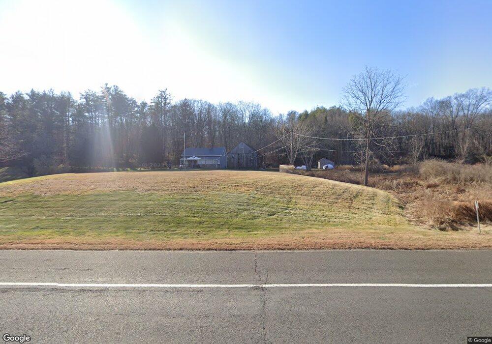
262 Route 6 Andover, CT 06232
Estimated Value: $394,170 - $438,000
3
Beds
3
Baths
1,488
Sq Ft
$278/Sq Ft
Est. Value
About This Home
This home is located at 262 Route 6, Andover, CT 06232 and is currently estimated at $413,293, approximately $277 per square foot. 262 Route 6 is a home located in Tolland County with nearby schools including Andover Elementary School, RHAM Middle School, and RHAM High School.
Ownership History
Date
Name
Owned For
Owner Type
Purchase Details
Closed on
Dec 20, 2002
Sold by
Touctellotte Raymond and Touctellotte Lossaine
Bought by
Wright Jonathan
Current Estimated Value
Home Financials for this Owner
Home Financials are based on the most recent Mortgage that was taken out on this home.
Original Mortgage
$75,000
Interest Rate
6.16%
Purchase Details
Closed on
Aug 23, 2001
Sold by
Wright Timothy and Green Carol
Bought by
Tourtellotte Raymond and Tourtellotte Lorraine
Home Financials for this Owner
Home Financials are based on the most recent Mortgage that was taken out on this home.
Original Mortgage
$180,000
Interest Rate
7.21%
Create a Home Valuation Report for This Property
The Home Valuation Report is an in-depth analysis detailing your home's value as well as a comparison with similar homes in the area
Home Values in the Area
Average Home Value in this Area
Purchase History
| Date | Buyer | Sale Price | Title Company |
|---|---|---|---|
| Wright Jonathan | $215,000 | -- | |
| Wright Jonathan | $215,000 | -- | |
| Tourtellotte Raymond | $200,000 | -- | |
| Tourtellotte Raymond | $200,000 | -- |
Source: Public Records
Mortgage History
| Date | Status | Borrower | Loan Amount |
|---|---|---|---|
| Open | Tourtellotte Raymond | $170,000 | |
| Closed | Tourtellotte Raymond | $75,000 | |
| Previous Owner | Tourtellotte Raymond | $180,000 |
Source: Public Records
Tax History
| Year | Tax Paid | Tax Assessment Tax Assessment Total Assessment is a certain percentage of the fair market value that is determined by local assessors to be the total taxable value of land and additions on the property. | Land | Improvement |
|---|---|---|---|---|
| 2025 | $4,522 | $143,150 | $38,360 | $104,790 |
| 2024 | $4,503 | $143,150 | $38,360 | $104,790 |
| 2023 | $4,479 | $143,150 | $38,360 | $104,790 |
| 2022 | $4,568 | $143,150 | $38,360 | $104,790 |
| 2021 | $3,920 | $108,900 | $38,600 | $70,300 |
| 2020 | $3,881 | $109,000 | $38,600 | $70,400 |
| 2019 | $3,814 | $109,000 | $38,600 | $70,400 |
| 2018 | $3,701 | $109,000 | $38,600 | $70,400 |
| 2017 | $3,543 | $109,000 | $38,600 | $70,400 |
| 2016 | $4,083 | $132,900 | $46,700 | $86,200 |
| 2015 | $4,083 | $132,900 | $46,700 | $86,200 |
| 2014 | $4,083 | $132,900 | $46,700 | $86,200 |
Source: Public Records
Map
Nearby Homes
- 0 Us Highway 6
- 0 Wheeling Rd Unit 24116879
- 14 Times Farm Rd
- 8 Times Farm Rd
- 0 Skinner Hill Rd Unit 24077239
- 273 Hebron Rd
- 869 East St
- 126 Hebron Rd
- 9 Tumblebrook Rd
- 34 Hanover Farms Rd
- 400 West St
- 24 Brian Dr
- 277 Lake Rd
- 0 Hinkel Mae Dr
- 17 Ireland Dr
- 1 West St
- 27 Fox Trail
- 559 East St
- 687 Hop River Rd
- 10 Lakeview Park
- 272 Route 6
- 272 Jonathan Trumbull Hwy
- 254 Route 6
- 0007 Route 6
- LOT # 7 Route 6
- 43 Shoddy Mill Rd
- 290 Route 6
- 296 Route 6
- 249 Route 6
- 151 Wales Rd Unit Bldg 2
- 151 Wales Rd
- 151 Wales Building 1 Rd
- 151 Wales (Buildings 1 & 2) Rd
- 133 Wales Rd
- 141 Wales Rd
- 288 Route 6
- 29 Shoddy Mill Rd
- 265 Route 6
- 127 Wales Rd
- 9 Shoddy Mill Rd
Your Personal Tour Guide
Ask me questions while you tour the home.