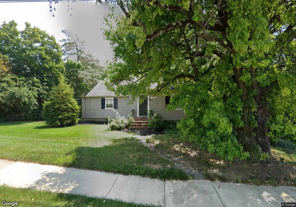
262 W Franklin St Dayton, OH 45459
Estimated Value: $192,000 - $255,000
2
Beds
1
Bath
993
Sq Ft
$214/Sq Ft
Est. Value
About This Home
This home is located at 262 W Franklin St, Dayton, OH 45459 and is currently estimated at $212,904, approximately $214 per square foot. 262 W Franklin St is a home located in Montgomery County with nearby schools including Primary Village South, Cline Elementary, and Magsig Middle School.
Ownership History
Date
Name
Owned For
Owner Type
Purchase Details
Closed on
Jan 24, 2006
Sold by
Zengel & Sons Inc
Bought by
Zengel John Adam and Zengel Robert L
Current Estimated Value
Purchase Details
Closed on
Nov 27, 2000
Sold by
Zengel John A and Zengel John August
Bought by
Zengel & Sons Inc
Purchase Details
Closed on
Jan 19, 2000
Sold by
Freeman Charles L
Bought by
Zengel John A and Zengel John August
Home Financials for this Owner
Home Financials are based on the most recent Mortgage that was taken out on this home.
Original Mortgage
$84,000
Interest Rate
7.81%
Mortgage Type
Purchase Money Mortgage
Create a Home Valuation Report for This Property
The Home Valuation Report is an in-depth analysis detailing your home's value as well as a comparison with similar homes in the area
Home Values in the Area
Average Home Value in this Area
Purchase History
| Date | Buyer | Sale Price | Title Company |
|---|---|---|---|
| Zengel John Adam | -- | None Available | |
| Zengel & Sons Inc | -- | -- | |
| Zengel John A | $109,900 | -- |
Source: Public Records
Mortgage History
| Date | Status | Borrower | Loan Amount |
|---|---|---|---|
| Previous Owner | Zengel John A | $84,000 |
Source: Public Records
Tax History Compared to Growth
Tax History
| Year | Tax Paid | Tax Assessment Tax Assessment Total Assessment is a certain percentage of the fair market value that is determined by local assessors to be the total taxable value of land and additions on the property. | Land | Improvement |
|---|---|---|---|---|
| 2024 | $3,539 | $59,510 | $30,820 | $28,690 |
| 2023 | $3,539 | $59,510 | $30,820 | $28,690 |
| 2022 | $3,306 | $44,080 | $22,830 | $21,250 |
| 2021 | $3,244 | $44,080 | $22,830 | $21,250 |
| 2020 | $3,240 | $44,080 | $22,830 | $21,250 |
| 2019 | $3,018 | $36,630 | $22,830 | $13,800 |
| 2018 | $2,676 | $36,630 | $22,830 | $13,800 |
| 2017 | $2,645 | $36,630 | $22,830 | $13,800 |
| 2016 | $2,801 | $36,630 | $22,830 | $13,800 |
| 2015 | $2,773 | $36,630 | $22,830 | $13,800 |
| 2014 | $2,773 | $36,630 | $22,830 | $13,800 |
| 2012 | -- | $39,140 | $22,830 | $16,310 |
Source: Public Records
Map
Nearby Homes
- 20 Gershwin Dr
- 7687 Normandy Ln
- 7767 Brams Hill Dr Unit 7767
- 51 Winchester (#E) Place
- 210 Anton Ct
- 284 Tauber Dr
- 155 Bristol Dr
- 170 S Main St Unit C
- 325 Annette Dr
- 59 Wythe Parish St Unit 4
- 8030 Paragon Rd
- 8370 Paragon Rd
- 140 Mallard Glen Dr Unit 3
- 8749 Shadycreek Dr Unit 8751
- 8760 Shadycreek Dr Unit 8758
- 40 Cemetery Dr
- 7853 Betsy Ross Cir Unit 11
- 8768 Washington Colony Dr Unit 12
- 508 Peachcreek Rd
- 8738 Washington Colony Dr Unit 832
- 252 W Franklin St
- 21 Gershwin Dr
- 31 Gershwin Dr
- 41 Gershwin Dr
- 7950 Normandy Ln
- 235 W Franklin St
- 11 Lynn Rae Cir
- 51 Gershwin Dr
- 21 Lynn Rae Cir
- 7939 Normandy Ln
- 8000 Miller Farm Ln
- 8000 Miller Farm Ln Unit 3 & 4 (Building 2)
- 8000 Miller Farm Ln Unit Building 2, Unit 4
- 8000 Miller Farm Ln Unit Building 2 , Unit 3
- 8000 Miller Farm Ln Unit 4
- 61 Gershwin Dr
- 20 Lynn Rae Cir
- 2 Miller Farm Ln Unit 4
- 7926 Normandy Ln
- 31 Lynn Rae Cir