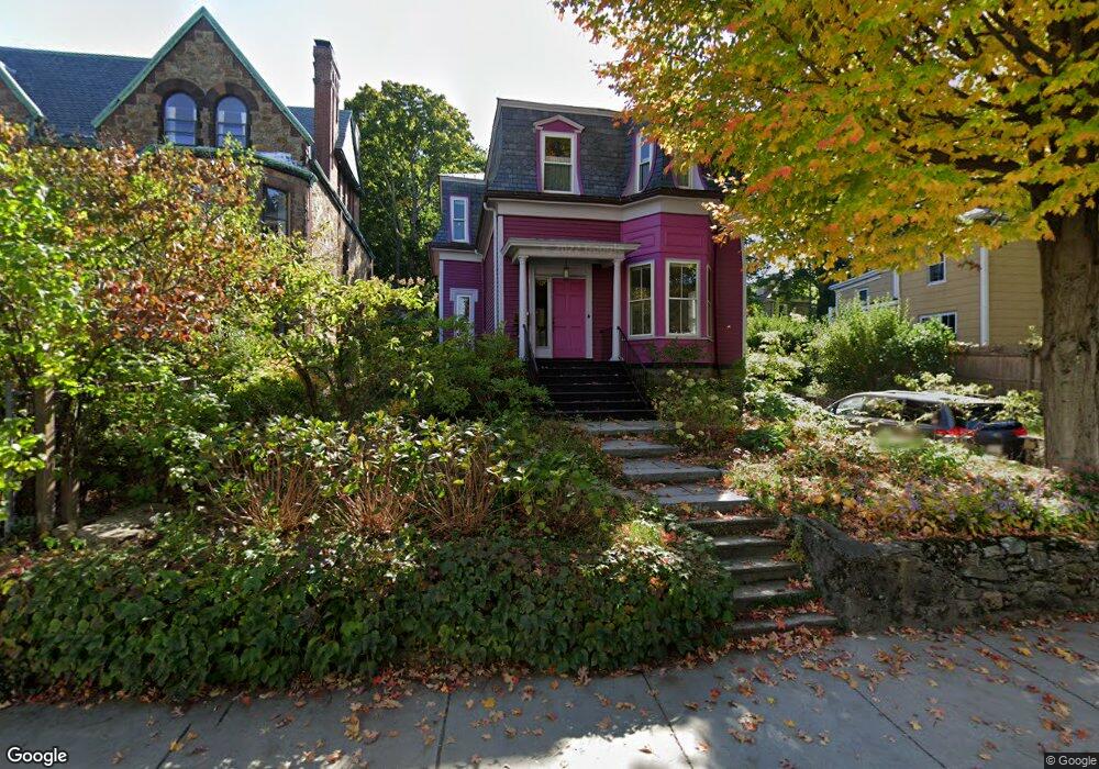
262 Walnut St Brookline, MA 02445
Brookline Village NeighborhoodEstimated Value: $2,226,000 - $2,473,264
4
Beds
3
Baths
2,436
Sq Ft
$966/Sq Ft
Est. Value
About This Home
This home is located at 262 Walnut St, Brookline, MA 02445 and is currently estimated at $2,354,316, approximately $966 per square foot. 262 Walnut St is a home located in Norfolk County with nearby schools including William H. Lincoln School, Brookline High School, and Maimonides School.
Ownership History
Date
Name
Owned For
Owner Type
Purchase Details
Closed on
Mar 27, 2013
Sold by
Schwartz Thomas
Bought by
Schwartz Thomas and Mueller Britta
Current Estimated Value
Purchase Details
Closed on
Jul 15, 2011
Sold by
Krantz Stuart and Krantz Heidi
Bought by
Schwartz Thomas
Home Financials for this Owner
Home Financials are based on the most recent Mortgage that was taken out on this home.
Original Mortgage
$550,000
Interest Rate
3%
Mortgage Type
Purchase Money Mortgage
Purchase Details
Closed on
Jun 29, 2007
Sold by
Vandecarr John and Vandecarr Marian
Bought by
Krantz Heidi and Krantz Stuart
Home Financials for this Owner
Home Financials are based on the most recent Mortgage that was taken out on this home.
Original Mortgage
$560,000
Interest Rate
6.24%
Mortgage Type
Purchase Money Mortgage
Create a Home Valuation Report for This Property
The Home Valuation Report is an in-depth analysis detailing your home's value as well as a comparison with similar homes in the area
Home Values in the Area
Average Home Value in this Area
Purchase History
| Date | Buyer | Sale Price | Title Company |
|---|---|---|---|
| Schwartz Thomas | -- | -- | |
| Schwartz Thomas | $1,085,000 | -- | |
| Krantz Heidi | $700,000 | -- |
Source: Public Records
Mortgage History
| Date | Status | Borrower | Loan Amount |
|---|---|---|---|
| Previous Owner | Schwartz Thomas | $550,000 | |
| Previous Owner | Krantz Heidi | $560,000 |
Source: Public Records
Tax History
| Year | Tax Paid | Tax Assessment Tax Assessment Total Assessment is a certain percentage of the fair market value that is determined by local assessors to be the total taxable value of land and additions on the property. | Land | Improvement |
|---|---|---|---|---|
| 2025 | $20,690 | $2,096,300 | $1,154,500 | $941,800 |
| 2024 | $19,696 | $2,016,000 | $1,110,000 | $906,000 |
| 2023 | $18,338 | $1,839,300 | $951,700 | $887,600 |
| 2022 | $17,849 | $1,751,600 | $906,300 | $845,300 |
| 2021 | $16,505 | $1,684,200 | $871,400 | $812,800 |
| 2020 | $14,930 | $1,579,900 | $792,200 | $787,700 |
| 2019 | $14,099 | $1,504,700 | $754,500 | $750,200 |
| 2018 | $13,308 | $1,406,800 | $666,400 | $740,400 |
| 2017 | $13,113 | $1,327,200 | $628,700 | $698,500 |
| 2016 | $12,924 | $1,240,300 | $587,500 | $652,800 |
| 2015 | $12,380 | $1,159,200 | $549,100 | $610,100 |
| 2014 | $11,773 | $1,033,600 | $499,200 | $534,400 |
Source: Public Records
Map
Nearby Homes
- 236 Walnut St
- 20 Rice St Unit 2
- 42 Prince St
- 8 Leverett St Unit 3
- 18 Chestnut Place
- 3 Upland Rd Unit 2
- 140 Sumner Rd Unit 1
- 124 Chestnut St Unit 2
- 75-83 Boylston St Unit R3
- 75 Greenough St Unit 2
- 12 Thayer St
- 12 Goodwin Place Unit 12-1
- 12 Goodwin Place Unit 12-2
- 11 Goodwin Place Unit 1
- 11 Goodwin Place Unit 11-1
- 11 Goodwin Place Unit 11-2
- 71 Greenough St Unit 71-1
- 209 High St
- 370 Washington St
- 69 Walnut St Unit 2
- 258 Walnut St
- 256 Walnut St
- 272 Walnut St
- 268 Walnut St
- 268 Walnut St Unit 2
- 254 Walnut St
- 263 Walnut St
- 263 Walnut St Unit 3
- 263 Walnut St Unit 2
- 261 Walnut St
- 261-3 Walnut St Unit 261
- 261 Walnut St
- 261 Walnut St Unit 3C
- 261 Walnut St Unit 3
- 261 Walnut St Unit 2
- 261 Walnut St Unit 1
- 261 Walnut St Unit 1, 2, or 3
- 267 Walnut St
- 257 Walnut St Unit 3
- 257 Walnut St Unit 2
Your Personal Tour Guide
Ask me questions while you tour the home.