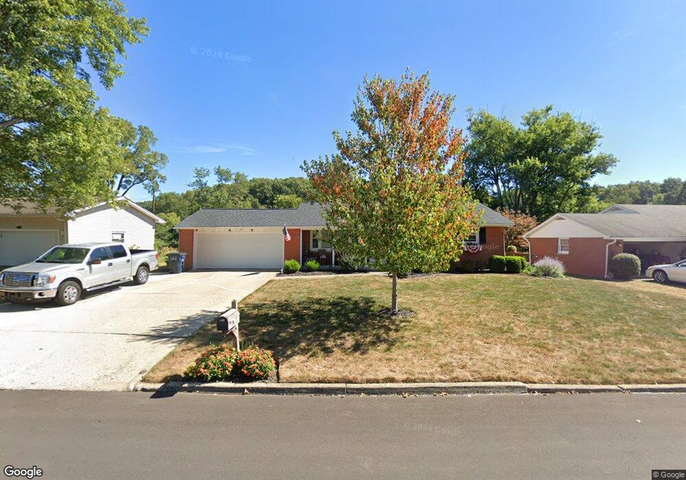
262 Whittier Dr N Lancaster, OH 43130
Estimated Value: $280,682 - $298,000
3
Beds
2
Baths
1,825
Sq Ft
$159/Sq Ft
Est. Value
About This Home
This home is located at 262 Whittier Dr N, Lancaster, OH 43130 and is currently estimated at $290,171, approximately $158 per square foot. 262 Whittier Dr N is a home located in Fairfield County with nearby schools including Tarhe Elementary School, General Sherman Junior High School, and Lancaster High School.
Ownership History
Date
Name
Owned For
Owner Type
Purchase Details
Closed on
Aug 18, 2017
Sold by
Kessler Keith A and Kessler Relinda
Bought by
Schmeltzer Edward J and Schmeltzer Julie L
Current Estimated Value
Purchase Details
Closed on
Jul 24, 2017
Sold by
Kessler Dean E and The Richard S Kessler Revocabl
Bought by
Phyllis J Kessler Trustee Of The Phyllis
Purchase Details
Closed on
May 11, 2011
Sold by
Messerly Patrick F and Messerly Julie D
Bought by
Kessler Richard S and Richard S Kessler Revocable Tr
Purchase Details
Closed on
May 2, 2003
Sold by
Hedges Sara J and Case #61118
Bought by
Messerly Patrick F
Home Financials for this Owner
Home Financials are based on the most recent Mortgage that was taken out on this home.
Original Mortgage
$129,600
Interest Rate
5.86%
Mortgage Type
Purchase Money Mortgage
Create a Home Valuation Report for This Property
The Home Valuation Report is an in-depth analysis detailing your home's value as well as a comparison with similar homes in the area
Home Values in the Area
Average Home Value in this Area
Purchase History
| Date | Buyer | Sale Price | Title Company |
|---|---|---|---|
| Schmeltzer Edward J | $172,500 | Valmer Land Title Agency Box | |
| Phyllis J Kessler Trustee Of The Phyllis | -- | None Available | |
| Kessler Richard S | $162,500 | Attorney | |
| Messerly Patrick F | $144,000 | -- |
Source: Public Records
Mortgage History
| Date | Status | Borrower | Loan Amount |
|---|---|---|---|
| Previous Owner | Messerly Patrick F | $129,600 |
Source: Public Records
Tax History
| Year | Tax Paid | Tax Assessment Tax Assessment Total Assessment is a certain percentage of the fair market value that is determined by local assessors to be the total taxable value of land and additions on the property. | Land | Improvement |
|---|---|---|---|---|
| 2025 | $5,967 | $92,250 | $16,950 | $75,300 |
| 2024 | $5,967 | $66,370 | $13,180 | $53,190 |
| 2023 | $2,409 | $66,220 | $13,180 | $53,040 |
| 2022 | $2,418 | $66,220 | $13,180 | $53,040 |
| 2021 | $2,049 | $52,560 | $10,990 | $41,570 |
| 2020 | $1,963 | $52,560 | $10,990 | $41,570 |
| 2019 | $1,866 | $52,560 | $10,990 | $41,570 |
| 2018 | $1,810 | $41,320 | $10,990 | $30,330 |
| 2017 | $1,767 | $47,250 | $10,990 | $36,260 |
| 2016 | $1,721 | $47,250 | $10,990 | $36,260 |
| 2015 | $1,713 | $45,630 | $10,990 | $34,640 |
| 2014 | $1,631 | $45,630 | $10,990 | $34,640 |
| 2013 | $1,631 | $45,630 | $10,990 | $34,640 |
Source: Public Records
Map
Nearby Homes
- 338 Scott Dr
- 1917 Nichole Cir
- 2014 N Columbus St
- 1836 Glenmar Dr
- 1789 Wacker Dr
- 202 Wildwood Ave
- 0 Wacker Dr Unit 225036189
- 136 N Arlington Ave
- 1400 N Columbus St
- 1125 Zimmer St
- 1825 Zimmer St
- 0 Marks Ave Unit 225036443
- 1829 Beacon St
- 932 Goodwin Ave
- 2422 Long Bow Ave
- 181 Marks Ave
- 1004 W Fair Ave
- 0 Hillside Ave
- 844 Washington Ave
- 2560 Fox Trail Dr
- 252 Whittier Dr N
- 272 Whittier Dr N
- 246 Whittier Dr N
- 280 Whittier Dr N
- 301 Scott Dr
- 309 Scott Dr
- 293 Scott Dr
- 265 Whittier Dr N
- 273 Whittier Dr N
- 255 Whittier Dr N
- 290 Whittier Dr N
- 236 Whittier Dr N
- 317 Scott Dr
- 249 Whittier Dr N
- 285 Scott Dr
- 283 Whittier Dr N
- 239 Whittier Dr N
- 298 Whittier Dr N
- 325 Scott Dr
- 287 Whittier Dr N
Your Personal Tour Guide
Ask me questions while you tour the home.