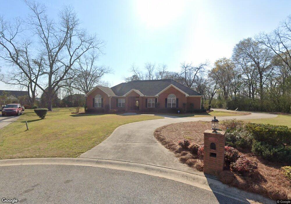
262 Whittington Ct Macon, GA 31216
Estimated Value: $345,000 - $408,906
3
Beds
2
Baths
2,629
Sq Ft
$139/Sq Ft
Est. Value
About This Home
This home is located at 262 Whittington Ct, Macon, GA 31216 and is currently estimated at $365,977, approximately $139 per square foot. 262 Whittington Ct is a home located in Bibb County with nearby schools including Heard Elementary School, Rutland Middle School, and Rutland High School.
Ownership History
Date
Name
Owned For
Owner Type
Purchase Details
Closed on
Jun 13, 2007
Sold by
Adams Louis and Adams Juanita S
Bought by
Straws Johnest L and Straws Eileen S
Current Estimated Value
Home Financials for this Owner
Home Financials are based on the most recent Mortgage that was taken out on this home.
Original Mortgage
$270,750
Outstanding Balance
$164,239
Interest Rate
6.12%
Mortgage Type
Unknown
Estimated Equity
$201,738
Purchase Details
Closed on
May 25, 2004
Purchase Details
Closed on
Sep 15, 2003
Purchase Details
Closed on
Jul 2, 1999
Create a Home Valuation Report for This Property
The Home Valuation Report is an in-depth analysis detailing your home's value as well as a comparison with similar homes in the area
Home Values in the Area
Average Home Value in this Area
Purchase History
| Date | Buyer | Sale Price | Title Company |
|---|---|---|---|
| Straws Johnest L | $285,000 | None Available | |
| -- | $100 | -- | |
| -- | $31,800 | -- | |
| -- | $23,900 | -- |
Source: Public Records
Mortgage History
| Date | Status | Borrower | Loan Amount |
|---|---|---|---|
| Open | Straws Johnest L | $270,750 |
Source: Public Records
Tax History Compared to Growth
Tax History
| Year | Tax Paid | Tax Assessment Tax Assessment Total Assessment is a certain percentage of the fair market value that is determined by local assessors to be the total taxable value of land and additions on the property. | Land | Improvement |
|---|---|---|---|---|
| 2025 | $3,244 | $138,998 | $18,000 | $120,998 |
| 2024 | $3,048 | $127,013 | $18,000 | $109,013 |
| 2023 | $2,591 | $127,013 | $18,000 | $109,013 |
| 2022 | $3,626 | $111,745 | $15,960 | $95,785 |
| 2021 | $3,233 | $92,091 | $12,600 | $79,491 |
| 2020 | $3,304 | $92,091 | $12,600 | $79,491 |
| 2019 | $3,031 | $84,439 | $12,600 | $71,839 |
| 2018 | $4,822 | $84,439 | $12,600 | $71,839 |
| 2017 | $2,718 | $79,553 | $12,600 | $66,953 |
| 2016 | $2,510 | $79,553 | $12,600 | $66,953 |
| 2015 | $3,553 | $79,553 | $12,600 | $66,953 |
| 2014 | $4,587 | $100,504 | $15,120 | $85,384 |
Source: Public Records
Map
Nearby Homes
- 436 Joseph Chandler Dr
- 428 Bob White Rd
- 411 Bob White Rd
- 465 Bob White Rd
- 102 Haylie Ct
- 104 Alayna Ct
- 408 Resting Fawn Place
- 330 Cody Dr
- 328 Cody Dr
- 708 Coopers Lnd
- DUPONT Plan at Quail Ridge
- GARDNER Plan at Quail Ridge
- KINGSTON Plan at Quail Ridge
- ESSEX Plan at Quail Ridge
- Jodeco Plan at Goodall Woods
- Sierra Plan at Goodall Woods
- Poplar Plan at Goodall Woods
- Russell Plan at Goodall Woods
- Clayton Plan at Goodall Woods
- 108 Alayna Ct
- 268 Whittington Ct
- 443 Joseph Chandler Dr
- 265 Whittington Ct
- 447 Joseph Chandler Dr
- 272 Whittington Ct
- 269 Whittington Ct
- 435 Joseph Chandler Dr
- 451 Joseph Chandler Dr
- 276 Whittington Ct
- 273 Whittington Ct
- 609 Nicholas Ln
- 431 Joseph Chandler Dr
- 4256 Sardis Church Rd
- 455 Joseph Chandler Dr
- 0 Whittington Ct Unit 8090588
- 0 Whittington Ct
- 277 Whittington Ct
- 280 Whittington Ct
- 4216 Sardis Church Rd
- 448 Joseph Chandler Dr