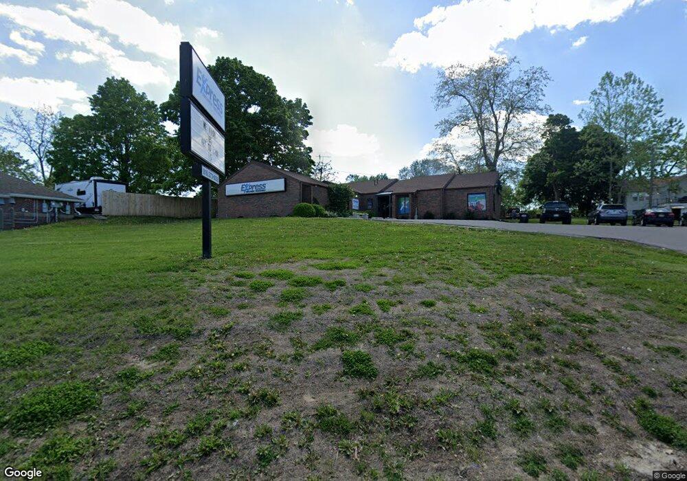
2620 N Belt Hwy Saint Joseph, MO 64506
Ashland NeighborhoodEstimated Value: $519,482
--
Bed
--
Bath
2,589
Sq Ft
$201/Sq Ft
Est. Value
About This Home
This home is located at 2620 N Belt Hwy, Saint Joseph, MO 64506 and is currently estimated at $519,482, approximately $200 per square foot. 2620 N Belt Hwy is a home located in Buchanan County with nearby schools including Field Elementary School, Bode Middle School, and Central High School.
Ownership History
Date
Name
Owned For
Owner Type
Purchase Details
Closed on
Jul 21, 2016
Sold by
Staffright Llc
Bought by
Shooting Star Llc
Current Estimated Value
Home Financials for this Owner
Home Financials are based on the most recent Mortgage that was taken out on this home.
Original Mortgage
$676,000
Outstanding Balance
$539,304
Interest Rate
3.56%
Mortgage Type
Commercial
Estimated Equity
-$19,822
Purchase Details
Closed on
Mar 29, 2007
Sold by
Tabony Gary L
Bought by
Co Staffright Llc
Home Financials for this Owner
Home Financials are based on the most recent Mortgage that was taken out on this home.
Original Mortgage
$240,000
Interest Rate
6.3%
Mortgage Type
Future Advance Clause Open End Mortgage
Create a Home Valuation Report for This Property
The Home Valuation Report is an in-depth analysis detailing your home's value as well as a comparison with similar homes in the area
Home Values in the Area
Average Home Value in this Area
Purchase History
| Date | Buyer | Sale Price | Title Company |
|---|---|---|---|
| Shooting Star Llc | -- | First American Title | |
| Co Staffright Llc | -- | Hall Abstract&Title Co |
Source: Public Records
Mortgage History
| Date | Status | Borrower | Loan Amount |
|---|---|---|---|
| Open | Shooting Star Llc | $676,000 | |
| Previous Owner | Co Staffright Llc | $240,000 |
Source: Public Records
Tax History Compared to Growth
Tax History
| Year | Tax Paid | Tax Assessment Tax Assessment Total Assessment is a certain percentage of the fair market value that is determined by local assessors to be the total taxable value of land and additions on the property. | Land | Improvement |
|---|---|---|---|---|
| 2024 | $8,609 | $105,140 | $37,640 | $67,500 |
| 2023 | $8,609 | $105,140 | $37,640 | $67,500 |
| 2022 | $8,029 | $105,140 | $37,640 | $67,500 |
| 2021 | $8,060 | $105,140 | $37,640 | $67,500 |
| 2020 | $8,017 | $105,140 | $37,640 | $67,500 |
| 2019 | $7,780 | $105,140 | $37,640 | $67,500 |
| 2018 | $7,130 | $105,140 | $37,640 | $67,500 |
| 2017 | $7,074 | $105,140 | $0 | $0 |
| 2015 | $1 | $86,450 | $0 | $0 |
| 2014 | $6,092 | $83,180 | $0 | $0 |
Source: Public Records
Map
Nearby Homes
- 00 Lot 2 Highway 169
- 00 Lot 1 Highway 169
- 4301 N 169 Hwy
- 4411 Rochester Rd
- 3128 Floral Ave
- 2102 N 34th Terrace
- 3111 N 35th St
- 3208 Arbor Lake Dr
- 3028 Ashland Ave
- 3315 Chatham Ave
- 2815 Quail Dr
- 3800 Beck Rd
- 3412 N 35th Place
- 3904 Remington Ct
- 3326 Chatham Ave
- 2519 Forest Ave
- 3015 Miller Rd
- 3101 Douglas St
- 2110 Ashland Ave
- 2704 N Woodbine Rd
- 3101 N Belt Hwy
- 3416 Gene Field Rd
- 3412 Gene Field Rd
- 2618 N Belt Hwy
- 3410 Gene Field Rd
- 3325 Brown Rd
- 3005 N Belt Hwy
- 3415 Brown Rd
- 3003 N Belt Hwy
- 2616 N Belt Hwy
- 0 Highway 169
- 3116 N Belt Hwy
- 3308 Gene Field Rd
- 3309 Brown Rd
- 3411 Gene Field Rd
- 3304 Gene Field Rd
- O Pembroke Ln
- 3307 Brown Rd
- 3407 Gene Field Rd
- 3406 Brown Rd