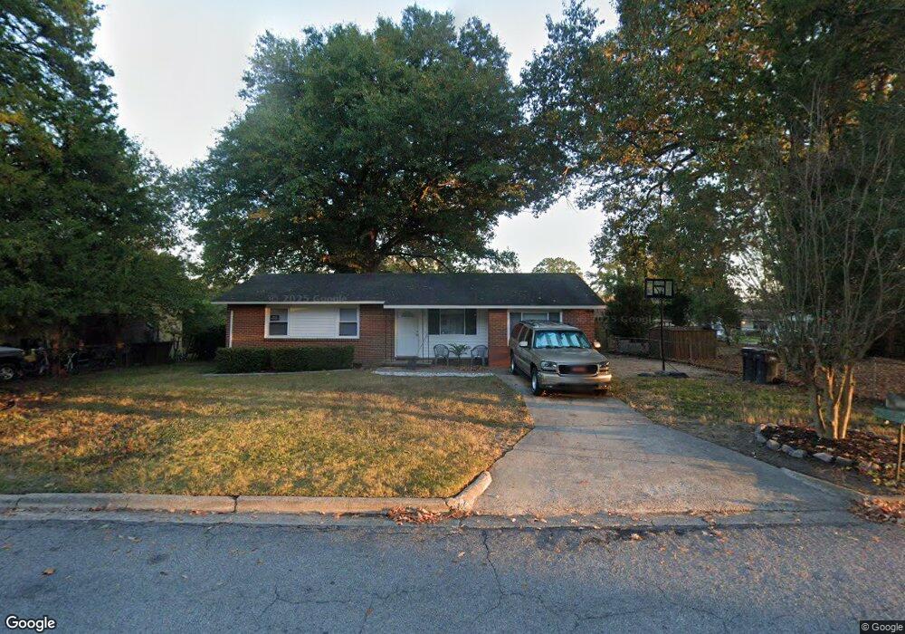
2620 Nannette Dr Augusta, GA 30906
Old Savannah NeighborhoodEstimated Value: $131,816 - $162,000
About This Home
This home is located at 2620 Nannette Dr, Augusta, GA 30906 and is currently estimated at $143,204, approximately $89 per square foot. 2620 Nannette Dr is a home located in Richmond County with nearby schools including Hains Elementary School, Richmond Hill K-8, and Johnson Magnet.
Ownership History
We collect this data history from publicly available records. To have your information removed, we recommend requesting removal directly through your county’s website.
Purchase Details
Home Financials for this Owner
Home Financials are based on the most recent Mortgage that was taken out on this home.Purchase Details
Purchase Details
Purchase Details
Home Values in the Area
Average Home Value in this Area
Purchase History
We collect this data history from publicly available records. To have your information removed, we recommend requesting removal directly through your county’s website.
| Date | Buyer | Sale Price | Title Company |
|---|---|---|---|
| -- | -- | ||
| $40,500 | -- | ||
| -- | -- | ||
| $40,104 | -- | ||
| $40,100 | -- | ||
| $40,100 | -- | ||
| -- | -- |
Mortgage History
We collect this data history from publicly available records. To have your information removed, we recommend requesting removal directly through your county’s website.
| Date | Status | Borrower | Loan Amount |
|---|---|---|---|
| Closed | $49,500 |
Tax History
We collect this data history from publicly available records. To have your information removed, we recommend requesting removal directly through your county’s website.
| Year | Tax Paid | Tax Assessment Tax Assessment Total Assessment is a certain percentage of the fair market value that is determined by local assessors to be the total taxable value of land and additions on the property. | Land | Improvement |
|---|---|---|---|---|
| 2025 | $1,735 | $40,252 | $6,040 | $34,212 |
| 2024 | $1,735 | $49,172 | $6,040 | $43,132 |
| 2023 | $1,848 | $36,008 | $6,040 | $29,968 |
| 2022 | $1,523 | $35,828 | $6,040 | $29,788 |
| 2021 | $1,325 | $30,236 | $6,040 | $24,196 |
| 2020 | $1,307 | $30,236 | $6,040 | $24,196 |
| 2019 | $1,374 | $30,236 | $6,040 | $24,196 |
| 2018 | $1,382 | $30,236 | $6,040 | $24,196 |
| 2017 | $1,330 | $30,236 | $6,040 | $24,196 |
| 2016 | $1,331 | $30,236 | $6,040 | $24,196 |
| 2015 | $1,339 | $30,236 | $6,040 | $24,196 |
| 2014 | $1,341 | $30,236 | $6,040 | $24,196 |
Map
- 2617 Blueberry Dr
- 1926 Dunham Ct
- 3001 Lonsdale Dr
- 2911 Fernwood Dr
- 2514 Elderberry Dr
- 2521 Briarwood Ave
- 2515 Elderberry Dr
- 2512 Elderberry Dr
- 2022 Dunham Ct
- 2042 Fernwood Cir
- 1831 Catalina Dr
- 1822 Catalina Dr
- 3203 Young Forest Dr
- 3214 Sylvester Dr
- 3108 Wilbur St
- 2105 Eastside Ct
- 1704 Susan Cir
- 3206 Rhonda Dr
- 2918 Abelia Dr
- 104 Thomas Cir
- 2615 Nannette Dr
- 2617 Nannette Dr
- 2613 Nannette Dr
- 2621 Blueberry Dr
- 2619 Nannette Dr
- 2623 Blueberry Dr
- 2619 Blueberry Dr
- 2611 Nannette Dr
- 2618 Nannette Dr
- 2615 Blueberry Dr
- 2616 Nannette Dr
- 1933 Dunham Ct
- 2609 Nannette Dr
- 2613 Blueberry Dr
- 1931 Dunham Ct
- 1935 Dunham Ct
- 2614 Nannette Dr
- 2627 Blueberry Dr
- 1929 Dunham Ct
- 1927 Dunham Ct
Ask me questions while you tour the home.