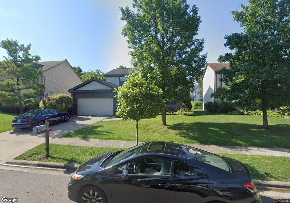
2621 Breathstone Ct Powell, OH 43065
Estimated Value: $431,160 - $489,000
4
Beds
3
Baths
2,050
Sq Ft
$221/Sq Ft
Est. Value
About This Home
This home is located at 2621 Breathstone Ct, Powell, OH 43065 and is currently estimated at $453,540, approximately $221 per square foot. 2621 Breathstone Ct is a home located in Franklin County with nearby schools including Albert Chapman Elementary School, Ann Simpson Davis Middle School, and Dublin Scioto High School.
Ownership History
Date
Name
Owned For
Owner Type
Purchase Details
Closed on
Sep 5, 2000
Sold by
Turner Richard M and Turner Dana D
Bought by
Herman Michael D and Herman Brenda M
Current Estimated Value
Home Financials for this Owner
Home Financials are based on the most recent Mortgage that was taken out on this home.
Original Mortgage
$139,200
Outstanding Balance
$46,986
Interest Rate
7.06%
Estimated Equity
$406,554
Purchase Details
Closed on
Mar 29, 1990
Bought by
Turner Richard M and Turner Dana D
Create a Home Valuation Report for This Property
The Home Valuation Report is an in-depth analysis detailing your home's value as well as a comparison with similar homes in the area
Home Values in the Area
Average Home Value in this Area
Purchase History
| Date | Buyer | Sale Price | Title Company |
|---|---|---|---|
| Herman Michael D | $174,000 | Midland Celtic Title | |
| Turner Richard M | $121,500 | -- |
Source: Public Records
Mortgage History
| Date | Status | Borrower | Loan Amount |
|---|---|---|---|
| Open | Herman Michael D | $139,200 |
Source: Public Records
Tax History Compared to Growth
Tax History
| Year | Tax Paid | Tax Assessment Tax Assessment Total Assessment is a certain percentage of the fair market value that is determined by local assessors to be the total taxable value of land and additions on the property. | Land | Improvement |
|---|---|---|---|---|
| 2024 | $7,117 | $117,670 | $33,740 | $83,930 |
| 2023 | $7,017 | $117,670 | $33,740 | $83,930 |
| 2022 | $5,738 | $89,430 | $17,290 | $72,140 |
| 2021 | $5,831 | $89,430 | $17,290 | $72,140 |
| 2020 | $5,796 | $89,430 | $17,290 | $72,140 |
| 2019 | $5,432 | $74,200 | $14,420 | $59,780 |
| 2018 | $5,122 | $74,200 | $14,420 | $59,780 |
| 2017 | $5,015 | $74,200 | $14,420 | $59,780 |
| 2016 | $4,761 | $66,160 | $14,530 | $51,630 |
| 2015 | $4,791 | $66,160 | $14,530 | $51,630 |
| 2014 | $4,795 | $66,160 | $14,530 | $51,630 |
| 2013 | $2,434 | $66,150 | $14,525 | $51,625 |
Source: Public Records
Map
Nearby Homes
- 3836 Woodbury Landing
- 3910 Summit View Rd
- 4933 Emerald Lakes Blvd Unit 4903
- 2300 Benning Dr
- 7909 Melrue Ct
- 7841 Breen Cir
- 2608 Sawmill Meadows Ave
- 7899 Sethwick Rd
- 261 Andover Dr
- 2168 Summit Row Blvd
- 2228 Gnarled Pine Dr
- 274 Stamford Dr
- 7818 Sanbrooke Rd
- 2734 Saltergate Dr Unit 2734
- 7746 Willowcove Ct
- 8128 Conine Dr
- 8803 Yates Point Ct
- 1992 Edmunds Ct
- 2961 Lexington Dr
- 8796 Yates Point Ct
- 2629 Breathstone Ct
- 2613 Breathstone Ct
- 2601 Breathstone Ct
- 8826 Worrell Ct
- 2637 Breathstone Ct
- 2616 Breathstone Ct
- 2624 Breathstone Ct
- 2608 Breathstone Ct
- 8841 Crampton Dr
- 2602 Breathstone Ct
- 2593 Breathstone Ct
- 8825 Worrell Ct
- 2600 Breathstone Ct
- 2632 Breathstone Ct
- 8833 Crampton Dr
- 2645 Breathstone Ct
- 8820 Worrell Ct
- 2588 Breathstone Ct
- 8825 Crampton Dr
- 2564 Breathstone Ct