Estimated Value: $342,873 - $381,000
4
Beds
3
Baths
2,016
Sq Ft
$178/Sq Ft
Est. Value
About This Home
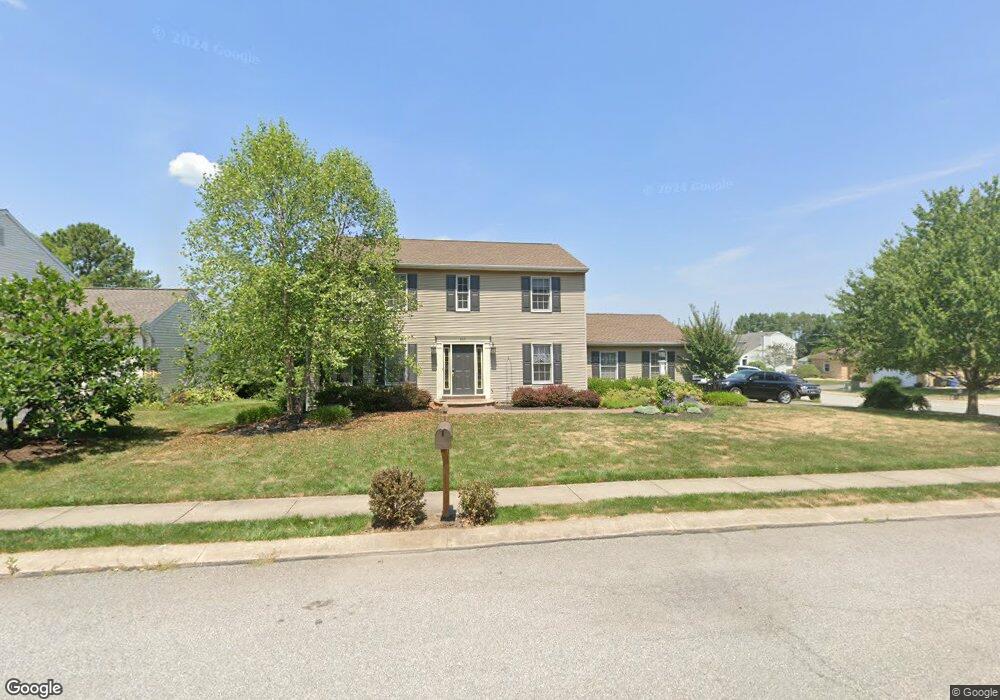
This home is located at 2621 Rock Creek Dr, Dover, PA 17315 and is currently estimated at $359,718, approximately $178 per square foot. 2621 Rock Creek Dr is a home located in York County with nearby schools including Dover Area High School and Lighthouse Christian School.
Ownership History
Date
Name
Owned For
Owner Type
Purchase Details
Closed on
May 2, 2002
Sold by
Harcourt Roger L
Bought by
Kinard Daryl and Kinard Amanda B
Current Estimated Value
Home Financials for this Owner
Home Financials are based on the most recent Mortgage that was taken out on this home.
Original Mortgage
$134,800
Outstanding Balance
$57,721
Interest Rate
7.13%
Estimated Equity
$301,997
Purchase Details
Closed on
Jun 26, 2001
Sold by
Harcourt Roger L and Harcourt Nancy L
Bought by
Harcourt Roger L
Create a Home Valuation Report for This Property
The Home Valuation Report is an in-depth analysis detailing your home's value as well as a comparison with similar homes in the area
Home Values in the Area
Average Home Value in this Area
Purchase History
| Date | Buyer | Sale Price | Title Company |
|---|---|---|---|
| Kinard Daryl | $141,900 | -- | |
| Harcourt Roger L | -- | -- |
Source: Public Records
Mortgage History
| Date | Status | Borrower | Loan Amount |
|---|---|---|---|
| Open | Kinard Daryl | $134,800 |
Source: Public Records
Tax History Compared to Growth
Tax History
| Year | Tax Paid | Tax Assessment Tax Assessment Total Assessment is a certain percentage of the fair market value that is determined by local assessors to be the total taxable value of land and additions on the property. | Land | Improvement |
|---|---|---|---|---|
| 2025 | $5,167 | $157,510 | $29,580 | $127,930 |
| 2024 | $5,120 | $157,510 | $29,580 | $127,930 |
| 2023 | $5,120 | $157,510 | $29,580 | $127,930 |
| 2022 | $5,027 | $157,510 | $29,580 | $127,930 |
| 2021 | $4,743 | $157,510 | $29,580 | $127,930 |
| 2020 | $4,701 | $157,510 | $29,580 | $127,930 |
| 2019 | $4,642 | $157,510 | $29,580 | $127,930 |
| 2018 | $4,526 | $157,510 | $29,580 | $127,930 |
| 2017 | $4,526 | $157,510 | $29,580 | $127,930 |
| 2016 | $0 | $157,510 | $29,580 | $127,930 |
| 2015 | -- | $157,510 | $29,580 | $127,930 |
| 2014 | -- | $157,510 | $29,580 | $127,930 |
Source: Public Records
Map
Nearby Homes
- 3711 AB Tiffany Dr
- 3720 Davidsburg Rd Unit C-7
- 3471 Holly Rd
- 3580 Cypress Ct
- 3700 Castle Dr
- 2601 Village Rd
- 3690 Rye Ct Unit 2
- 2602 Brownstone Dr
- 2632 Brownstone Dr
- 2538 Brownstone Ct
- 3078 Jodi Ln
- 3600 Fieldstone Dr
- 3800 Castle Dr
- 3607 Fieldstone Dr
- 3143 Jayne Ln
- 2670 Victorian Dr
- 2692 Victorian Dr
- 2638 Victorian Dr
- 2642 Victorian Dr
- 2646 Victorian Dr
- 2631 Rock Creek Dr
- 2611 Rock Creek Dr
- 2640 Rock Creek Dr
- 2630 Rock Creek Dr
- 3511 Wyngate Rd
- 2641 Rock Creek Dr
- 2650 Rock Creek Dr
- 2620 Rock Creek Dr
- 3521 Wyngate Rd
- 2610 Rock Creek Dr
- 2660 Rock Creek Dr
- 3531 Wyngate Rd
- 2651 Rock Creek Dr
- 3510 Tower Dr
- 3470 Tower Dr
- 3540 Wyngate Rd
- 3520 Tower Dr
- 2670 Rock Creek Dr
- 3530 Tower Dr
- 3500 Tower Dr