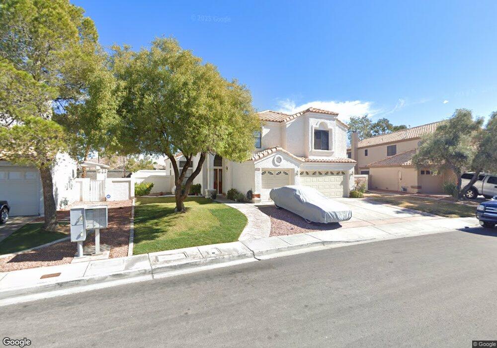
2621 White Pine Dr Henderson, NV 89074
Green Valley North NeighborhoodEstimated Value: $661,000 - $707,000
5
Beds
3
Baths
3,027
Sq Ft
$228/Sq Ft
Est. Value
About This Home
This home is located at 2621 White Pine Dr, Henderson, NV 89074 and is currently estimated at $689,708, approximately $227 per square foot. 2621 White Pine Dr is a home located in Clark County with nearby schools including David M Cox Elementary School, Barbara and Hank Greenspun Junior High School, and Silverado High School.
Ownership History
Date
Name
Owned For
Owner Type
Purchase Details
Closed on
Sep 2, 2005
Sold by
Wingard Barbara A
Bought by
Lopez Fernando and Sosa Guadalupe D
Current Estimated Value
Home Financials for this Owner
Home Financials are based on the most recent Mortgage that was taken out on this home.
Original Mortgage
$399,200
Outstanding Balance
$210,747
Interest Rate
5.64%
Mortgage Type
Fannie Mae Freddie Mac
Estimated Equity
$478,961
Purchase Details
Closed on
Oct 22, 2004
Sold by
Wingard Donald P
Bought by
Wingard Barbara A
Home Financials for this Owner
Home Financials are based on the most recent Mortgage that was taken out on this home.
Original Mortgage
$150,000
Interest Rate
5.69%
Mortgage Type
Credit Line Revolving
Create a Home Valuation Report for This Property
The Home Valuation Report is an in-depth analysis detailing your home's value as well as a comparison with similar homes in the area
Home Values in the Area
Average Home Value in this Area
Purchase History
| Date | Buyer | Sale Price | Title Company |
|---|---|---|---|
| Lopez Fernando | $499,000 | Lawyers Title Of Nevada | |
| Wingard Barbara A | -- | Lawyers Title Of Nevada |
Source: Public Records
Mortgage History
| Date | Status | Borrower | Loan Amount |
|---|---|---|---|
| Open | Lopez Fernando | $399,200 | |
| Previous Owner | Wingard Barbara A | $150,000 |
Source: Public Records
Tax History Compared to Growth
Tax History
| Year | Tax Paid | Tax Assessment Tax Assessment Total Assessment is a certain percentage of the fair market value that is determined by local assessors to be the total taxable value of land and additions on the property. | Land | Improvement |
|---|---|---|---|---|
| 2025 | $2,769 | $148,761 | $57,050 | $91,711 |
| 2024 | $2,689 | $148,761 | $57,050 | $91,711 |
| 2023 | $2,194 | $135,036 | $47,250 | $87,786 |
| 2022 | $2,611 | $118,399 | $37,450 | $80,949 |
| 2021 | $2,535 | $114,892 | $37,450 | $77,442 |
| 2020 | $2,458 | $114,794 | $37,450 | $77,344 |
| 2019 | $2,386 | $109,950 | $33,250 | $76,700 |
| 2018 | $2,317 | $101,175 | $27,300 | $73,875 |
| 2017 | $2,978 | $102,732 | $27,300 | $75,432 |
| 2016 | $2,194 | $95,003 | $19,250 | $75,753 |
| 2015 | $2,190 | $86,163 | $16,800 | $69,363 |
| 2014 | $2,122 | $71,057 | $12,250 | $58,807 |
Source: Public Records
Map
Nearby Homes
- 2657 Storey Cir
- 314 Lander Dr
- 7483 Forestdale Ct
- 367 Lander Dr
- 2670 Ridgewater Cir
- 353 Lander Terrace
- 353 Clayton St
- 2766 Red Vista Ct
- 2763 Red Vista Ct
- 2775 Red Vista Ct
- 2786 Fountain Ridge Ln
- 2722 Briarcliff Ave
- 2709 Briarcliff Ave
- 2792 Fountain Ridge Ln
- 319 Carrington St
- 2520 Machado Dr
- 3120 E Eldorado Ln
- 2926 E Eldorado Ln
- 3221 Montecito Dr
- 2544 Wellworth Ave
- 2619 White Pine Dr
- 2619 White Pine Dr Unit n/a
- 2623 White Pine Dr
- 2617 White Pine Dr
- 2624 White Pine Dr
- 2625 White Pine Cir
- 2620 White Pine Dr
- 2628 White Pine Dr
- 2627 White Pine Cir
- 2615 White Pine Dr
- 2618 White Pine Dr
- 342 S Humboldt Dr
- 2637 Pershing Cir
- 2632 White Pine Dr
- 2616 White Pine Dr
- 2616 White Pine Dr Unit 1
- 2629 White Pine Cir
- 340 S Humboldt Dr
- 2613 White Pine Dr
- 2638 Pershing Cir