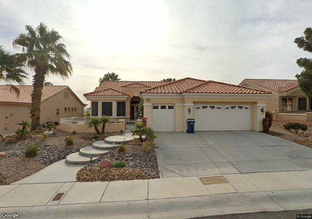
2624 High Range Dr Las Vegas, NV 89134
Sun City Summerlin NeighborhoodEstimated Value: $676,000 - $755,000
2
Beds
2
Baths
2,102
Sq Ft
$341/Sq Ft
Est. Value
About This Home
This home is located at 2624 High Range Dr, Las Vegas, NV 89134 and is currently estimated at $716,610, approximately $340 per square foot. 2624 High Range Dr is a home located in Clark County with nearby schools including William Lummis Elementary School, Ernest Becker Middle School, and Palo Verde High School.
Ownership History
Date
Name
Owned For
Owner Type
Purchase Details
Closed on
Jul 21, 2024
Sold by
Kramzar Trust and Kramzar Audrey M
Bought by
Schnepp Jason and Moore Audrey
Current Estimated Value
Purchase Details
Closed on
Nov 10, 2021
Sold by
Kramzar Dwain A
Bought by
Kramzar Dwain A and Kramzar Audrey M
Purchase Details
Closed on
Jun 19, 2009
Sold by
Kramzar Dwain A
Bought by
Kramzar Dwain A and Kramzar Audrey M
Purchase Details
Closed on
Sep 11, 1998
Sold by
Del Webb Communities Inc
Bought by
Kramzar Dwain and Kramzar Donna J
Home Financials for this Owner
Home Financials are based on the most recent Mortgage that was taken out on this home.
Original Mortgage
$200,000
Interest Rate
6.88%
Create a Home Valuation Report for This Property
The Home Valuation Report is an in-depth analysis detailing your home's value as well as a comparison with similar homes in the area
Home Values in the Area
Average Home Value in this Area
Purchase History
| Date | Buyer | Sale Price | Title Company |
|---|---|---|---|
| Schnepp Jason | -- | None Listed On Document | |
| Kramzar Dwain A | -- | None Available | |
| Kramzar Dwain A | -- | None Available | |
| Kramzar Dwain | $284,500 | First American Title Co |
Source: Public Records
Mortgage History
| Date | Status | Borrower | Loan Amount |
|---|---|---|---|
| Previous Owner | Kramzar Dwain | $200,000 |
Source: Public Records
Tax History Compared to Growth
Tax History
| Year | Tax Paid | Tax Assessment Tax Assessment Total Assessment is a certain percentage of the fair market value that is determined by local assessors to be the total taxable value of land and additions on the property. | Land | Improvement |
|---|---|---|---|---|
| 2025 | $4,098 | $161,411 | $76,160 | $85,251 |
| 2024 | $3,979 | $161,411 | $76,160 | $85,251 |
| 2023 | $3,979 | $147,307 | $66,500 | $80,807 |
| 2022 | $3,863 | $131,719 | $57,750 | $73,969 |
| 2021 | $3,751 | $121,037 | $50,505 | $70,532 |
| 2020 | $3,639 | $120,473 | $50,505 | $69,968 |
| 2019 | $3,533 | $114,209 | $45,273 | $68,936 |
| 2018 | $3,430 | $107,317 | $40,845 | $66,472 |
| 2017 | $3,472 | $105,055 | $38,430 | $66,625 |
| 2016 | $3,247 | $100,710 | $32,515 | $68,195 |
| 2015 | $3,241 | $96,514 | $29,295 | $67,219 |
| 2014 | $3,146 | $92,261 | $27,283 | $64,978 |
Source: Public Records
Map
Nearby Homes
- 2616 High Range Dr
- 10009 Netherton Dr
- 2652 Youngdale Dr
- 10036 Keysborough Dr
- 2601 Lotus Hill Dr
- 10025 Netherton Dr
- 2540 Youngdale Dr
- 2712 Lotus Hill Dr
- 2548 Tumble Brook Dr
- 2816 High Range Dr
- 2820 High Range Dr
- 2725 Byron Dr
- 2801 Byron Dr
- 10017 Bundella Dr Unit 34
- 10144 Hunter Springs Dr
- 9948 Bundella Dr
- 9840 Kernville Dr
- 2624 Spalding Dr
- 9908 Bundella Dr
- 2737 Tumble Brook Dr
- 2628 High Range Dr
- 2620 High Range Dr
- 2632 High Range Dr
- 10000 Hope Island Dr
- 10001 Keysborough Dr
- 2636 High Range Dr
- 2617 High Range Dr
- 10004 Hope Island Dr
- 2612 High Range Dr
- 10009 Keysborough Dr
- 2613 High Range Dr
- 2700 High Range Dr
- 2608 High Range Dr
- 10013 Keysborough Dr
- 2609 High Range Dr
- 10000 Keysborough Dr
- 10012 Hope Island Dr
- 10017 Keysborough Dr
- 2704 High Range Dr