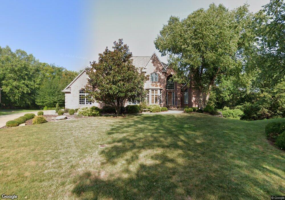
2624 NW Ashurst Ln Lees Summit, MO 64081
Estimated Value: $934,000 - $1,026,000
About This Home
This home is located at 2624 NW Ashurst Ln, Lees Summit, MO 64081 and is currently estimated at $971,122, approximately $224 per square foot. 2624 NW Ashurst Ln is a home located in Jackson County with nearby schools including Cedar Creek Elementary School, Pleasant Lea Middle School, and Lee's Summit Senior High School.
Ownership History
We collect this data history from publicly available records. To have your information removed, we recommend requesting removal directly through your county’s website.
Purchase Details
Home Financials for this Owner
Home Financials are based on the most recent Mortgage that was taken out on this home.Purchase Details
Purchase Details
Home Financials for this Owner
Home Financials are based on the most recent Mortgage that was taken out on this home.Purchase Details
Home Values in the Area
Average Home Value in this Area
Purchase History
We collect this data history from publicly available records. To have your information removed, we recommend requesting removal directly through your county’s website.
| Date | Buyer | Sale Price | Title Company |
|---|---|---|---|
| -- | Nations Title Agency Mo Inc | ||
| -- | None Available | ||
| -- | Security Land Title Company | ||
| -- | Security Land Title Company | ||
| -- | Security Land Title Company |
Mortgage History
We collect this data history from publicly available records. To have your information removed, we recommend requesting removal directly through your county’s website.
| Date | Status | Borrower | Loan Amount |
|---|---|---|---|
| Open | $417,000 | ||
| Closed | $600,000 |
Tax History
We collect this data history from publicly available records. To have your information removed, we recommend requesting removal directly through your county’s website.
| Year | Tax Paid | Tax Assessment Tax Assessment Total Assessment is a certain percentage of the fair market value that is determined by local assessors to be the total taxable value of land and additions on the property. | Land | Improvement |
|---|---|---|---|---|
| 2025 | $11,455 | $145,237 | $24,121 | $121,116 |
| 2024 | $11,372 | $158,650 | $22,838 | $135,812 |
| 2023 | $11,372 | $158,650 | $22,838 | $135,812 |
| 2022 | $8,865 | $109,820 | $23,874 | $85,946 |
| 2021 | $9,049 | $109,820 | $23,874 | $85,946 |
| 2020 | $8,695 | $104,501 | $23,874 | $80,627 |
| 2019 | $11,405 | $140,919 | $23,874 | $117,045 |
| 2018 | $1,420,097 | $136,746 | $19,040 | $117,706 |
| 2017 | $11,926 | $136,746 | $19,040 | $117,706 |
| 2016 | $11,983 | $136,002 | $22,743 | $113,259 |
| 2014 | $12,467 | $138,700 | $20,389 | $118,311 |
Map
- 2648 NW Ashurst Ln
- 510 NW Ashurst Place
- 336 NW Thoreau Cir
- 341 NW Thoreau Cir
- 469 NW Riven Rock Place
- 2508 NW Bent Tree Cir
- 2702 NW Cedar Brook
- 3121 SW Merriam Dr
- 319 NW Rockwood Ct
- 2448 NW Valley View Dr
- 202 NW Joshua Dr
- 317 NW Lovins
- 316 NW Lovins
- 320 NW Lovins
- 321 NW Lovins
- 129 NW Morton Dr
- 321 NW Earle Ln
- 3104 NW Berkebile Ln
- 1056 NW High Point Dr
- 202 NW Ambersham Dr
- 2620 NW Ashurst Ln
- 2628 NW Ashurst Ln
- 2616 NW Ashurst Ln
- 2632 NW Ashurst Ln
- 2612 NW Ashurst Ln
- 2617 NW Ashurst Ln
- 2636 NW Ashurst Ln
- 2621 NW Ashurst Ln
- 2613 NW Ashurst Ln
- 2608 NW Ashurst Ln
- 2625 NW Ashurst Ln
- 2640 NW Ashurst Ln
- 2609 NW Ashurst Ln
- 2775 NW Chipman Rd
- 2629 NW Ashurst Ln
- 596 NW Riven Rock Trail
- 592 NW Riven Rock Trail
- 2644 NW Ashurst Ln
- 2755 NW Chipman Rd
- 2725 NW Chipman Rd
Ask me questions while you tour the home.