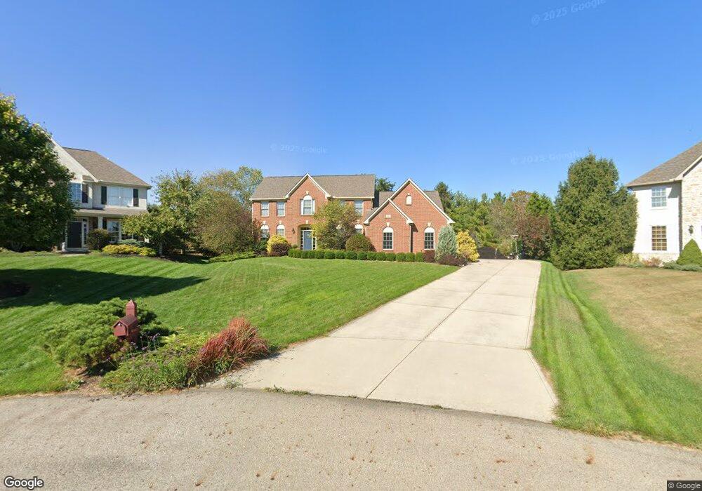
2625 Bayshore Ct Lewis Center, OH 43035
Orange NeighborhoodEstimated Value: $614,000 - $674,410
4
Beds
4
Baths
3,129
Sq Ft
$206/Sq Ft
Est. Value
About This Home
This home is located at 2625 Bayshore Ct, Lewis Center, OH 43035 and is currently estimated at $646,103, approximately $206 per square foot. 2625 Bayshore Ct is a home located in Delaware County with nearby schools including Alum Creek Elementary School, Olentangy Shanahan Middle School, and Olentangy High School.
Ownership History
Date
Name
Owned For
Owner Type
Purchase Details
Closed on
Jul 29, 2005
Sold by
Musgrave Construction Co Inc
Bought by
Foy Jerry J and Foy Deanne K
Current Estimated Value
Home Financials for this Owner
Home Financials are based on the most recent Mortgage that was taken out on this home.
Original Mortgage
$244,900
Outstanding Balance
$129,310
Interest Rate
5.74%
Mortgage Type
Fannie Mae Freddie Mac
Estimated Equity
$516,793
Purchase Details
Closed on
Nov 19, 2004
Sold by
Evergreen Land Co
Bought by
Musgrave Construction Co Inc
Home Financials for this Owner
Home Financials are based on the most recent Mortgage that was taken out on this home.
Original Mortgage
$300,000
Interest Rate
5.86%
Mortgage Type
Purchase Money Mortgage
Create a Home Valuation Report for This Property
The Home Valuation Report is an in-depth analysis detailing your home's value as well as a comparison with similar homes in the area
Home Values in the Area
Average Home Value in this Area
Purchase History
| Date | Buyer | Sale Price | Title Company |
|---|---|---|---|
| Foy Jerry J | $424,900 | Assurance Title Agency | |
| Musgrave Construction Co Inc | $80,600 | Assurance Title Agency |
Source: Public Records
Mortgage History
| Date | Status | Borrower | Loan Amount |
|---|---|---|---|
| Open | Foy Jerry J | $244,900 | |
| Previous Owner | Musgrave Construction Co Inc | $300,000 |
Source: Public Records
Tax History Compared to Growth
Tax History
| Year | Tax Paid | Tax Assessment Tax Assessment Total Assessment is a certain percentage of the fair market value that is determined by local assessors to be the total taxable value of land and additions on the property. | Land | Improvement |
|---|---|---|---|---|
| 2024 | $10,477 | $188,620 | $42,770 | $145,850 |
| 2023 | $10,515 | $188,620 | $42,770 | $145,850 |
| 2022 | $10,294 | $150,160 | $29,650 | $120,510 |
| 2021 | $10,352 | $150,160 | $29,650 | $120,510 |
| 2020 | $10,401 | $150,160 | $29,650 | $120,510 |
| 2019 | $9,291 | $139,200 | $29,650 | $109,550 |
| 2018 | $9,333 | $139,200 | $29,650 | $109,550 |
| 2017 | $3,970 | $121,700 | $26,430 | $95,270 |
| 2016 | $8,696 | $121,700 | $26,430 | $95,270 |
| 2015 | $7,939 | $121,700 | $26,430 | $95,270 |
| 2014 | $8,051 | $121,700 | $26,430 | $95,270 |
| 2013 | $8,236 | $121,700 | $26,430 | $95,270 |
Source: Public Records
Map
Nearby Homes
- 2567 Carmel Dr
- 2868 Lewis Center Rd
- 2946 Lewis Center Rd
- 5669 Maplewood Ct
- 6440 Morningside Dr
- 2070 Alum Village Dr
- 2840 Waukeegan Ave
- 6566 Morningside Dr
- 5491 Sandy Dr
- 3177 Shoreline Dr
- 1929 Rocklake Ct
- 2515 Coltsbridge Dr
- 1915 Myrtle St
- 2241 Red Oak St
- 2948 Prairie Dr
- 5737 Butternut Dr
- 5450 Maple Dr
- 1811 Ivy St
- 1654 Sunflower St
- 5390 Maple Dr
- 2631 Bayshore Ct
- 2630 Bayshore Ct
- 6019 S Old State Rd
- 6003 S Old State Rd
- 6037 S Old State Rd
- 2639 Bayshore Ct
- 2638 Bayshore Ct
- 6057 S Old State Rd
- 2651 Bayshore Ct
- 2643 Sandhurst Dr
- 6075 S Old State Rd
- 2619 Sandhurst Dr
- 1963 Parklawn Dr
- 5937 Rocky Shore Dr
- 1957 Parklawn Dr
- 5951 Rocky Shore Dr
- 1969 Parklawn Dr
- 1951 Parklawn Dr
- 2589 Sandhurst Dr
- 5923 Rocky Shore Dr