Estimated Value: $281,000 - $305,000
3
Beds
3
Baths
1,610
Sq Ft
$179/Sq Ft
Est. Value
About This Home
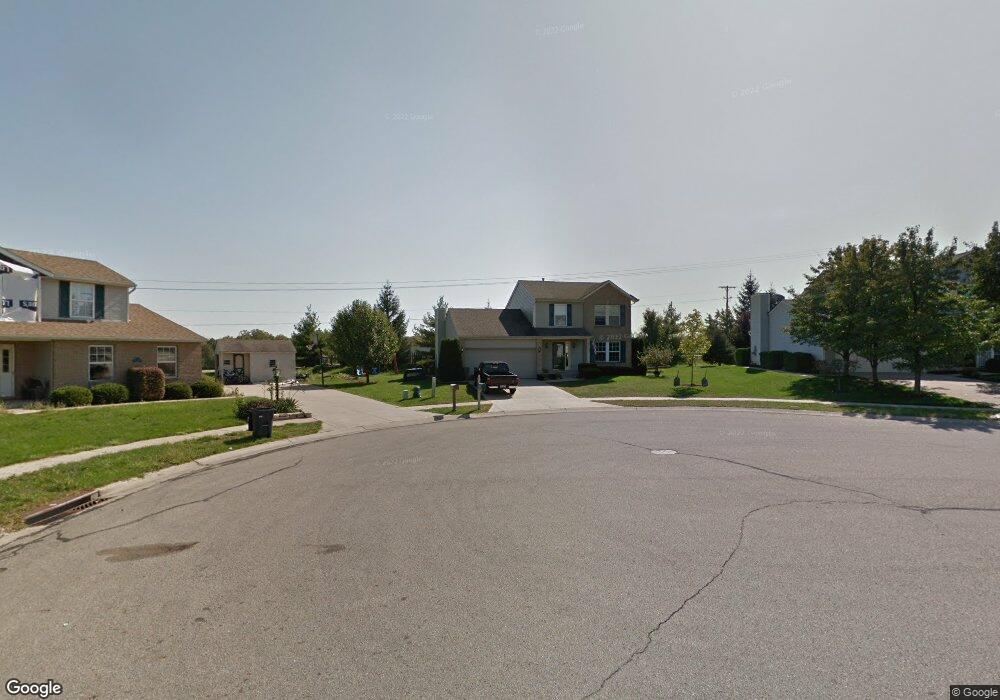
This home is located at 2625 Greystoke Ct, Xenia, OH 45385 and is currently estimated at $288,120, approximately $178 per square foot. 2625 Greystoke Ct is a home located in Greene County with nearby schools including Xenia High School, Summit Academy Community School for Alternative Learners - Xenia, and Legacy Christian Academy.
Ownership History
Date
Name
Owned For
Owner Type
Purchase Details
Closed on
Dec 8, 2006
Sold by
Beneficial Ohio Inc
Bought by
Hunt Matthew B and Hunt Kelli
Current Estimated Value
Home Financials for this Owner
Home Financials are based on the most recent Mortgage that was taken out on this home.
Original Mortgage
$108,000
Interest Rate
6.22%
Mortgage Type
Unknown
Purchase Details
Closed on
Aug 2, 2006
Sold by
Taylor Larry E and Taylor Alice L
Bought by
Beneficial Ohio Inc and Financial Mortgage Co Of Ohio
Purchase Details
Closed on
Dec 4, 1996
Sold by
Crossmann Communties Of
Bought by
Taylor Larry E and Taylor L
Home Financials for this Owner
Home Financials are based on the most recent Mortgage that was taken out on this home.
Original Mortgage
$113,550
Interest Rate
7.91%
Mortgage Type
VA
Create a Home Valuation Report for This Property
The Home Valuation Report is an in-depth analysis detailing your home's value as well as a comparison with similar homes in the area
Home Values in the Area
Average Home Value in this Area
Purchase History
| Date | Buyer | Sale Price | Title Company |
|---|---|---|---|
| Hunt Matthew B | $138,000 | Attorney | |
| Beneficial Ohio Inc | $110,000 | Attorney | |
| Taylor Larry E | $110,243 | -- |
Source: Public Records
Mortgage History
| Date | Status | Borrower | Loan Amount |
|---|---|---|---|
| Previous Owner | Hunt Matthew B | $108,000 | |
| Previous Owner | Taylor Larry E | $113,550 |
Source: Public Records
Tax History Compared to Growth
Tax History
| Year | Tax Paid | Tax Assessment Tax Assessment Total Assessment is a certain percentage of the fair market value that is determined by local assessors to be the total taxable value of land and additions on the property. | Land | Improvement |
|---|---|---|---|---|
| 2024 | $3,238 | $75,680 | $18,940 | $56,740 |
| 2023 | $3,238 | $75,680 | $18,940 | $56,740 |
| 2022 | $2,846 | $56,740 | $12,630 | $44,110 |
| 2021 | $2,885 | $56,740 | $12,630 | $44,110 |
| 2020 | $2,764 | $56,740 | $12,630 | $44,110 |
| 2019 | $2,249 | $43,470 | $9,390 | $34,080 |
| 2018 | $2,258 | $43,470 | $9,390 | $34,080 |
| 2017 | $2,222 | $43,470 | $9,390 | $34,080 |
| 2016 | $2,223 | $41,990 | $9,390 | $32,600 |
| 2015 | $2,229 | $41,990 | $9,390 | $32,600 |
| 2014 | $2,134 | $41,990 | $9,390 | $32,600 |
Source: Public Records
Map
Nearby Homes
- 2540 Cornwall Dr
- 0 Berkshire Dr Unit 942854
- 2540 Jenny Marie Dr
- 2784 Greystoke Dr
- 2421 Louisiana Dr
- 2499 Jenny Marie Dr
- 2821 Raxit Ct
- 2345 Tennessee Dr
- 1318 Prem Place
- 1107 Arkansas Dr
- 2144 Tandem Dr
- 1255 Colorado Dr
- 2705 Tennessee Dr
- 1248 Prem Place
- 1304 Baybury Ave
- 1298 Baybury Ave
- 2692 Kingman Dr
- 910 Wright Ave
- 1282 Baybury Ave
- 1213 Prem Place
- 2633 Greystoke Ct
- 2641 Greystoke Ct
- 2620 Greystoke Ct
- 2628 Greystoke Ct
- 2649 Greystoke Ct
- 2636 Greystoke Ct
- 2612 Greystoke Ct
- 2644 Greystoke Ct
- 2657 Greystoke Ct
- 2652 Greystoke Ct
- 2621 Ketki Ct
- 2629 Ketki Ct
- 855 Lower Bellbrook Rd
- 2637 Ketki Ct
- 2669 Greystoke Ct
- 2660 Greystoke Ct
- 2645 Ketki Ct
- 2613 Ketki Ct
- 2653 Ketki Ct
- 2668 Greystoke Ct