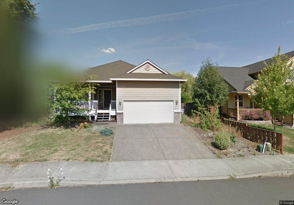
2625 SE Davies Ct Milwaukie, OR 97267
Estimated Value: $578,128 - $644,000
3
Beds
3
Baths
1,871
Sq Ft
$323/Sq Ft
Est. Value
About This Home
This home is located at 2625 SE Davies Ct, Milwaukie, OR 97267 and is currently estimated at $605,032, approximately $323 per square foot. 2625 SE Davies Ct is a home located in Clackamas County with nearby schools including Riverside Elementary School, Alder Creek Middle School, and Rex Putnam High School.
Ownership History
Date
Name
Owned For
Owner Type
Purchase Details
Closed on
Jun 5, 2003
Sold by
Apollo Homes
Bought by
Brown Kory L and Menefer Roxanne G
Current Estimated Value
Home Financials for this Owner
Home Financials are based on the most recent Mortgage that was taken out on this home.
Original Mortgage
$194,900
Outstanding Balance
$84,214
Interest Rate
5.71%
Mortgage Type
Unknown
Estimated Equity
$520,818
Create a Home Valuation Report for This Property
The Home Valuation Report is an in-depth analysis detailing your home's value as well as a comparison with similar homes in the area
Home Values in the Area
Average Home Value in this Area
Purchase History
| Date | Buyer | Sale Price | Title Company |
|---|---|---|---|
| Brown Kory L | $194,900 | Chicago Title Insurance Comp |
Source: Public Records
Mortgage History
| Date | Status | Borrower | Loan Amount |
|---|---|---|---|
| Open | Brown Kory L | $194,900 |
Source: Public Records
Tax History Compared to Growth
Tax History
| Year | Tax Paid | Tax Assessment Tax Assessment Total Assessment is a certain percentage of the fair market value that is determined by local assessors to be the total taxable value of land and additions on the property. | Land | Improvement |
|---|---|---|---|---|
| 2025 | $5,528 | $289,787 | -- | -- |
| 2024 | $5,334 | $281,347 | -- | -- |
| 2023 | $5,334 | $273,153 | $0 | $0 |
| 2022 | $4,907 | $265,198 | $0 | $0 |
| 2021 | $4,728 | $257,474 | $0 | $0 |
| 2020 | $4,582 | $249,975 | $0 | $0 |
| 2019 | $4,516 | $242,695 | $0 | $0 |
| 2018 | $3,956 | $235,626 | $0 | $0 |
| 2017 | $3,830 | $228,763 | $0 | $0 |
| 2016 | $3,695 | $222,100 | $0 | $0 |
| 2015 | $3,591 | $215,631 | $0 | $0 |
| 2014 | $3,394 | $209,350 | $0 | $0 |
Source: Public Records
Map
Nearby Homes
- 15565 SE Wildwoods Ct
- 15315 SE East Ave
- 3200 SE Silver Leaf Ln Unit 33
- 15316 SE Lee Ave
- 2850 SE Oak Grove Blvd
- 3500 SE Concord Rd Unit 78
- 1875 SE River Glen Ct
- 16620 SE Ladd Ct
- 0 SE Concord Rd
- 15427 SE River Rd
- 14824 SE Kellogg Ave
- 3405 SE Vineyard Rd Unit SP 49
- 3419 SE Kingsley Rd
- 16889 SE Azalea Dr
- 15109 SE Oatfield Rd
- 15885 SE Harold Ave
- 14368 SE Lee Ave
- 15915 SE Harold Ave
- 0 SE Cedar Ave
- 15323 SE Fairoaks Ave
- 2510 SE Swain Ave
- 2613 SE Davies Ct
- 2637 SE Davies Ct
- 15714 SE Arista Dr
- 2540 SE Swain Ave
- 15716 SE Arista Dr
- 2655 SE Davies Ct
- 15712 SE Arista Dr
- 15718 SE Arista Dr
- 2679 SE Davies Ct
- 2600 SE Swain Ave
- 2638 SE Davies Ct
- 2691 SE Davies Ct
- 15728 SE Arista Dr
- 2711 SE Risley Ave
- 15800 SE Arista Dr
- 2620 SE Swain Ave
- 15575 SE Mcallister Ct
- 15636 SE Arista Dr
- 15591 SE Mcallister Ct