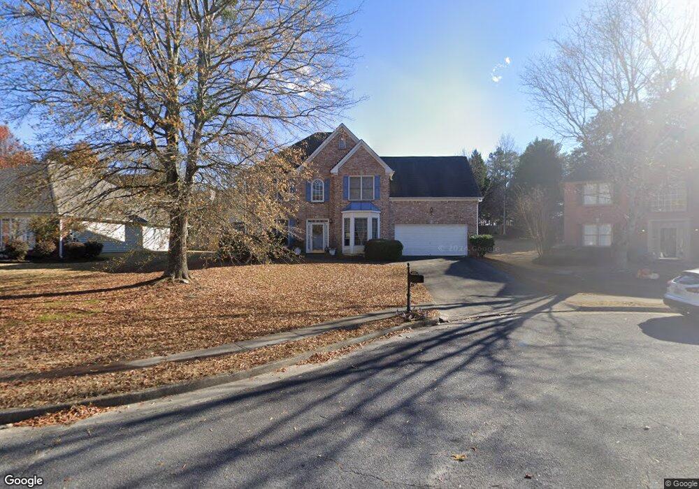
2627 Gold Rust Dr Unit 1 Buford, GA 30519
Estimated Value: $455,745 - $473,000
4
Beds
3
Baths
2,540
Sq Ft
$182/Sq Ft
Est. Value
About This Home
This home is located at 2627 Gold Rust Dr Unit 1, Buford, GA 30519 and is currently estimated at $463,436, approximately $182 per square foot. 2627 Gold Rust Dr Unit 1 is a home located in Gwinnett County with nearby schools including Patrick Elementary School and Glenn C. Jones Middle School.
Ownership History
Date
Name
Owned For
Owner Type
Purchase Details
Closed on
Dec 28, 2001
Sold by
Stamborski Edwin P and Stamborski Karen J
Bought by
Mcclenton Arturo and Mcclenton Regina
Current Estimated Value
Home Financials for this Owner
Home Financials are based on the most recent Mortgage that was taken out on this home.
Original Mortgage
$184,620
Outstanding Balance
$81,194
Interest Rate
7.08%
Mortgage Type
VA
Estimated Equity
$382,242
Purchase Details
Closed on
Feb 25, 2000
Sold by
Torrey D R Horton Inc-
Bought by
Stamborski Edwin P and Stamborski Karen J
Home Financials for this Owner
Home Financials are based on the most recent Mortgage that was taken out on this home.
Original Mortgage
$143,550
Interest Rate
7.5%
Mortgage Type
New Conventional
Create a Home Valuation Report for This Property
The Home Valuation Report is an in-depth analysis detailing your home's value as well as a comparison with similar homes in the area
Home Values in the Area
Average Home Value in this Area
Purchase History
| Date | Buyer | Sale Price | Title Company |
|---|---|---|---|
| Mcclenton Arturo | $181,000 | -- | |
| Stamborski Edwin P | $179,500 | -- |
Source: Public Records
Mortgage History
| Date | Status | Borrower | Loan Amount |
|---|---|---|---|
| Open | Mcclenton Arturo | $184,620 | |
| Previous Owner | Stamborski Edwin P | $143,550 |
Source: Public Records
Tax History
| Year | Tax Paid | Tax Assessment Tax Assessment Total Assessment is a certain percentage of the fair market value that is determined by local assessors to be the total taxable value of land and additions on the property. | Land | Improvement |
|---|---|---|---|---|
| 2025 | $4,841 | $180,520 | $40,000 | $140,520 |
| 2024 | $4,910 | $176,920 | $34,000 | $142,920 |
| 2023 | $4,910 | $176,920 | $34,000 | $142,920 |
| 2022 | $4,308 | $149,360 | $29,200 | $120,160 |
| 2021 | $3,596 | $112,240 | $22,800 | $89,440 |
| 2020 | $3,621 | $112,240 | $22,800 | $89,440 |
| 2019 | $3,526 | $112,240 | $22,800 | $89,440 |
| 2018 | $2,928 | $84,520 | $18,000 | $66,520 |
| 2016 | $2,796 | $77,486 | $15,300 | $62,186 |
| 2015 | $2,963 | $83,880 | $16,000 | $67,880 |
| 2014 | $2,978 | $83,880 | $16,000 | $67,880 |
Source: Public Records
Map
Nearby Homes
- 2640 Chandler Grove Dr
- 2551 Kilgore Rd
- 2705 Chandler Grove Dr
- 2550 Kilgore Rd
- 2710 Kilgore Rd
- 2718 Kilgore Rd
- 3665 Mystic Dr Unit 2
- 2753 Blue Moon Dr Unit 4
- 3496 Ravens Nest Trail
- 3685 Rolling Creek Dr
- 3430 Camp Branch - Lot 3 Rd
- 3430 Camp Branch-Lot 7 Rd
- 3588 Old Hamilton Mill Rd
- 3590 Old Hamilton Mill Rd NE
- 3663 Lost Oak Dr
- 2716 Hamilton Mill Rd
- 3775 Rolling Creek Dr
- 3861 Heirloom Loop Ct NE
- 3671 Hamilton Mill Rd
- 2380 Black Bear Ct
- 2637 Gold Rust Dr
- 2637 Gold Rust Dr Unit n/a
- 2617 Gold Rust Dr
- 2612 Ambria Dr
- 3520 Mystic Dr
- 2647 Gold Rust Dr
- 2604 Gold Rust Dr Unit 1
- 2602 Ambria Dr
- 2632 Ambria Dr
- 2634 Gold Rust Dr
- 2624 Gold Rust Dr
- 2614 Gold Rust Dr Unit I
- 2644 Gold Rust Dr
- 3525 Mystic Dr Unit 1
- 2613 Silver Dust Dr
- 2629 Ambria Dr
- 2642 Ambria Dr
- 2609 Ambria Dr Unit 4
- 2609 Ambria Dr
- 3550 Mystic Dr
Your Personal Tour Guide
Ask me questions while you tour the home.