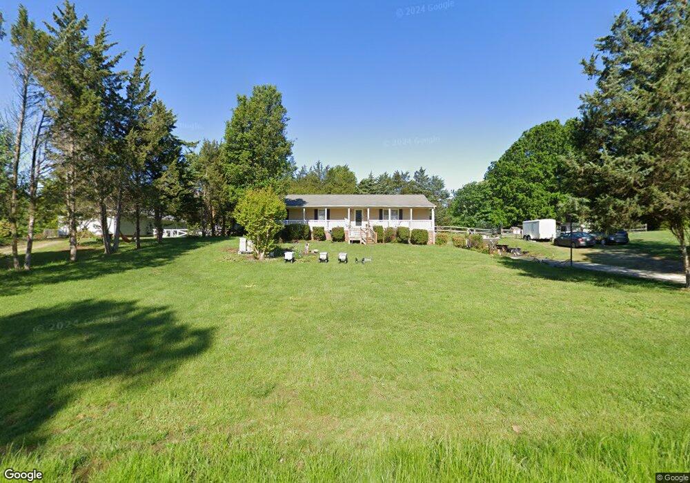
2627 Maxine Dr High Point, NC 27265
Hickswood NeighborhoodEstimated Value: $296,387 - $318,000
2
Beds
2
Baths
1,620
Sq Ft
$188/Sq Ft
Est. Value
About This Home
This home is located at 2627 Maxine Dr, High Point, NC 27265 and is currently estimated at $304,847, approximately $188 per square foot. 2627 Maxine Dr is a home located in Guilford County with nearby schools including Montlieu Academy of Technology, Welborn Academy of Science & Technology, and T.W. Andrews High School.
Ownership History
Date
Name
Owned For
Owner Type
Purchase Details
Closed on
Oct 31, 2014
Sold by
Lantz Bethany Robin Collins and Lantz Luther J
Bought by
Lantz Bethany Robin Collins and Lantz Luther J
Current Estimated Value
Home Financials for this Owner
Home Financials are based on the most recent Mortgage that was taken out on this home.
Original Mortgage
$174,600
Outstanding Balance
$129,951
Interest Rate
3.25%
Mortgage Type
Adjustable Rate Mortgage/ARM
Estimated Equity
$174,896
Purchase Details
Closed on
Apr 26, 2006
Sold by
Cromer Terry W and Cromer Pamela K
Bought by
Collins Bethany Robin
Home Financials for this Owner
Home Financials are based on the most recent Mortgage that was taken out on this home.
Original Mortgage
$156,000
Interest Rate
6.31%
Mortgage Type
Fannie Mae Freddie Mac
Create a Home Valuation Report for This Property
The Home Valuation Report is an in-depth analysis detailing your home's value as well as a comparison with similar homes in the area
Home Values in the Area
Average Home Value in this Area
Purchase History
| Date | Buyer | Sale Price | Title Company |
|---|---|---|---|
| Lantz Bethany Robin Collins | -- | None Available | |
| Collins Bethany Robin | $195,000 | None Available |
Source: Public Records
Mortgage History
| Date | Status | Borrower | Loan Amount |
|---|---|---|---|
| Open | Lantz Bethany Robin Collins | $174,600 | |
| Closed | Collins Bethany Robin | $156,000 |
Source: Public Records
Tax History
| Year | Tax Paid | Tax Assessment Tax Assessment Total Assessment is a certain percentage of the fair market value that is determined by local assessors to be the total taxable value of land and additions on the property. | Land | Improvement |
|---|---|---|---|---|
| 2025 | $1,498 | $175,300 | $40,000 | $135,300 |
| 2024 | $1,498 | $175,300 | $40,000 | $135,300 |
| 2023 | $1,498 | $175,300 | $40,000 | $135,300 |
| 2022 | $1,498 | $175,300 | $40,000 | $135,300 |
| 2021 | $1,210 | $141,600 | $25,000 | $116,600 |
| 2020 | $1,168 | $141,600 | $25,000 | $116,600 |
| 2019 | $1,168 | $141,600 | $0 | $0 |
| 2018 | $1,162 | $141,600 | $0 | $0 |
| 2017 | $1,168 | $141,600 | $0 | $0 |
| 2016 | $1,167 | $137,400 | $0 | $0 |
| 2015 | $1,174 | $137,400 | $0 | $0 |
| 2014 | $1,187 | $137,400 | $0 | $0 |
Source: Public Records
Map
Nearby Homes
- 3723 Apple Orchard Cove
- 2922 Hearthstone Point Dr
- 3946 Cobblestone Bend Dr
- 3973 Cobblestone Bend Dr
- 3871 Eagleston Ct
- 3724 Spanish Peak Dr Unit 2B
- 2606 Wexford Place
- 2731 Dandelion Dr
- 3630 Sunset Hollow Dr
- 3908 Garden Creek Dr
- 3710 Spanish Peak Dr Unit 2D
- 3521 Sunset Hollow Ct
- 1650 Penny Rd
- 3505 Timbergate Ln
- 3869 Hickswood Creek Dr
- 2674 Splitbrooke Dr
- 3534 Running Cedar Trail
- 2706 Edenridge Dr
- 2700 Edenridge Dr
- 1217 Lakeview Heights Dr
- 2625 Maxine Dr
- 2633 Maxine Dr
- 2216 Hickswood Rd
- 2212 Hickswood Rd
- 2621 Maxine Dr
- 2210 Hickswood Rd
- 2628 Maxine Dr
- 2636 Maxine Dr
- 2220 Hickswood Rd
- 2612 Willard Rd
- 2619 Maxine Dr
- 2702 Willard Rd
- 2213 Hickswood Rd
- 2620 Maxine Dr
- 2708 Pinelyn Dr
- 2226 Hickswood Rd
- 2611 Maxine Dr
- 2706 Pinelyn Dr
- 2206 Hickswood Rd
- 3965 Queens Grant Ct
Your Personal Tour Guide
Ask me questions while you tour the home.