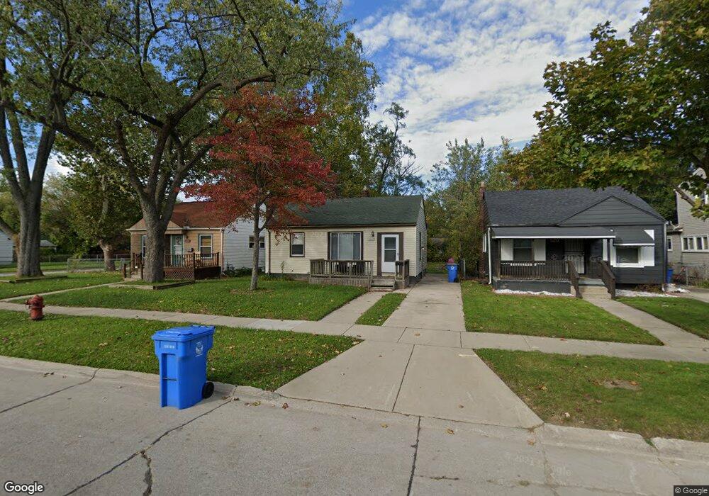
26286 Powers Ave Dearborn Heights, MI 48125
Estimated Value: $115,767 - $123,000
2
Beds
1
Bath
700
Sq Ft
$169/Sq Ft
Est. Value
About This Home
This home is located at 26286 Powers Ave, Dearborn Heights, MI 48125 and is currently estimated at $118,442, approximately $169 per square foot. 26286 Powers Ave is a home located in Wayne County with nearby schools including Quest Charter Academy, West Village Academy, and Peterson-Warren Academy.
Ownership History
Date
Name
Owned For
Owner Type
Purchase Details
Closed on
Apr 2, 2009
Sold by
Secretary Of Housing & Urban Development
Bought by
Rakipi Fezi
Current Estimated Value
Purchase Details
Closed on
Dec 17, 2007
Sold by
Citimortgage Inc
Bought by
Hud
Purchase Details
Closed on
Jul 25, 2007
Sold by
Nichols Robert J and Nichols Carly
Bought by
Abn Amro Mortgage Group Inc
Purchase Details
Closed on
Jan 4, 2002
Sold by
Osorio Teresa L
Bought by
Nichols Carly
Purchase Details
Closed on
Aug 9, 2001
Sold by
Osorio Oscar J
Bought by
Osorio Teresa L
Create a Home Valuation Report for This Property
The Home Valuation Report is an in-depth analysis detailing your home's value as well as a comparison with similar homes in the area
Home Values in the Area
Average Home Value in this Area
Purchase History
| Date | Buyer | Sale Price | Title Company |
|---|---|---|---|
| Rakipi Fezi | $3,000 | None Available | |
| Hud | -- | None Available | |
| Abn Amro Mortgage Group Inc | $65,158 | None Available | |
| Nichols Carly | $66,000 | -- | |
| Osorio Teresa L | -- | -- |
Source: Public Records
Tax History Compared to Growth
Tax History
| Year | Tax Paid | Tax Assessment Tax Assessment Total Assessment is a certain percentage of the fair market value that is determined by local assessors to be the total taxable value of land and additions on the property. | Land | Improvement |
|---|---|---|---|---|
| 2025 | $1,126 | $55,100 | $0 | $0 |
| 2024 | $1,126 | $45,000 | $0 | $0 |
| 2023 | $1,023 | $38,600 | $0 | $0 |
| 2022 | $1,506 | $32,700 | $0 | $0 |
| 2021 | $1,494 | $29,000 | $0 | $0 |
| 2019 | $1,383 | $22,600 | $0 | $0 |
| 2018 | $887 | $21,400 | $0 | $0 |
| 2017 | $915 | $20,900 | $0 | $0 |
| 2016 | $1,315 | $21,200 | $0 | $0 |
| 2015 | $1,970 | $19,700 | $0 | $0 |
| 2013 | $2,120 | $22,100 | $0 | $0 |
| 2010 | -- | $26,100 | $0 | $0 |
Source: Public Records
Map
Nearby Homes
- 26106 Powers Ave
- 26532 Powers Ave
- 26225 McDonald St
- 25926 Powers Ave
- 25965 Currier St
- 4863 Glenis St
- 26439 Hopkins St
- 25895 Annapolis St
- 26458 Hopkins St
- 26159 Stanford St
- 25628 Powers Ave
- 5970 John Daly St
- 5961 Marvin St
- 5993 John Daly St
- 5526 Sylvia St
- 5845 Beech Daly Rd
- 6075 Duncan St
- 26202 Colgate St
- 4110 John Daly St
- 5961 Beech Daly Rd
- 26276 Powers Ave
- 26266 Powers Ave
- 26256 Powers Ave
- 26295 Pennie St
- 26275 Pennie St
- 26246 Powers Ave
- 26308 Powers Ave
- 26265 Pennie St
- 26316 Powers Ave
- 26255 Pennie St
- 26236 Powers Ave
- 26309 Pennie St
- 26245 Pennie St
- 26324 Powers Ave
- 26317 Pennie St
- 26226 Powers Ave
- 26235 Pennie St
- 26332 Powers Ave
- 26325 Pennie St
- 26216 Powers Ave