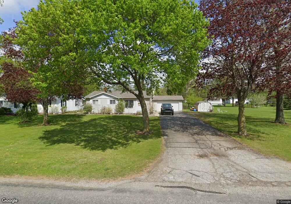
2629 Airport Rd Adrian, MI 49221
Estimated Value: $204,803 - $218,000
3
Beds
1
Bath
1,178
Sq Ft
$181/Sq Ft
Est. Value
About This Home
This home is located at 2629 Airport Rd, Adrian, MI 49221 and is currently estimated at $212,934, approximately $180 per square foot. 2629 Airport Rd is a home located in Lenawee County with nearby schools including Adrian High School, Berean Baptist Academy, and St. Stephen Lutheran School.
Ownership History
Date
Name
Owned For
Owner Type
Purchase Details
Closed on
Aug 3, 2007
Sold by
Sheldon Walter W
Bought by
Pifer Scott D and Pifer Tammie S
Current Estimated Value
Home Financials for this Owner
Home Financials are based on the most recent Mortgage that was taken out on this home.
Original Mortgage
$80,000
Outstanding Balance
$50,730
Interest Rate
6.69%
Mortgage Type
New Conventional
Estimated Equity
$162,204
Create a Home Valuation Report for This Property
The Home Valuation Report is an in-depth analysis detailing your home's value as well as a comparison with similar homes in the area
Home Values in the Area
Average Home Value in this Area
Purchase History
| Date | Buyer | Sale Price | Title Company |
|---|---|---|---|
| Pifer Scott D | $120,000 | Prestige Title Insurance Age |
Source: Public Records
Mortgage History
| Date | Status | Borrower | Loan Amount |
|---|---|---|---|
| Open | Pifer Scott D | $80,000 |
Source: Public Records
Tax History Compared to Growth
Tax History
| Year | Tax Paid | Tax Assessment Tax Assessment Total Assessment is a certain percentage of the fair market value that is determined by local assessors to be the total taxable value of land and additions on the property. | Land | Improvement |
|---|---|---|---|---|
| 2025 | $1,728 | $91,900 | $0 | $0 |
| 2024 | $998 | $83,400 | $0 | $0 |
| 2023 | $1,602 | $71,900 | $0 | $0 |
| 2022 | $904 | $61,500 | $0 | $0 |
| 2021 | $1,572 | $59,100 | $0 | $0 |
| 2020 | $1,571 | $60,900 | $0 | $0 |
| 2019 | $135,977 | $51,800 | $0 | $0 |
| 2018 | $1,524 | $51,805 | $0 | $0 |
| 2017 | $1,469 | $51,370 | $0 | $0 |
| 2016 | $1,708 | $48,448 | $0 | $0 |
| 2014 | -- | $44,442 | $0 | $0 |
Source: Public Records
Map
Nearby Homes
- 2682 Elmwood Dr
- 2018 Green Acres Dr
- 2029 Green Acres Dr
- 2023 Green Acres Dr
- 2027 Green Acres Dr
- 2015 Green Acres Dr
- 2012 Green Acres Dr
- 2010 Green Acres Dr
- 2008 Green Acres Dr
- 1902 W Cadmus Rd
- 1692 Rivers Edge Ct
- 1639 Rivers Edge Ct
- 302 Lakewood Dr
- 802 Lakewood Dr
- 1227 Sherman St
- 301 Ohio River Dr Unit LOT 52
- 3079 Hillview Dr
- 3224 Sand Creek Hwy
- 3520 Crestone Way
- 1035 Scottdale Dr
- 2601 Airport Rd
- 2605 Airport Rd
- 2657 Airport Rd
- 2547 Macarthur Dr
- 2673 Airport Rd
- 2540 Macarthur Dr
- 2531 Macarthur Dr
- 2548 Macarthur Dr
- 2526 Macarthur Dr
- 2687 Airport Rd
- 2617 Sharon Dr
- 2699 Airport Rd
- 2511 Macarthur Dr
- 2662 Sharon Dr
- 2508 Macarthur Dr
- 2670 Sharon Dr
- 2715 Airport Rd
- 2501 Macarthur Dr
- 2678 Sharon Dr
- 2608 Park Dr