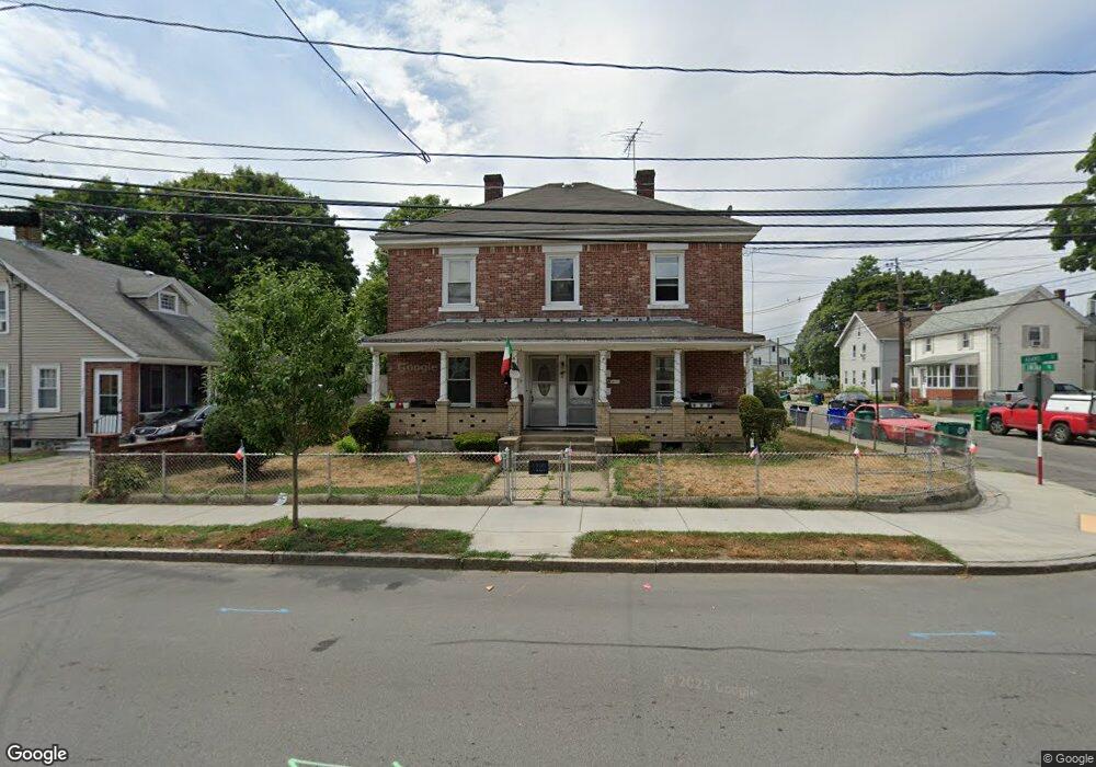
263 Adams St Unit 265 Newton, MA 02458
Nonantum NeighborhoodEstimated Value: $894,000 - $1,367,000
6
Beds
3
Baths
2,100
Sq Ft
$529/Sq Ft
Est. Value
About This Home
This home is located at 263 Adams St Unit 265, Newton, MA 02458 and is currently estimated at $1,111,851, approximately $529 per square foot. 263 Adams St Unit 265 is a home located in Middlesex County with nearby schools including Lincoln-Eliot Elementary School, Bigelow Middle School, and Newton North High School.
Ownership History
Date
Name
Owned For
Owner Type
Purchase Details
Closed on
Dec 9, 2014
Sold by
Uberti Mary E
Bought by
Uberti Michael W and Uberti Daniel M
Current Estimated Value
Home Financials for this Owner
Home Financials are based on the most recent Mortgage that was taken out on this home.
Original Mortgage
$240,000
Outstanding Balance
$183,906
Interest Rate
3.93%
Mortgage Type
New Conventional
Estimated Equity
$927,945
Purchase Details
Closed on
Jun 28, 1990
Sold by
Cetrone Dorothy A
Bought by
Uberti William L
Home Financials for this Owner
Home Financials are based on the most recent Mortgage that was taken out on this home.
Original Mortgage
$48,000
Interest Rate
10.27%
Mortgage Type
Purchase Money Mortgage
Create a Home Valuation Report for This Property
The Home Valuation Report is an in-depth analysis detailing your home's value as well as a comparison with similar homes in the area
Home Values in the Area
Average Home Value in this Area
Purchase History
| Date | Buyer | Sale Price | Title Company |
|---|---|---|---|
| Uberti Michael W | $300,000 | -- | |
| Uberti William L | $60,000 | -- |
Source: Public Records
Mortgage History
| Date | Status | Borrower | Loan Amount |
|---|---|---|---|
| Open | Uberti Michael W | $240,000 | |
| Previous Owner | Uberti William L | $16,500 | |
| Previous Owner | Uberti William L | $48,000 | |
| Previous Owner | Uberti William L | $15,000 |
Source: Public Records
Tax History Compared to Growth
Tax History
| Year | Tax Paid | Tax Assessment Tax Assessment Total Assessment is a certain percentage of the fair market value that is determined by local assessors to be the total taxable value of land and additions on the property. | Land | Improvement |
|---|---|---|---|---|
| 2025 | $8,699 | $887,700 | $600,800 | $286,900 |
| 2024 | $8,411 | $861,800 | $583,300 | $278,500 |
| 2023 | $8,048 | $790,600 | $463,900 | $326,700 |
| 2022 | $7,701 | $732,000 | $429,500 | $302,500 |
| 2021 | $7,226 | $671,600 | $394,000 | $277,600 |
| 2020 | $7,012 | $671,600 | $394,000 | $277,600 |
| 2019 | $6,559 | $627,700 | $368,200 | $259,500 |
| 2018 | $6,451 | $596,200 | $345,500 | $250,700 |
| 2017 | $6,083 | $547,000 | $317,000 | $230,000 |
| 2016 | $5,710 | $501,800 | $290,800 | $211,000 |
| 2015 | $5,445 | $469,000 | $271,800 | $197,200 |
Source: Public Records
Map
Nearby Homes
- 86 West St
- 12-14 Middle St
- 11 Murphy Ct
- 188-190 Adams St
- 53 West St
- 3 Ashmont Ave
- 22-24 Emerald St
- 49 Hawthorn St
- 34 West St Unit A
- 324 Adams St Unit 2
- 158 Adams St
- 290 Watertown St Unit 3
- 290 Watertown St Unit 4
- 90 Waban Park Unit 2
- 230 Bellevue St Unit 1
- 42-44 Judkins St
- 77 Pond Ave Unit 1103
- 77 Court St Unit 205
- 282 Nevada St Unit 282
- 286 Nevada St Unit 286
- 267 Adams St Unit 269
- 12 Lincoln Rd
- 12 Lincoln Rd Unit T
- 12 Lincoln Rd Unit 4
- 12 Lincoln Rd
- 12 Lincoln Rd Unit 2
- 12 Lincoln Rd
- 12 Lincoln Rd
- 12 Lincoln Rd
- 12 Lincoln Rd
- 12 Lincoln Rd
- 12 Lincoln Rd
- 12 Lincoln Rd
- 12 Lincoln Rd
- 12 Lincoln Rd
- 12 Lincoln Rd
- 12 Lincoln Rd
- 12 Lincoln Rd
- 12 Lincoln Rd
- 12 Lincoln Rd