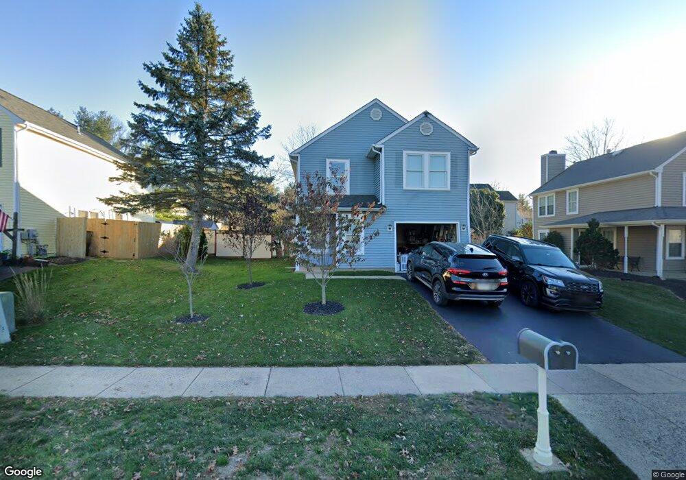
263 Davis Ln Newtown, PA 18940
Estimated Value: $468,000 - $648,000
3
Beds
3
Baths
1,284
Sq Ft
$429/Sq Ft
Est. Value
About This Home
This home is located at 263 Davis Ln, Newtown, PA 18940 and is currently estimated at $550,768, approximately $428 per square foot. 263 Davis Ln is a home located in Bucks County with nearby schools including Goodnoe Elementary School, Newtown Middle School, and Council Rock High School North.
Ownership History
Date
Name
Owned For
Owner Type
Purchase Details
Closed on
Jul 11, 2007
Sold by
Holsclaw Kurt C and Holsclaw Jill
Bought by
Marcus Michael H
Current Estimated Value
Home Financials for this Owner
Home Financials are based on the most recent Mortgage that was taken out on this home.
Original Mortgage
$245,600
Interest Rate
6.43%
Mortgage Type
Purchase Money Mortgage
Purchase Details
Closed on
Aug 13, 2005
Sold by
Hutchison Ryan J and Hutchison Wendy Lynn
Bought by
Holsclaw Kurt C and Holsclaw Jill
Home Financials for this Owner
Home Financials are based on the most recent Mortgage that was taken out on this home.
Original Mortgage
$169,000
Interest Rate
5.84%
Mortgage Type
Fannie Mae Freddie Mac
Create a Home Valuation Report for This Property
The Home Valuation Report is an in-depth analysis detailing your home's value as well as a comparison with similar homes in the area
Home Values in the Area
Average Home Value in this Area
Purchase History
| Date | Buyer | Sale Price | Title Company |
|---|---|---|---|
| Marcus Michael H | $307,000 | None Available | |
| Holsclaw Kurt C | $319,000 | None Available |
Source: Public Records
Mortgage History
| Date | Status | Borrower | Loan Amount |
|---|---|---|---|
| Open | Marcus Michael H | $30,700 | |
| Previous Owner | Marcus Michael H | $245,600 | |
| Previous Owner | Holsclaw Kurt C | $169,000 |
Source: Public Records
Tax History
| Year | Tax Paid | Tax Assessment Tax Assessment Total Assessment is a certain percentage of the fair market value that is determined by local assessors to be the total taxable value of land and additions on the property. | Land | Improvement |
|---|---|---|---|---|
| 2025 | $5,104 | $28,720 | $4,400 | $24,320 |
| 2024 | $5,104 | $28,720 | $4,400 | $24,320 |
| 2023 | $4,883 | $28,720 | $4,400 | $24,320 |
| 2022 | $4,789 | $28,720 | $4,400 | $24,320 |
| 2021 | $4,715 | $28,720 | $4,400 | $24,320 |
| 2020 | $4,488 | $28,720 | $4,400 | $24,320 |
| 2019 | $4,381 | $28,720 | $4,400 | $24,320 |
| 2018 | $4,298 | $28,720 | $4,400 | $24,320 |
| 2017 | $4,149 | $28,720 | $4,400 | $24,320 |
| 2016 | $4,120 | $28,720 | $4,400 | $24,320 |
| 2015 | -- | $28,720 | $4,400 | $24,320 |
| 2014 | -- | $28,720 | $4,400 | $24,320 |
Source: Public Records
Map
Nearby Homes
- 272 Stanford Place
- 32 Eaton Ct Unit B
- 348 Burgundy Ln
- 17 Essex Place
- 226 Andrew Dr
- 25 Essex Place
- 206 Paxon Aly Unit 51
- 4 Independence Place
- 25 Independence Place
- 35 David Dr
- 297 Cliveden Dr
- 313 Washington Ave
- 203 Cliveden Dr
- 21 S Lincoln Ave Unit 10
- 55 Violet Ln Unit 158E
- 111 S State St
- 1 Denton Cir
- 22 Penn St
- 113 Thorton Ln
- 18 Penn St
Your Personal Tour Guide
Ask me questions while you tour the home.