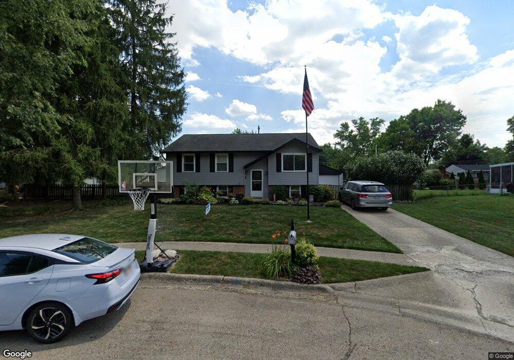
263 Embassy Ct Columbus, OH 43230
Estimated Value: $288,000 - $301,000
3
Beds
2
Baths
1,693
Sq Ft
$173/Sq Ft
Est. Value
About This Home
This home is located at 263 Embassy Ct, Columbus, OH 43230 and is currently estimated at $292,098, approximately $172 per square foot. 263 Embassy Ct is a home located in Franklin County with nearby schools including Chapelfield Elementary School, Gahanna West Middle School, and Lincoln High School.
Ownership History
Date
Name
Owned For
Owner Type
Purchase Details
Closed on
Jun 1, 2005
Sold by
Stevenson Renda M
Bought by
Enyart Kenneth R
Current Estimated Value
Home Financials for this Owner
Home Financials are based on the most recent Mortgage that was taken out on this home.
Original Mortgage
$132,965
Outstanding Balance
$67,584
Interest Rate
5.75%
Mortgage Type
FHA
Estimated Equity
$224,514
Purchase Details
Closed on
Jun 18, 2002
Sold by
Stevenson John T
Bought by
Stevenson Renda M
Purchase Details
Closed on
Mar 27, 1998
Sold by
Swafford Sandra J and Peterman Sandra J
Bought by
Stevenson John T and Stevenson Renda M
Purchase Details
Closed on
May 14, 1990
Create a Home Valuation Report for This Property
The Home Valuation Report is an in-depth analysis detailing your home's value as well as a comparison with similar homes in the area
Purchase History
| Date | Buyer | Sale Price | Title Company |
|---|---|---|---|
| Enyart Kenneth R | $137,000 | -- | |
| Stevenson Renda M | -- | -- | |
| Stevenson John T | $93,500 | -- | |
| -- | $77,900 | -- |
Source: Public Records
Mortgage History
| Date | Status | Borrower | Loan Amount |
|---|---|---|---|
| Open | Enyart Kenneth R | $132,965 |
Source: Public Records
Tax History
| Year | Tax Paid | Tax Assessment Tax Assessment Total Assessment is a certain percentage of the fair market value that is determined by local assessors to be the total taxable value of land and additions on the property. | Land | Improvement |
|---|---|---|---|---|
| 2025 | $5,135 | $87,160 | $26,640 | $60,520 |
| 2024 | $5,135 | $87,160 | $26,640 | $60,520 |
| 2023 | $5,070 | $87,150 | $26,635 | $60,515 |
| 2022 | $4,504 | $60,310 | $14,700 | $45,610 |
| 2021 | $4,356 | $60,310 | $14,700 | $45,610 |
| 2020 | $4,319 | $60,310 | $14,700 | $45,610 |
| 2019 | $3,607 | $50,260 | $12,250 | $38,010 |
| 2018 | $3,371 | $49,880 | $12,250 | $37,630 |
| 2017 | $3,236 | $49,880 | $12,250 | $37,630 |
| 2016 | $3,185 | $44,040 | $12,360 | $31,680 |
| 2015 | $3,188 | $44,040 | $12,360 | $31,680 |
| 2014 | $3,163 | $44,040 | $12,360 | $31,680 |
| 2013 | $1,571 | $44,030 | $12,355 | $31,675 |
Source: Public Records
Map
Nearby Homes
- 208 Rugby Ln
- 292 Moorfield Dr
- 278 Empire Dr
- 140 Walnut St
- 299 Sherwood Meadows Dr
- 464 Foxwood Dr
- 439 Canterwood Ct
- 206 Lintner St
- 388 Elkwood Place
- 475 Denwood Ct
- 300 Dunbarton Rd
- 167 Lansdowne Ave
- 424 Lincolnshire Rd
- 586 Pinegrove Place
- 362 Banbury Dr
- 394 Banbury Dr
- 427 Canfield Dr
- 371 Banbury Dr
- 730 Penny Ct
- 402 Citadel St
- 253 Embassy Ct
- 273 Embassy Ct
- 260 Dunchurch Rd
- 268 Dunchurch Rd
- 252 Dunchurch Rd
- 274 Dunchurch Rd
- 196 Moorfield Dr
- 254 Embassy Ct
- 262 Embassy Ct
- 187 Rugby Ln
- 191 Rugby Ln
- 272 Embassy Ct
- 195 Rugby Ln
- 284 Dunchurch Rd
- 212 Moorfield Dr
- 199 Rugby Ln
- 263 Dunchurch Rd
- 265 White Swan Ct
- 255 Dunchurch Rd
- 183 Rugby Ln
Your Personal Tour Guide
Ask me questions while you tour the home.