Estimated Value: $294,000 - $415,000
Studio
--
Bath
--
Sq Ft
7,841
Sq Ft Lot
About This Home
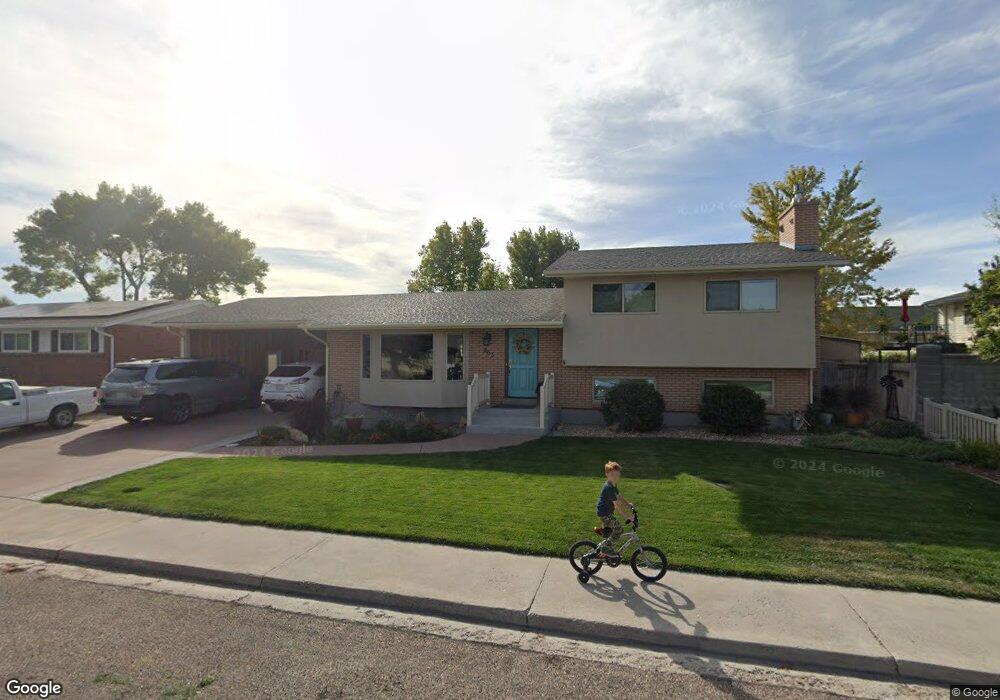
This home is located at 263 N 420 E, Delta, UT 84624 and is currently estimated at $351,124. 263 N 420 E is a home with nearby schools including Cba Center and White River Academy.
Ownership History
Date
Name
Owned For
Owner Type
Purchase Details
Closed on
May 27, 2011
Sold by
Davis Leo S and Davis Lynne
Bought by
Davis Leo S and Davis Lynne
Current Estimated Value
Home Financials for this Owner
Home Financials are based on the most recent Mortgage that was taken out on this home.
Original Mortgage
$112,000
Outstanding Balance
$76,944
Interest Rate
4.71%
Estimated Equity
$274,180
Create a Home Valuation Report for This Property
The Home Valuation Report is an in-depth analysis detailing your home's value as well as a comparison with similar homes in the area
Home Values in the Area
Average Home Value in this Area
Purchase History
| Date | Buyer | Sale Price | Title Company |
|---|---|---|---|
| Davis Leo S | -- | -- | |
| Davis Leo S | -- | -- |
Source: Public Records
Mortgage History
| Date | Status | Borrower | Loan Amount |
|---|---|---|---|
| Open | Davis Leo S | $112,000 | |
| Closed | Davis Leo S | $112,000 |
Source: Public Records
Tax History
| Year | Tax Paid | Tax Assessment Tax Assessment Total Assessment is a certain percentage of the fair market value that is determined by local assessors to be the total taxable value of land and additions on the property. | Land | Improvement |
|---|---|---|---|---|
| 2025 | $188 | $225,985 | $15,375 | $210,610 |
| 2024 | $188 | $160,652 | $14,485 | $146,167 |
| 2023 | $288 | $160,652 | $14,485 | $146,167 |
| 2022 | $1,531 | $115,134 | $13,168 | $101,966 |
| 2021 | $1,319 | $94,688 | $11,450 | $83,238 |
| 2020 | $1,227 | $87,577 | $10,409 | $77,168 |
| 2019 | $1,183 | $84,520 | $10,106 | $74,414 |
| 2018 | $1,088 | $78,376 | $10,106 | $68,270 |
| 2017 | $1,130 | $78,376 | $10,106 | $68,270 |
| 2016 | $1,095 | $78,376 | $10,106 | $68,270 |
| 2015 | $1,094 | $78,376 | $10,106 | $68,270 |
| 2014 | -- | $71,527 | $10,106 | $61,421 |
| 2013 | -- | $71,527 | $10,106 | $61,421 |
Source: Public Records
Map
Nearby Homes
- 7900 E 250 Rd N
- 445 Topaz Blvd Unit 10
- 520 E 450 North Rd
- 628 Sunset St
- 0 E Highway 6 Unit LotWP001 16586023
- 44 E 300 S
- 87 S 300 East Rd
- 901 E 750 Rd N
- 321 E 200 S
- 325 N 100 W
- Locust Ave Unit LotWP001
- 163 W 100 S
- 38 E 300 S
- 32 E 300 S
- 648 Tamarix St
- 98 W 1000 N
- 341 W 100 S
- 451 W 300 N
- 700 N Highway 6
- 294 S 300 W
Your Personal Tour Guide
Ask me questions while you tour the home.