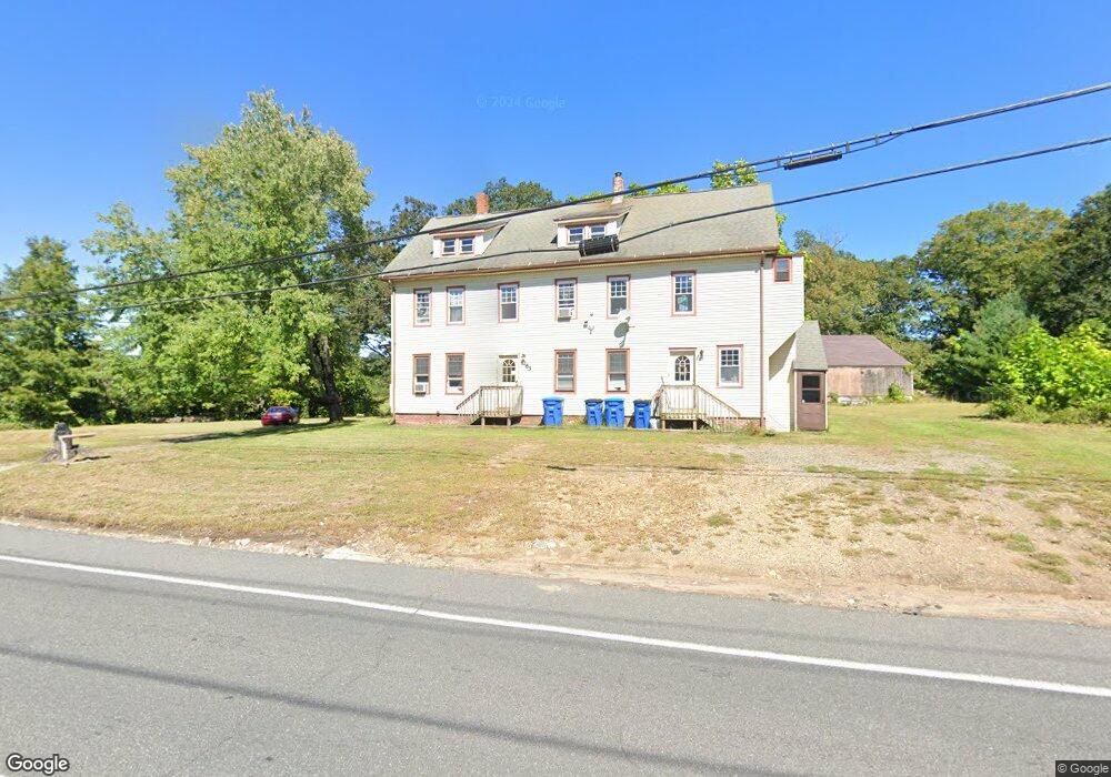
263 Palmer Rd Monson, MA 01057
Estimated Value: $232,000 - $340,000
6
Beds
4
Baths
3,145
Sq Ft
$86/Sq Ft
Est. Value
About This Home
This home is located at 263 Palmer Rd, Monson, MA 01057 and is currently estimated at $270,000, approximately $85 per square foot. 263 Palmer Rd is a home located in Hampden County with nearby schools including Quarry Hill Community School, Granite Valley School, and Monson High School.
Ownership History
Date
Name
Owned For
Owner Type
Purchase Details
Closed on
Jul 18, 2011
Sold by
Nubile Paolo O
Bought by
263 Palmer Road Rt and Nubile Paolo O
Current Estimated Value
Home Financials for this Owner
Home Financials are based on the most recent Mortgage that was taken out on this home.
Original Mortgage
$150,000
Outstanding Balance
$103,536
Interest Rate
4.58%
Mortgage Type
Purchase Money Mortgage
Estimated Equity
$166,464
Purchase Details
Closed on
Sep 29, 1997
Sold by
Weskosky William A and Weskosky Sally A
Bought by
Nubile Paulo O
Create a Home Valuation Report for This Property
The Home Valuation Report is an in-depth analysis detailing your home's value as well as a comparison with similar homes in the area
Home Values in the Area
Average Home Value in this Area
Purchase History
| Date | Buyer | Sale Price | Title Company |
|---|---|---|---|
| 263 Palmer Road Rt | -- | -- | |
| Nubile Paulo O | $53,250 | -- |
Source: Public Records
Mortgage History
| Date | Status | Borrower | Loan Amount |
|---|---|---|---|
| Open | 263 Palmer Road Rt | $150,000 | |
| Previous Owner | Nubile Paulo O | $57,900 |
Source: Public Records
Tax History Compared to Growth
Tax History
| Year | Tax Paid | Tax Assessment Tax Assessment Total Assessment is a certain percentage of the fair market value that is determined by local assessors to be the total taxable value of land and additions on the property. | Land | Improvement |
|---|---|---|---|---|
| 2025 | $4,286 | $288,200 | $69,000 | $219,200 |
| 2024 | $4,241 | $273,600 | $69,000 | $204,600 |
| 2023 | $4,079 | $257,200 | $69,000 | $188,200 |
| 2022 | $3,803 | $226,300 | $69,000 | $157,300 |
| 2021 | $3,803 | $209,900 | $69,000 | $140,900 |
| 2020 | $3,835 | $209,900 | $69,000 | $140,900 |
| 2019 | $4,016 | $219,000 | $69,000 | $150,000 |
| 2018 | $3,665 | $219,100 | $76,400 | $142,700 |
| 2017 | $3,665 | $210,500 | $73,300 | $137,200 |
| 2016 | $3,573 | $208,700 | $71,500 | $137,200 |
| 2015 | $3,479 | $208,700 | $71,500 | $137,200 |
| 2014 | $3,381 | $208,700 | $71,500 | $137,200 |
Source: Public Records
Map
Nearby Homes
- 9 Silva St
- 268 Palmer Rd Unit 27
- 268 Palmer Rd Unit 57
- 268 Palmer Rd Unit 44
- 11 Allen St
- 1415 Park St
- 4 Salem St
- 65 Breckenridge St
- 169 Palmer Rd
- 72 Quaboag Valley Co Op St Unit 70
- 2034 Pleasant St
- 7 Cedar Hill St
- 0 Palmer Rd
- 44 Converse St
- 0 Hovey Rd
- 207 Breckenridge St
- 0 Bethany Rd
- 14 Squier St
- 16 Old Farm Rd
- 1045 Pine St