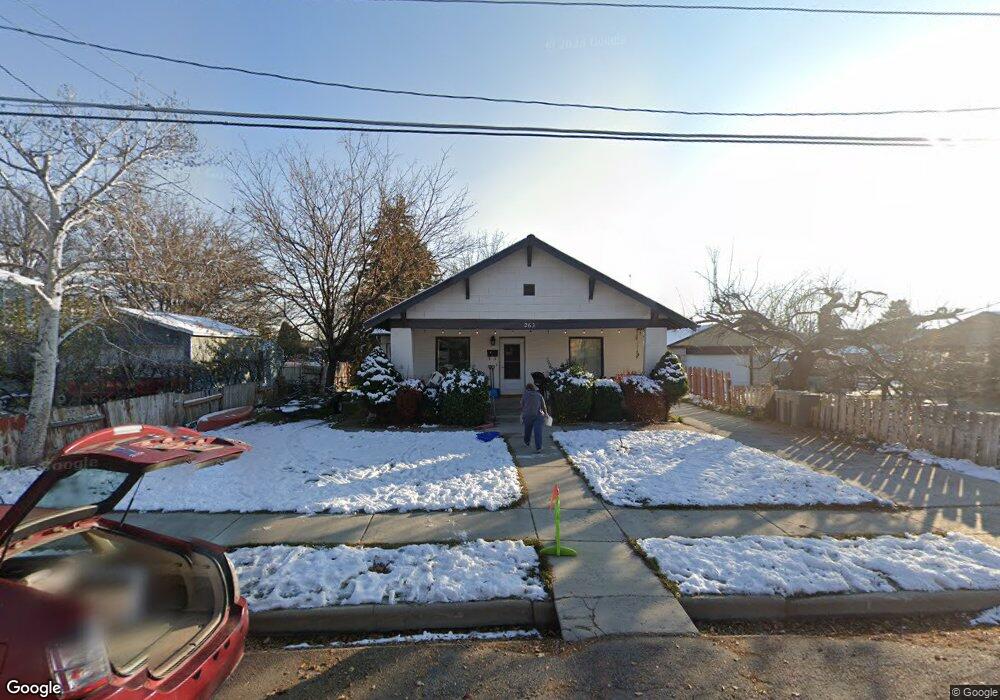
263 W 100 S American Fork, UT 84003
Estimated Value: $568,000 - $646,000
6
Beds
3
Baths
3,456
Sq Ft
$176/Sq Ft
Est. Value
About This Home
This home is located at 263 W 100 S, American Fork, UT 84003 and is currently estimated at $607,511, approximately $175 per square foot. 263 W 100 S is a home located in Utah County with nearby schools including Greenwood Elementary School, American Fork Junior High School, and American Fork High School.
Ownership History
Date
Name
Owned For
Owner Type
Purchase Details
Closed on
Oct 6, 2022
Sold by
Mortensen Family Trust
Bought by
Anderson Paul K and Anderson Katherine Ann
Current Estimated Value
Home Financials for this Owner
Home Financials are based on the most recent Mortgage that was taken out on this home.
Original Mortgage
$400,000
Outstanding Balance
$383,563
Interest Rate
5.55%
Mortgage Type
New Conventional
Estimated Equity
$223,948
Create a Home Valuation Report for This Property
The Home Valuation Report is an in-depth analysis detailing your home's value as well as a comparison with similar homes in the area
Home Values in the Area
Average Home Value in this Area
Purchase History
| Date | Buyer | Sale Price | Title Company |
|---|---|---|---|
| Anderson Paul K | -- | First American Title |
Source: Public Records
Mortgage History
| Date | Status | Borrower | Loan Amount |
|---|---|---|---|
| Open | Anderson Paul K | $400,000 |
Source: Public Records
Tax History Compared to Growth
Tax History
| Year | Tax Paid | Tax Assessment Tax Assessment Total Assessment is a certain percentage of the fair market value that is determined by local assessors to be the total taxable value of land and additions on the property. | Land | Improvement |
|---|---|---|---|---|
| 2025 | $2,515 | $302,995 | $220,700 | $330,200 |
| 2024 | $2,515 | $279,455 | $0 | $0 |
| 2023 | $2,320 | $273,240 | $0 | $0 |
| 2022 | $2,289 | $266,090 | $0 | $0 |
| 2021 | $1,957 | $355,400 | $158,400 | $197,000 |
| 2020 | $1,829 | $322,100 | $141,400 | $180,700 |
| 2019 | $1,657 | $301,900 | $121,200 | $180,700 |
| 2018 | $1,529 | $266,200 | $109,100 | $157,100 |
| 2017 | $1,464 | $137,610 | $0 | $0 |
| 2016 | $1,331 | $116,270 | $0 | $0 |
| 2015 | $1,403 | $116,270 | $0 | $0 |
| 2014 | $1,395 | $114,015 | $0 | $0 |
Source: Public Records
Map
Nearby Homes
- 351 Washington Ave
- 82 S Lincoln Ave
- 271 S Barratt Cir
- 55 Roosevelt Ave
- 217 W Main St
- 382 W 330 S
- 120 N 350 W Unit 133
- 120 N 350 W Unit 130
- 368 S Storrs Ct Unit 107
- 365 W 370 S
- 129 W Pacific Dr
- 316 W 390 S
- 171 S Center St
- 195 S Center St
- 391 W 370 S
- 105 N 100 W
- 429 S Storrs Ave
- 412 S 390 W
- 424 S 340 W
- 399 W Pacific Dr
- 251 W 100 S
- 285 W 100 S
- 148 S 270 Cir W Unit 104
- 148 S 270 Cir W
- 135 S 300 W
- 146 S 270 West Cir
- 239 W 100 S
- 158 S 270 West Cir Unit 103
- 158 S 270 West Cir
- 162 S 270 West Cir Unit 102
- 162 S 270 West Cir
- 107 S 300 W
- 225 W 100 S
- 143 S 270 West Cir Unit 105
- 143 S 270 West Cir
- 254 W 100 S
- 143 S 300 W
- 174 S 270 West Cir Unit 101
- 174 S 270 West Cir
- 278 W 100 S