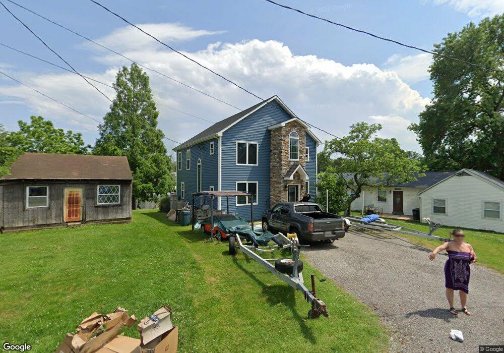
2630 Brannan Ave Sparrows Point, MD 21219
Estimated Value: $427,000 - $570,000
--
Bed
2
Baths
2,080
Sq Ft
$252/Sq Ft
Est. Value
About This Home
This home is located at 2630 Brannan Ave, Sparrows Point, MD 21219 and is currently estimated at $524,348, approximately $252 per square foot. 2630 Brannan Ave is a home located in Baltimore County with nearby schools including Edgemere Elementary School, Sparrows Point Middle School, and Sparrows Point High School.
Ownership History
Date
Name
Owned For
Owner Type
Purchase Details
Closed on
Apr 28, 2005
Sold by
Helsel Kent and Helsel Rew
Bought by
Bullis Peter Dean
Current Estimated Value
Home Financials for this Owner
Home Financials are based on the most recent Mortgage that was taken out on this home.
Original Mortgage
$252,000
Outstanding Balance
$128,513
Interest Rate
5.5%
Mortgage Type
Adjustable Rate Mortgage/ARM
Estimated Equity
$395,835
Purchase Details
Closed on
Apr 25, 2005
Sold by
Helsel Kent and Helsel Rew
Bought by
Bullis Peter Dean
Home Financials for this Owner
Home Financials are based on the most recent Mortgage that was taken out on this home.
Original Mortgage
$252,000
Outstanding Balance
$128,513
Interest Rate
5.5%
Mortgage Type
Adjustable Rate Mortgage/ARM
Estimated Equity
$395,835
Create a Home Valuation Report for This Property
The Home Valuation Report is an in-depth analysis detailing your home's value as well as a comparison with similar homes in the area
Home Values in the Area
Average Home Value in this Area
Purchase History
| Date | Buyer | Sale Price | Title Company |
|---|---|---|---|
| Bullis Peter Dean | $315,000 | -- | |
| Bullis Peter Dean | $315,000 | -- |
Source: Public Records
Mortgage History
| Date | Status | Borrower | Loan Amount |
|---|---|---|---|
| Open | Bullis Peter Dean | $252,000 | |
| Closed | Bullis Peter Dean | $252,000 |
Source: Public Records
Tax History Compared to Growth
Tax History
| Year | Tax Paid | Tax Assessment Tax Assessment Total Assessment is a certain percentage of the fair market value that is determined by local assessors to be the total taxable value of land and additions on the property. | Land | Improvement |
|---|---|---|---|---|
| 2025 | $3,405 | $457,667 | -- | -- |
| 2024 | $3,405 | $408,233 | $0 | $0 |
| 2023 | $1,636 | $358,800 | $159,500 | $199,300 |
| 2022 | $3,205 | $348,767 | $0 | $0 |
| 2021 | $3,564 | $338,733 | $0 | $0 |
| 2020 | $3,564 | $328,700 | $159,500 | $169,200 |
| 2019 | $2,628 | $172,000 | $159,500 | $12,500 |
| 2018 | $1,026 | $172,000 | $159,500 | $12,500 |
| 2017 | $2,179 | $285,700 | $0 | $0 |
| 2016 | $1,477 | $285,700 | $0 | $0 |
| 2015 | $1,477 | $285,700 | $0 | $0 |
| 2014 | $1,477 | $287,600 | $0 | $0 |
Source: Public Records
Map
Nearby Homes
- 2636 Haddaway Rd
- 2400 Lincoln Ave Unit 2
- 2400 Lincoln Ave Unit 15
- 7316A Hughes Ave
- 7349 Hughes Ave
- 2621 N Snyder Ave
- 2408 Lodge Farm Rd
- 0 Lodge Farm Rd
- 2703 Sparrows Point Rd
- 2217 Lodge Farm Rd
- 2322 Lodge Forest Dr
- 0 Wagner Ave Unit MDBC2107998
- 2542 Sycamore Ave
- 2409 Woodridge Rd
- 7708 S Cove Rd
- 7428 Bay Front Rd
- 2122 Lodge Forest Dr
- 2924 Waterfront Way
- 2918 Waterfront Way
- 8610 Oak Rd
- 2632 Brannan Ave
- 2626 Brannan Ave
- 2631 Brannan Ave
- 2634 Brannan Ave
- 2629 Brannan Ave
- 2627 Brannan Ave
- 2622 Brannan Ave
- 2625 Brannan Ave
- 2400 S Snyder Ave
- 2621 Brannan Ave
- 2512 Haddaway Rd
- 2421 Ketchum Ave
- 2510 Haddaway Rd
- 2620 Brannan Ave
- 2508 Haddaway Rd
- 2504 Haddaway Rd
- 2410 Ketchum Ave
- 362 Millers Island Boulevard Lot362
- 363 Millers Island Boulevard Lot363
- 360 Millers Island Boulevard Lot361