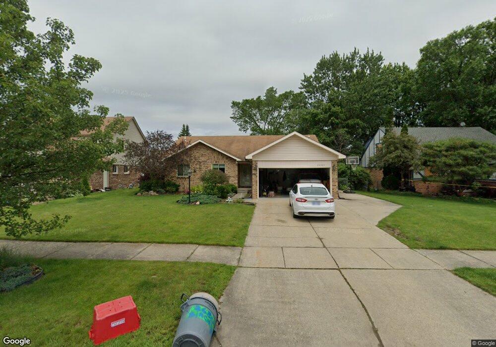
26305 Birchcrest Dr Chesterfield, MI 48051
Estimated Value: $316,117 - $350,000
3
Beds
2
Baths
1,559
Sq Ft
$219/Sq Ft
Est. Value
About This Home
This home is located at 26305 Birchcrest Dr, Chesterfield, MI 48051 and is currently estimated at $340,779, approximately $218 per square foot. 26305 Birchcrest Dr is a home located in Macomb County with nearby schools including Green Elementary School, L'Anse Creuse Middle School - North, and L'Anse Creuse High School - North.
Ownership History
Date
Name
Owned For
Owner Type
Purchase Details
Closed on
Jun 27, 2003
Sold by
Vincent J & Cynthia M L Agreement Trust
Bought by
Delamielleure Charles R
Current Estimated Value
Home Financials for this Owner
Home Financials are based on the most recent Mortgage that was taken out on this home.
Original Mortgage
$130,000
Interest Rate
5.31%
Mortgage Type
Purchase Money Mortgage
Create a Home Valuation Report for This Property
The Home Valuation Report is an in-depth analysis detailing your home's value as well as a comparison with similar homes in the area
Home Values in the Area
Average Home Value in this Area
Purchase History
| Date | Buyer | Sale Price | Title Company |
|---|---|---|---|
| Delamielleure Charles R | $204,000 | Metropolitan Title Co | |
| Delamielleure Charles R | -- | Metropolitan Title Company |
Source: Public Records
Mortgage History
| Date | Status | Borrower | Loan Amount |
|---|---|---|---|
| Previous Owner | Delamielleure Charles R | $130,000 |
Source: Public Records
Tax History Compared to Growth
Tax History
| Year | Tax Paid | Tax Assessment Tax Assessment Total Assessment is a certain percentage of the fair market value that is determined by local assessors to be the total taxable value of land and additions on the property. | Land | Improvement |
|---|---|---|---|---|
| 2025 | $3,327 | $140,200 | $0 | $0 |
| 2024 | $2,047 | $132,800 | $0 | $0 |
| 2023 | $1,941 | $122,700 | $0 | $0 |
| 2022 | $3,112 | $115,100 | $0 | $0 |
| 2021 | $2,869 | $109,000 | $0 | $0 |
| 2020 | $1,782 | $104,600 | $0 | $0 |
| 2019 | $2,727 | $99,000 | $0 | $0 |
| 2018 | $2,714 | $97,300 | $13,000 | $84,300 |
| 2017 | $2,582 | $90,050 | $13,000 | $77,050 |
| 2016 | $2,563 | $90,050 | $0 | $0 |
| 2015 | $1,030 | $83,500 | $0 | $0 |
| 2014 | $1,030 | $72,750 | $13,000 | $59,750 |
| 2012 | -- | $0 | $0 | $0 |
Source: Public Records
Map
Nearby Homes
- 53283 Woodland Dr
- 53179 Woodland Dr
- 53197 Woodland Dr
- 53184 Woodland Dr
- 26207 Fairwood Dr
- 26112 Birchcrest Dr
- 26331 Wacker Dr
- 26607 Birchcrest Dr
- 47579 Valleybrook Dr
- 48270 Applegrove Ln
- 47302 Joanne Smith Ln
- 48358 Applegrove Ln Unit 31, Building 8
- 26123 Joanne Smith Ln
- 48341 Applegrove Ln Unit 11
- 47215 Admirals Cove Ln Unit 17
- 47608 Ramblewood Dr
- 48382 Applegrove Ln Unit 8
- 48365 Applegrove Ln Unit 14
- 48381 Applegrove Ln Unit 16
- 48530 Gratiot Ave
- 26281 Birchcrest Dr
- 26329 Birchcrest Dr
- 26257 Birchcrest Dr
- 26302 Woodland Dr
- 26353 Birchcrest Dr
- 26278 Woodland Dr
- 26326 Woodland Dr
- 26254 Woodland Dr
- 26350 Woodland Dr
- 26304 Birchcrest Dr
- 26280 Birchcrest Dr
- 26233 Birchcrest Dr
- 26328 Birchcrest Dr
- 53199 Woodland Dr
- 53209 Woodland Dr
- 53172 Woodland Dr
- 53178 Woodland Dr
- 53188 Woodland Dr
- 53195 Woodland Dr
- 53189 Woodland Dr