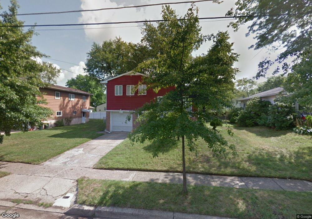
2632 Davies Ave Pennsauken, NJ 08109
Estimated Value: $250,688 - $348,000
--
Bed
--
Bath
1,569
Sq Ft
$201/Sq Ft
Est. Value
About This Home
This home is located at 2632 Davies Ave, Pennsauken, NJ 08109 and is currently estimated at $315,672, approximately $201 per square foot. 2632 Davies Ave is a home located in Camden County with nearby schools including Pennsauken High School and St. Peter Elementary School.
Ownership History
Date
Name
Owned For
Owner Type
Purchase Details
Closed on
Jun 25, 2003
Sold by
Kelley Jeffrey J
Bought by
Kelley Jeffrey J and Kelley Sandra J Dimatteo
Current Estimated Value
Home Financials for this Owner
Home Financials are based on the most recent Mortgage that was taken out on this home.
Original Mortgage
$50,000
Outstanding Balance
$21,202
Interest Rate
5.34%
Estimated Equity
$294,470
Create a Home Valuation Report for This Property
The Home Valuation Report is an in-depth analysis detailing your home's value as well as a comparison with similar homes in the area
Home Values in the Area
Average Home Value in this Area
Purchase History
| Date | Buyer | Sale Price | Title Company |
|---|---|---|---|
| Kelley Jeffrey J | -- | -- |
Source: Public Records
Mortgage History
| Date | Status | Borrower | Loan Amount |
|---|---|---|---|
| Open | Kelley Jeffrey J | $50,000 |
Source: Public Records
Tax History Compared to Growth
Tax History
| Year | Tax Paid | Tax Assessment Tax Assessment Total Assessment is a certain percentage of the fair market value that is determined by local assessors to be the total taxable value of land and additions on the property. | Land | Improvement |
|---|---|---|---|---|
| 2025 | $7,190 | $368,700 | $61,600 | $307,100 |
| 2024 | $7,051 | $165,200 | $46,900 | $118,300 |
| 2023 | $7,051 | $165,200 | $46,900 | $118,300 |
| 2022 | $6,375 | $165,200 | $46,900 | $118,300 |
| 2021 | $6,547 | $165,200 | $46,900 | $118,300 |
| 2020 | $5,865 | $165,200 | $46,900 | $118,300 |
| 2019 | $5,932 | $165,200 | $46,900 | $118,300 |
| 2018 | $5,964 | $165,200 | $46,900 | $118,300 |
| 2017 | $5,975 | $165,200 | $46,900 | $118,300 |
| 2016 | $5,868 | $165,200 | $46,900 | $118,300 |
| 2015 | $6,043 | $165,200 | $46,900 | $118,300 |
| 2014 | $5,929 | $106,600 | $26,800 | $79,800 |
Source: Public Records
Map
Nearby Homes
- 2602 Foehl Ave
- 7403 Grant Ave
- 7418 Harvey Ave
- 2603 Manall Ave
- 7270 Githens Ave
- 6902 Collins Ave
- 7263 Cedar Ave
- 3215 Cooper Ave
- 7624 Githens Ave
- 6936 Cedar Ave
- 6702 Grant Ave
- 7430 Walnut Ave
- 7515 Baxter Ave
- 7713 Piersanti Ct
- 3002 Gladwyn Ave
- 2429 Norwood Ave
- 6902 Walnut Ave
- 2543 Burning Tree Rd
- 7750 Hesson Ln
- 7235 Marion Ave
- 2638 Davies Ave
- 2626 Davies Ave
- 2633 Foehl Ave
- 2639 Foehl Ave
- 2627 Foehl Ave
- 2644 Davies Ave
- 2620 Davies Ave
- 2633 Davies Ave
- 2645 Foehl Ave
- 2621 Foehl Ave
- 2627 Davies Ave
- 2639 Davies Ave
- 2650 Davies Ave
- 2614 Davies Ave
- 2621 Davies Ave
- 2645 Davies Ave
- 2651 Foehl Ave
- 2615 Foehl Ave
- 2615 Davies Ave
- 2651 Davies Ave