Estimated Value: $348,222 - $721,000
--
Bed
--
Bath
--
Sq Ft
6,186
Sq Ft Lot
About This Home
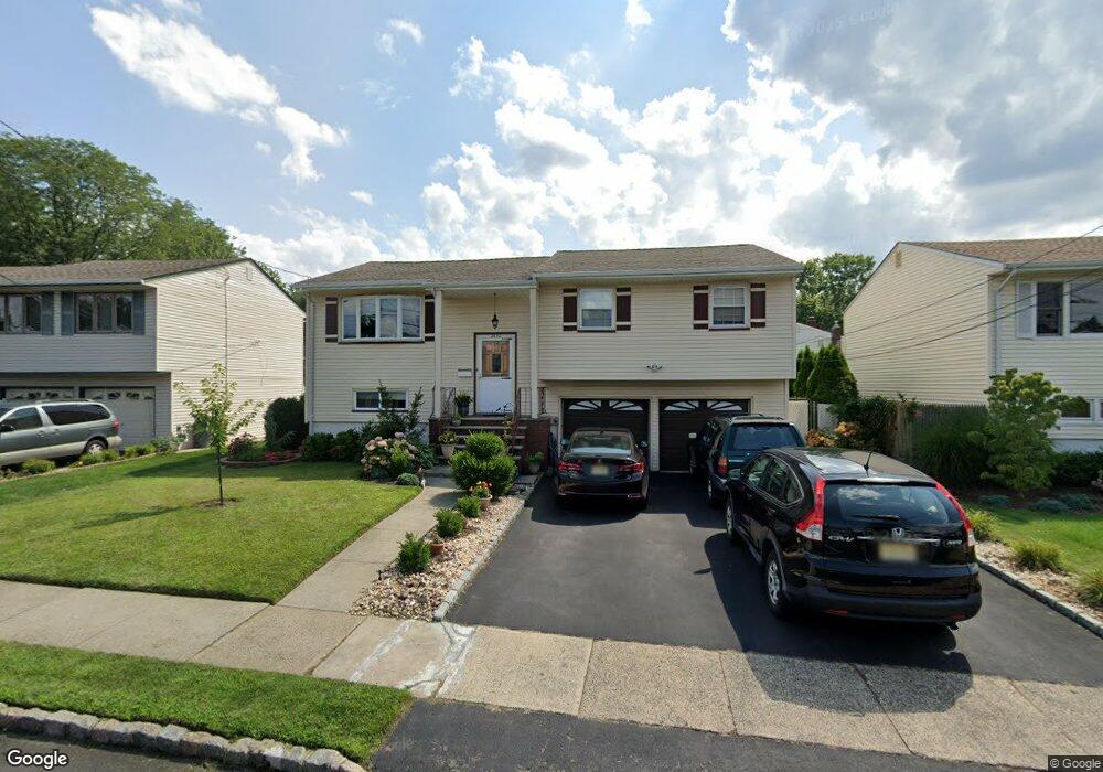
This home is located at 2632 Reid St, Union, NJ 07083 and is currently estimated at $588,306. 2632 Reid St is a home located in Union County with nearby schools including Battle Hill Elementary School, Burnet Middle School, and Union High School.
Ownership History
Date
Name
Owned For
Owner Type
Purchase Details
Closed on
Jun 26, 2000
Sold by
Beim Irving
Bought by
Juarez Godofredo S and Juarez Lorna R
Current Estimated Value
Home Financials for this Owner
Home Financials are based on the most recent Mortgage that was taken out on this home.
Original Mortgage
$160,000
Outstanding Balance
$58,348
Interest Rate
8.5%
Estimated Equity
$529,958
Purchase Details
Closed on
Jul 24, 1996
Sold by
Beim Neil Z
Bought by
Beim Irving
Purchase Details
Closed on
Jul 3, 1994
Sold by
Beim Irving
Bought by
Beim Neil Z
Create a Home Valuation Report for This Property
The Home Valuation Report is an in-depth analysis detailing your home's value as well as a comparison with similar homes in the area
Home Values in the Area
Average Home Value in this Area
Purchase History
| Date | Buyer | Sale Price | Title Company |
|---|---|---|---|
| Juarez Godofredo S | $200,000 | Chicago Title Insurance Co | |
| Beim Irving | -- | -- | |
| Beim Neil Z | $175,000 | -- |
Source: Public Records
Mortgage History
| Date | Status | Borrower | Loan Amount |
|---|---|---|---|
| Open | Juarez Godofredo S | $160,000 |
Source: Public Records
Tax History Compared to Growth
Tax History
| Year | Tax Paid | Tax Assessment Tax Assessment Total Assessment is a certain percentage of the fair market value that is determined by local assessors to be the total taxable value of land and additions on the property. | Land | Improvement |
|---|---|---|---|---|
| 2025 | $11,779 | $52,700 | $21,400 | $31,300 |
| 2024 | $11,420 | $52,700 | $21,400 | $31,300 |
| 2023 | $11,420 | $52,700 | $21,400 | $31,300 |
| 2022 | $11,023 | $52,700 | $21,400 | $31,300 |
| 2021 | $10,756 | $52,700 | $21,400 | $31,300 |
| 2020 | $10,541 | $52,700 | $21,400 | $31,300 |
| 2019 | $10,399 | $52,700 | $21,400 | $31,300 |
| 2018 | $10,222 | $52,700 | $21,400 | $31,300 |
| 2017 | $10,071 | $52,700 | $21,400 | $31,300 |
| 2016 | $9,825 | $52,700 | $21,400 | $31,300 |
| 2015 | $9,663 | $52,700 | $21,400 | $31,300 |
| 2014 | $9,446 | $52,700 | $21,400 | $31,300 |
Source: Public Records
Map
Nearby Homes
- 2670 Bancroft Ave
- 2636 Frederick Terrace
- 960 Moessner Ave
- 656 Garden St
- 980 Moessner Ave
- 888 Peach Tree Rd
- 920 Peach Tree Rd
- 887 Ray Ave
- 798 Pinewood Rd
- 2505 Girard Place
- 8 Bashford Ave Unit 8
- 2 Bashford-B Unit B
- 2785 Larchmont Rd
- 2615 Burns Place
- 2641 Burns Place
- 1042 Battle Hill Terrace
- 1071 Battle Hill Terrace
- 1066 Mayfair Rd
- 2389 Steuben St
- 105 Battle Hill Ave