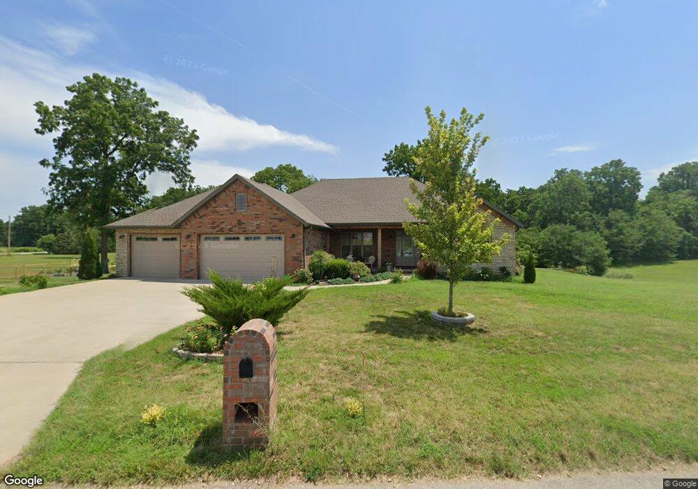
2632 S Francis Dr Brookline, MO 65619
Estimated Value: $352,000 - $544,284
3
Beds
2
Baths
1,976
Sq Ft
$227/Sq Ft
Est. Value
About This Home
This home is located at 2632 S Francis Dr, Brookline, MO 65619 and is currently estimated at $448,142, approximately $226 per square foot. 2632 S Francis Dr is a home with nearby schools including Price Elementary School, Republic Middle School, and Republic High School.
Ownership History
Date
Name
Owned For
Owner Type
Purchase Details
Closed on
Mar 25, 2015
Sold by
Edwards Peter and Edwards Rhiannon
Bought by
Schupbach Duke and Schupbach Kelly
Current Estimated Value
Home Financials for this Owner
Home Financials are based on the most recent Mortgage that was taken out on this home.
Original Mortgage
$30,600
Outstanding Balance
$23,480
Interest Rate
3.73%
Mortgage Type
Future Advance Clause Open End Mortgage
Estimated Equity
$424,662
Purchase Details
Closed on
Aug 11, 2008
Sold by
Sawyer Development Inc
Bought by
Edwarda Peter and Edwarda Rhiannon
Home Financials for this Owner
Home Financials are based on the most recent Mortgage that was taken out on this home.
Original Mortgage
$41,500
Interest Rate
6.42%
Mortgage Type
New Conventional
Create a Home Valuation Report for This Property
The Home Valuation Report is an in-depth analysis detailing your home's value as well as a comparison with similar homes in the area
Home Values in the Area
Average Home Value in this Area
Purchase History
| Date | Buyer | Sale Price | Title Company |
|---|---|---|---|
| Schupbach Duke | -- | None Available | |
| Edwarda Peter | -- | Synergy Title Svcs Llc |
Source: Public Records
Mortgage History
| Date | Status | Borrower | Loan Amount |
|---|---|---|---|
| Open | Schupbach Duke | $30,600 | |
| Previous Owner | Edwarda Peter | $41,500 |
Source: Public Records
Tax History Compared to Growth
Tax History
| Year | Tax Paid | Tax Assessment Tax Assessment Total Assessment is a certain percentage of the fair market value that is determined by local assessors to be the total taxable value of land and additions on the property. | Land | Improvement |
|---|---|---|---|---|
| 2025 | $3,404 | $66,960 | $9,030 | $57,930 |
| 2024 | $3,404 | $60,930 | $7,790 | $53,140 |
| 2023 | $3,339 | $60,930 | $7,790 | $53,140 |
| 2022 | $2,930 | $53,220 | $7,790 | $45,430 |
| 2021 | $2,913 | $53,220 | $7,790 | $45,430 |
| 2020 | $2,869 | $51,600 | $7,790 | $43,810 |
| 2019 | $2,783 | $50,240 | $7,790 | $42,450 |
| 2018 | $2,348 | $40,960 | $7,790 | $33,170 |
| 2017 | $443 | $7,790 | $7,790 | $0 |
| 2016 | $448 | $7,790 | $7,790 | $0 |
| 2015 | $446 | $7,790 | $7,790 | $0 |
| 2014 | $450 | $7,790 | $7,790 | $0 |
Source: Public Records
Map
Nearby Homes
- 1883 S Farm Road 107
- Tbd W Farm Road 148
- 000 W Farm Road 148
- 1707 S Farm Road 115
- 1895 S Lullwood Ave
- 1898 S Lullwood Ave
- 4914 W University St
- 4596 W Greenridge St
- 000 S State Highway Mm
- 4662 W University St
- 2031 S Pebble Ridge Rd
- 000 W Farm Road 156
- 4041 S Farm Road 107
- 5033 W Skyler Dr
- 5610 W Sugar Pine Dr
- 4085 E Ashwood Ct
- 1128 S Brecklyn Rd
- 4082 E Ashwood Ct
- 1755 N Boxwood Dr
- 4652 Blackfoot Dr
- 0 S Francis Dr Unit 10814528
- 0 S Francis Dr Unit 10909133
- 0 S Francis Dr
- 2619 S Francis Dr
- 5548 W Farm Road 156
- 2650 S Francis Dr
- 2664 S Francis Dr
- 2686 S Francis Dr
- 5547 W Farm Road 156
- 2620 S Louise Ct
- 5508 W Farm Road 156
- 0 S Louise Ct
- 3185 S Louise Ct
- 5504 W Farm Road 156
- 2649 S Maple Leaf Ln
- 2683 S Maple Leaf Ln
- 2605 S Maple Leaf Ln
- 2697 S Maple Leaf Ln
- 5885 W Farm Road 156
- 5401 W Farm Road 156