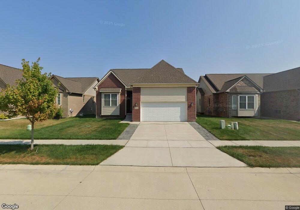
26326 Pheasant Cir Taylor, MI 48180
Estimated Value: $371,018 - $424,000
3
Beds
3
Baths
1,936
Sq Ft
$207/Sq Ft
Est. Value
About This Home
This home is located at 26326 Pheasant Cir, Taylor, MI 48180 and is currently estimated at $400,505, approximately $206 per square foot. 26326 Pheasant Cir is a home located in Wayne County with nearby schools including Holland Elementary School, Hoover Middle School, and Taylor High School.
Ownership History
Date
Name
Owned For
Owner Type
Purchase Details
Closed on
Feb 2, 2021
Sold by
Mjc Land Investments Llc
Bought by
Lane Belafonte R and Lane Linda M
Current Estimated Value
Home Financials for this Owner
Home Financials are based on the most recent Mortgage that was taken out on this home.
Original Mortgage
$251,228
Outstanding Balance
$224,306
Interest Rate
2.6%
Mortgage Type
New Conventional
Estimated Equity
$176,199
Create a Home Valuation Report for This Property
The Home Valuation Report is an in-depth analysis detailing your home's value as well as a comparison with similar homes in the area
Home Values in the Area
Average Home Value in this Area
Purchase History
| Date | Buyer | Sale Price | Title Company |
|---|---|---|---|
| Lane Belafonte R | $264,450 | Ata National Title Group |
Source: Public Records
Mortgage History
| Date | Status | Borrower | Loan Amount |
|---|---|---|---|
| Open | Lane Belafonte R | $251,228 |
Source: Public Records
Tax History
| Year | Tax Paid | Tax Assessment Tax Assessment Total Assessment is a certain percentage of the fair market value that is determined by local assessors to be the total taxable value of land and additions on the property. | Land | Improvement |
|---|---|---|---|---|
| 2025 | $7,025 | $175,200 | $0 | $0 |
| 2024 | $6,802 | $174,000 | $0 | $0 |
| 2023 | $8,063 | $157,500 | $0 | $0 |
| 2022 | $6,418 | $140,600 | $0 | $0 |
| 2021 | $7,106 | $137,900 | $0 | $0 |
| 2020 | $7,007 | $79,000 | $0 | $0 |
| 2019 | $49,531 | $7,500 | $0 | $0 |
| 2018 | $386 | $7,500 | $0 | $0 |
| 2017 | $139 | $1,300 | $0 | $0 |
| 2016 | $130 | $1,300 | $0 | $0 |
Source: Public Records
Map
Nearby Homes
- 11890 Partridge Dr Unit 91
- 11737 Partridge Dr Unit 70
- 11825 Partridge Dr Unit 74
- 11847 Partridge Dr Unit 75
- 11715 Partridge Dr Unit 69
- 11693 Partridge Dr Unit 38
- 11693 Partridge Dr
- 26400 Partridge Dr Unit 88
- 11098 Partridge Dr Unit 12
- 11098 Partridge Dr
- 11216 Cape Cod St
- Bayberry Plan at Cypress Garden
- Bannister Plan at Cypress Garden
- Cypress Plan at Cypress Garden
- Evanston IV Plan at Cypress Garden
- Cedar III Plan at Cypress Garden
- Aspen Plan at Cypress Garden
- Evanston III Plan at Cypress Garden
- Cedar IV Plan at Cypress Garden
- 25830 Belledale St
- 26326 Pheasant Cir Unit 67
- 26338 Pheasant Cir
- 11495 Pheasant Cir
- 11495 Pheasant Cir Unit 29
- 26337 Pheasant Cir Unit 41
- 11648 Pheasant Cir
- 11648 Pheasant Cir Unit 45
- 11626 Pheasant Cir
- 11626 Pheasant Cir Unit 46
- 11604 Pheasant Cir
- 11604 Pheasant Cir Unit 47
- 11560 Pheasant Cir
- 11560 Pheasant Cir Unit 49
- 26121 Belledale St
- 11538 Pheasant Cir
- 11538 Pheasant Cir Unit 50
- 11516 Pheasant Cir
- 26097 Belledale St
- 26130 Belledale St
- 11516 Partridge Dr