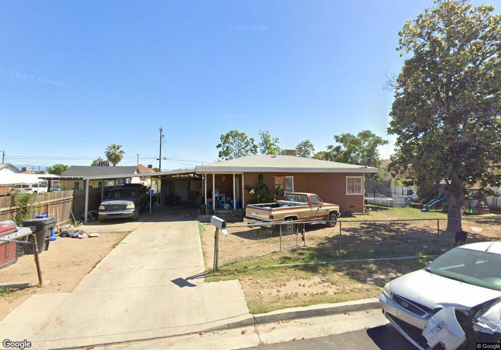
2633 Security Ave Bakersfield, CA 93306
West Pioneer Dr NeighborhoodEstimated Value: $224,017 - $268,000
3
Beds
1
Bath
1,215
Sq Ft
$194/Sq Ft
Est. Value
About This Home
This home is located at 2633 Security Ave, Bakersfield, CA 93306 and is currently estimated at $236,004, approximately $194 per square foot. 2633 Security Ave is a home located in Kern County with nearby schools including Horace Mann Elementary School, Emerson Middle School, and East Bakersfield High School.
Ownership History
Date
Name
Owned For
Owner Type
Purchase Details
Closed on
May 4, 2009
Sold by
American General Financial Services Inc
Bought by
Raya Richie
Current Estimated Value
Home Financials for this Owner
Home Financials are based on the most recent Mortgage that was taken out on this home.
Original Mortgage
$42,400
Interest Rate
5.25%
Mortgage Type
New Conventional
Purchase Details
Closed on
Apr 3, 2008
Sold by
King Garry D and King Arlene
Bought by
American General Financial Services Inc
Purchase Details
Closed on
Sep 4, 2001
Sold by
Hayes Harold H and Hayes Wanda J
Bought by
King Garry D and King Arlene
Home Financials for this Owner
Home Financials are based on the most recent Mortgage that was taken out on this home.
Original Mortgage
$64,374
Interest Rate
6.99%
Mortgage Type
FHA
Create a Home Valuation Report for This Property
The Home Valuation Report is an in-depth analysis detailing your home's value as well as a comparison with similar homes in the area
Home Values in the Area
Average Home Value in this Area
Purchase History
| Date | Buyer | Sale Price | Title Company |
|---|---|---|---|
| Raya Richie | $53,000 | Placer Title Company | |
| American General Financial Services Inc | $106,500 | Orange Coast Title | |
| King Garry D | $65,000 | Commonwealth Land Title Co |
Source: Public Records
Mortgage History
| Date | Status | Borrower | Loan Amount |
|---|---|---|---|
| Previous Owner | Raya Richie | $42,400 | |
| Previous Owner | King Garry D | $64,374 |
Source: Public Records
Tax History
| Year | Tax Paid | Tax Assessment Tax Assessment Total Assessment is a certain percentage of the fair market value that is determined by local assessors to be the total taxable value of land and additions on the property. | Land | Improvement |
|---|---|---|---|---|
| 2025 | $1,729 | $68,397 | $38,717 | $29,680 |
| 2024 | $1,672 | $67,057 | $37,958 | $29,099 |
| 2023 | $1,672 | $65,743 | $37,214 | $28,529 |
| 2022 | $1,588 | $64,455 | $36,485 | $27,970 |
| 2021 | $1,494 | $63,192 | $35,770 | $27,422 |
| 2020 | $1,458 | $62,545 | $35,404 | $27,141 |
| 2019 | $1,405 | $62,545 | $35,404 | $27,141 |
| 2018 | $1,367 | $60,118 | $34,030 | $26,088 |
| 2017 | $1,349 | $58,940 | $33,363 | $25,577 |
| 2016 | $1,164 | $57,785 | $32,709 | $25,076 |
| 2015 | $1,163 | $56,918 | $32,218 | $24,700 |
| 2014 | $1,135 | $55,804 | $31,587 | $24,217 |
Source: Public Records
Map
Nearby Homes
- 2711 Trust Ave
- 2608 Lake St
- 2728 Kentucky St
- 2717 Monterey St
- 2641 Niles St
- 0 Niles St
- 2512 Niles St
- 2229 Lucky St
- 2915 Edison Hwy
- 2525 Avenida Escuela
- 2930 Potomac Ave
- 3101 Pioneer Dr
- 601 Mount Vernon Ave
- 3017 Potomac Ave
- 401 Mcclean Ave
- 2712 Primera Vista
- 1604 Glenwood Dr
- 420 Oswell St Unit 37
- 404 Hill St
- 214 Dorrance St
- 2635 Security Ave
- 2631 Security Ave
- 2637 Security Ave
- 2629 Security Ave
- 2616 Trust Ave
- 2614 Trust Ave
- 2618 Trust Ave
- 2612 Trust Ave Unit 2
- 2612 Trust Ave
- 2641 Security Ave
- 2627 Security Ave
- 2620 Trust Ave
- 2610 Trust Ave
- 2634 Security Ave
- 2632 Security Ave
- 2636 Security Ave
- 2630 Security Ave
- 2638 Security Ave
- 2622 Trust Ave
- 2645 Security Ave
Your Personal Tour Guide
Ask me questions while you tour the home.