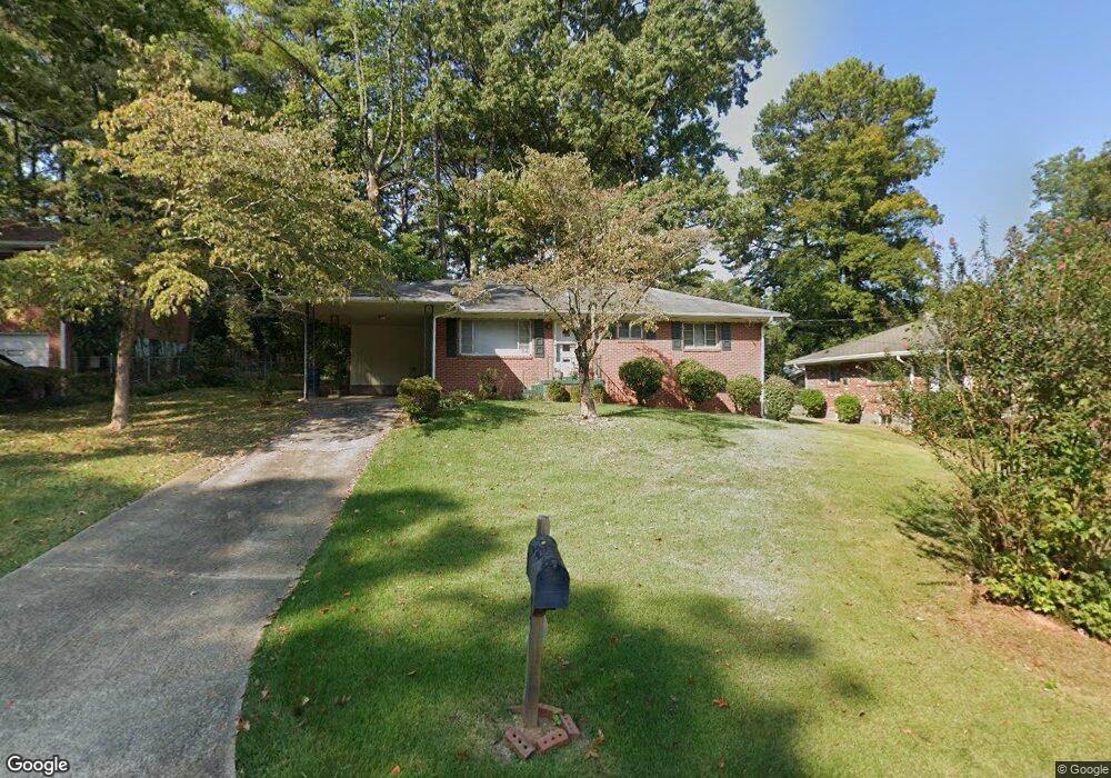
2635 Lancaster Dr Atlanta, GA 30344
Estimated Value: $170,000 - $240,000
3
Beds
2
Baths
1,248
Sq Ft
$164/Sq Ft
Est. Value
About This Home
This home is located at 2635 Lancaster Dr, Atlanta, GA 30344 and is currently estimated at $204,336, approximately $163 per square foot. 2635 Lancaster Dr is a home located in Fulton County with nearby schools including Conley Hills Elementary School, Paul D. West Middle School, and Tri-Cities High School.
Ownership History
Date
Name
Owned For
Owner Type
Purchase Details
Closed on
May 1, 2017
Sold by
Blount Ella Ree
Bought by
Blount Ella Ree and Blount Leslie
Current Estimated Value
Purchase Details
Closed on
Jan 7, 2010
Sold by
Banc Of America Funding Corp 2
Bought by
Blount Ella R
Purchase Details
Closed on
Oct 6, 2009
Sold by
Ferguson Harry K and Ferguson Joyce A
Bought by
Banc Of America Funding Corp 2
Purchase Details
Closed on
Aug 21, 1995
Sold by
Wilson Rosa P
Bought by
Ferguson Harry K
Create a Home Valuation Report for This Property
The Home Valuation Report is an in-depth analysis detailing your home's value as well as a comparison with similar homes in the area
Home Values in the Area
Average Home Value in this Area
Purchase History
| Date | Buyer | Sale Price | Title Company |
|---|---|---|---|
| Blount Ella Ree | -- | -- | |
| Blount Ella R | $35,000 | -- | |
| Banc Of America Funding Corp 2 | $30,750 | -- | |
| Ferguson Harry K | $71,000 | -- |
Source: Public Records
Mortgage History
| Date | Status | Borrower | Loan Amount |
|---|---|---|---|
| Closed | Ferguson Harry K | $0 |
Source: Public Records
Tax History Compared to Growth
Tax History
| Year | Tax Paid | Tax Assessment Tax Assessment Total Assessment is a certain percentage of the fair market value that is determined by local assessors to be the total taxable value of land and additions on the property. | Land | Improvement |
|---|---|---|---|---|
| 2025 | $110 | $81,320 | $26,560 | $54,760 |
| 2023 | $2,295 | $81,320 | $26,560 | $54,760 |
| 2022 | $47 | $60,400 | $10,680 | $49,720 |
| 2021 | $110 | $52,600 | $8,080 | $44,520 |
| 2020 | $149 | $47,880 | $10,360 | $37,520 |
| 2019 | $110 | $41,720 | $9,760 | $31,960 |
| 2018 | $257 | $24,440 | $4,480 | $19,960 |
| 2017 | $27 | $11,480 | $3,400 | $8,080 |
| 2016 | $27 | $11,480 | $3,400 | $8,080 |
| 2015 | $309 | $11,480 | $3,400 | $8,080 |
| 2014 | $27 | $11,480 | $3,400 | $8,080 |
Source: Public Records
Map
Nearby Homes
- 2595 Lancaster Dr
- 2581 N Clark Dr
- 2667 Plantation Dr
- 2011 Lexington Ave
- 2023 Montrose Dr
- 2008 Neely Ave
- 2550 Graywall St
- 2772 S Clark Dr
- 2302 Montrose Dr
- 2478 Graywall St
- 2228 Headland Dr
- 2382 Ridgecrest Ln
- 2564 Riggs Dr
- 2435 Wood Valley Dr
- 2830 Luther Dr
- 2370 Farley St
- 2442 Graywall St
- 2330 Dorsey Ave
- 0 Riggs Dr Unit 10600937
- 0 Riggs Dr Unit 7646715
- 2643 Lancaster Dr Unit 16
- 2627 Lancaster Dr
- 2642 Farley St Unit 16
- 2651 Lancaster Dr Unit 16
- 2619 Lancaster Dr
- 2632 Farley St
- 2650 Farley St
- 2624 Farley St
- 2632 Lancaster Dr Unit 16
- 2640 Lancaster Dr Unit 16
- 2624 Lancaster Dr Unit 16
- 2611 Lancaster Dr
- 2659 Lancaster Dr Unit 36
- 2660 Farley St Unit 16
- 2616 Lancaster Dr
- 2614 Farley St
- 2648 Lancaster Dr Unit 16
- 2603 Lancaster Dr
- 2608 Lancaster Dr
- 2656 Lancaster Dr Unit 16