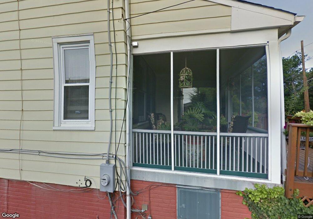
2635 Otis St NE Washington, DC 20018
Woodridge NeighborhoodEstimated Value: $680,000 - $885,000
4
Beds
3
Baths
1,850
Sq Ft
$417/Sq Ft
Est. Value
About This Home
This home is located at 2635 Otis St NE, Washington, DC 20018 and is currently estimated at $770,805, approximately $416 per square foot. 2635 Otis St NE is a home located in District of Columbia with nearby schools including Burroughs Education Campus, Brookland Middle School, and Dunbar High School.
Ownership History
Date
Name
Owned For
Owner Type
Purchase Details
Closed on
Jun 12, 2023
Sold by
Proctor James and Proctor James
Bought by
James And Rosa Proctor Living Trust and Proctor
Current Estimated Value
Purchase Details
Closed on
Jun 21, 1995
Sold by
Thomas Elizabeth K
Bought by
Proctor James
Home Financials for this Owner
Home Financials are based on the most recent Mortgage that was taken out on this home.
Original Mortgage
$143,150
Interest Rate
7.82%
Create a Home Valuation Report for This Property
The Home Valuation Report is an in-depth analysis detailing your home's value as well as a comparison with similar homes in the area
Home Values in the Area
Average Home Value in this Area
Purchase History
| Date | Buyer | Sale Price | Title Company |
|---|---|---|---|
| James And Rosa Proctor Living Trust | -- | None Listed On Document | |
| Proctor James | $145,000 | -- |
Source: Public Records
Mortgage History
| Date | Status | Borrower | Loan Amount |
|---|---|---|---|
| Previous Owner | Proctor James | $143,150 |
Source: Public Records
Tax History Compared to Growth
Tax History
| Year | Tax Paid | Tax Assessment Tax Assessment Total Assessment is a certain percentage of the fair market value that is determined by local assessors to be the total taxable value of land and additions on the property. | Land | Improvement |
|---|---|---|---|---|
| 2025 | $2,115 | $717,340 | $365,690 | $351,650 |
| 2024 | $2,085 | $708,930 | $362,410 | $346,520 |
| 2023 | $2,057 | $686,820 | $348,120 | $338,700 |
| 2022 | $2,039 | $602,540 | $305,990 | $296,550 |
| 2021 | $1,951 | $586,730 | $304,510 | $282,220 |
| 2020 | $1,861 | $578,160 | $297,360 | $280,800 |
| 2019 | $1,776 | $553,300 | $287,200 | $266,100 |
| 2018 | $1,697 | $534,630 | $0 | $0 |
| 2017 | $1,546 | $480,750 | $0 | $0 |
| 2016 | $1,409 | $444,790 | $0 | $0 |
| 2015 | $1,282 | $395,070 | $0 | $0 |
| 2014 | $1,170 | $345,560 | $0 | $0 |
Source: Public Records
Map
Nearby Homes
- 2814 Rhode Island Ave NE
- 2622 Rhode Island Ave NE
- 2439 Monroe St NE
- 2414 Perry St NE
- 3505 24th St NE
- 2874 Perry St NE
- 2222 Otis St NE
- 2316 Monroe St NE
- 2620 Brentwood Rd NE
- 3123 S Dakota Ave NE
- 3121 S Dakota Ave NE
- 3110 Newton St NE
- 2838 Myrtle Ave NE
- 2628 Myrtle Ave NE
- 2405 Rhode Island Ave NE
- 2639 Myrtle Ave NE
- 3141 Central Ave NE
- 3309 22nd St NE
- 3921 22nd St NE
- 3002 Bunker Hill Rd
- 2631 Otis St NE
- 2627 Otis St NE
- 3622 28th St NE
- 3618 28th St NE
- 3626 28th St NE
- 2623 Otis St NE
- 3612 28th St NE
- 3608 28th St NE
- 2619 Otis St NE
- 2634 Newton St NE
- 2630 Newton St NE
- 2626 Newton St NE
- 3604 28th St NE
- 2615 Otis St NE
- 2622 Newton St NE
- 2618 Newton St NE
- 3600 28th St NE
- 3621 28th St NE
- 2614 Newton St NE
- 3617 28th St NE