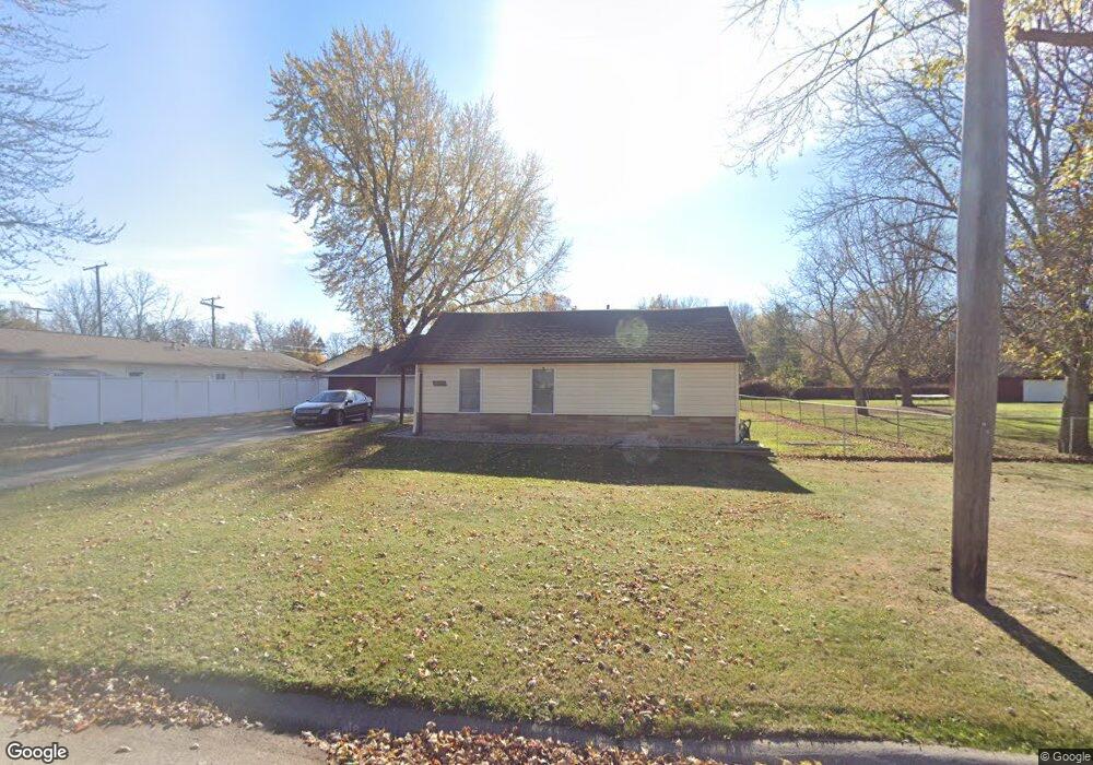
26355 Beverly Rd Taylor, MI 48180
Estimated Value: $145,000 - $156,000
2
Beds
1
Bath
942
Sq Ft
$161/Sq Ft
Est. Value
About This Home
This home is located at 26355 Beverly Rd, Taylor, MI 48180 and is currently estimated at $151,202, approximately $160 per square foot. 26355 Beverly Rd is a home located in Wayne County with nearby schools including Koch Elementary School, Clarence Randall Elementary School, and Hoover Middle School.
Ownership History
Date
Name
Owned For
Owner Type
Purchase Details
Closed on
Nov 26, 2008
Sold by
Murg Mihai
Bought by
Us Bank National Association
Current Estimated Value
Purchase Details
Closed on
Nov 14, 2006
Sold by
Murg Mihai Ionel
Bought by
Murg Mihai Ionel
Purchase Details
Closed on
Jul 28, 2005
Sold by
Hud
Bought by
Murg Mihai Ionel
Purchase Details
Closed on
Feb 2, 2005
Sold by
Mortgage Electronic Registration Systems
Bought by
Hud
Purchase Details
Closed on
Jul 21, 2004
Sold by
Gutowski Kevin L and Gutowski Lisa M
Bought by
Mortgage Electronic Registration Systems
Create a Home Valuation Report for This Property
The Home Valuation Report is an in-depth analysis detailing your home's value as well as a comparison with similar homes in the area
Home Values in the Area
Average Home Value in this Area
Purchase History
| Date | Buyer | Sale Price | Title Company |
|---|---|---|---|
| Us Bank National Association | $28,900 | None Available | |
| Murg Mihai Ionel | -- | None Available | |
| Murg Mihai Ionel | $65,150 | Multiple | |
| Hud | -- | -- | |
| Mortgage Electronic Registration Systems | $126,429 | -- |
Source: Public Records
Tax History Compared to Growth
Tax History
| Year | Tax Paid | Tax Assessment Tax Assessment Total Assessment is a certain percentage of the fair market value that is determined by local assessors to be the total taxable value of land and additions on the property. | Land | Improvement |
|---|---|---|---|---|
| 2025 | $1,468 | $75,900 | $0 | $0 |
| 2024 | $1,421 | $65,400 | $0 | $0 |
| 2023 | $1,779 | $58,600 | $0 | $0 |
| 2022 | $1,356 | $49,000 | $0 | $0 |
| 2021 | $1,554 | $44,800 | $0 | $0 |
| 2020 | $1,538 | $42,400 | $0 | $0 |
| 2019 | $152,605 | $36,400 | $0 | $0 |
| 2018 | $1,165 | $31,100 | $0 | $0 |
| 2017 | $741 | $30,600 | $0 | $0 |
| 2016 | $1,531 | $29,800 | $0 | $0 |
| 2015 | $2,631 | $27,200 | $0 | $0 |
| 2013 | $2,620 | $27,200 | $0 | $0 |
| 2012 | $1,141 | $26,800 | $9,500 | $17,300 |
Source: Public Records
Map
Nearby Homes
- 26424 Beverly Rd
- 6310 Duncan St
- 26215 Beverly Rd
- 25908 Beverly Rd
- 5993 John Daly St
- 6363 Mcguire St
- 6144 Princess St
- 5970 John Daly St
- 6143 Mcguire St
- 27029 Michelle Ct
- 5845 Beech Daly Rd
- 6810 Oldham St
- 5904 Janet St
- 6211 Inkster Rd
- 5842 Janet St
- 7306 Chesterfield St Unit RA254
- 7312 Chesterfield St Unit 257
- 25965 Currier St
- 26111 1st St Unit RA020
- 26118 2nd St Unit RA053
- 6414 Holland Rd
- 6432 Holland Rd
- 0 Holland St Unit 4915490
- 0 Holland St Unit 4922318
- 0 Holland St Unit 215002456
- 0 Holland St Unit 215033778
- 26401 Beverly Rd
- 26348 Beverly Rd
- 26334 Beverly Rd
- 6415 Holland Rd
- 26320 Beverly Rd
- 26410 Beverly Rd Unit Bldg-Unit
- 6452 Holland Rd
- Beverly Rd
- 26416 Beverly Rd
- 26308 Beverly Rd
- 6375 Dean St
- 6382 Dean St
- 26435 Beverly Rd
- 6370 Dean St