Estimated Value: $384,000 - $542,000
4
Beds
3
Baths
2,500
Sq Ft
$177/Sq Ft
Est. Value
About This Home
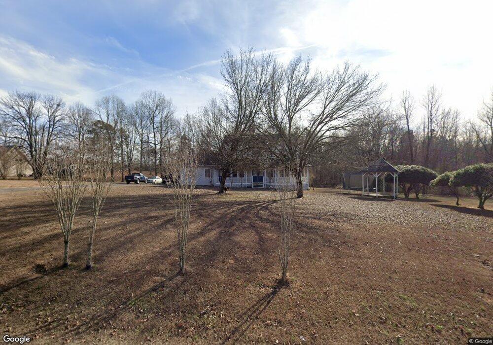
This home is located at 2636 Simpson Point Rd, Grant, AL 35747 and is currently estimated at $443,584, approximately $177 per square foot. 2636 Simpson Point Rd is a home located in Marshall County with nearby schools including Kate Duncan Smith DAR Elementary School, Claysville Jr High School, and Kate Duncan Smith DAR Middle School.
Ownership History
Date
Name
Owned For
Owner Type
Purchase Details
Closed on
Aug 14, 2012
Sold by
Headrick Mickey and Headrick Sandra
Bought by
Cox David W
Current Estimated Value
Home Financials for this Owner
Home Financials are based on the most recent Mortgage that was taken out on this home.
Original Mortgage
$195,000
Outstanding Balance
$134,514
Interest Rate
3.58%
Mortgage Type
VA
Estimated Equity
$309,070
Purchase Details
Closed on
Aug 22, 2006
Sold by
Foster James Michael and Foster Glenda D
Bought by
Lewis Benjamin and Lewis Mandy
Home Financials for this Owner
Home Financials are based on the most recent Mortgage that was taken out on this home.
Original Mortgage
$207,796
Interest Rate
6.67%
Mortgage Type
Purchase Money Mortgage
Create a Home Valuation Report for This Property
The Home Valuation Report is an in-depth analysis detailing your home's value as well as a comparison with similar homes in the area
Home Values in the Area
Average Home Value in this Area
Purchase History
| Date | Buyer | Sale Price | Title Company |
|---|---|---|---|
| Cox David W | $195,000 | None Available | |
| Lewis Benjamin | -- | None Available |
Source: Public Records
Mortgage History
| Date | Status | Borrower | Loan Amount |
|---|---|---|---|
| Open | Cox David W | $195,000 | |
| Previous Owner | Lewis Benjamin | $207,796 |
Source: Public Records
Tax History Compared to Growth
Tax History
| Year | Tax Paid | Tax Assessment Tax Assessment Total Assessment is a certain percentage of the fair market value that is determined by local assessors to be the total taxable value of land and additions on the property. | Land | Improvement |
|---|---|---|---|---|
| 2024 | $1,081 | $31,600 | $0 | $0 |
| 2023 | $1,192 | $31,140 | $0 | $0 |
| 2022 | $1,155 | $30,620 | $0 | $0 |
| 2021 | $1,101 | $29,160 | $0 | $0 |
| 2020 | $891 | $23,560 | $0 | $0 |
| 2017 | $870 | $23,000 | $0 | $0 |
| 2015 | -- | $19,540 | $0 | $0 |
| 2014 | -- | $19,540 | $0 | $0 |
Source: Public Records
Map
Nearby Homes
- 112 Shin Point Rd
- 1821 Simpson Point Rd
- 24 11 Forty Rd
- 15 Shin Point Rd
- 31654 Us Highway 431
- 244 Cherokee Ridge Rd
- 3.1 Acres Cherokee Ridge Rd
- 10.3 Acres Cherokee Ridge Rd
- 131 Winter Dr
- 66 Joeffie Rd
- 255 Joeffie Rd
- 80 Shelby Dr
- .57 acre Shelby Dr
- 773 Honeycomb Valley Rd
- 1169 Honeycomb Rd
- 135 Honeycomb Valley Rd
- 885 Honeycomb Rd
- 2333 White Elephant Rd
- .80 Honeycomb Rd
- 28543 Us Highway 431 Unit 23
- 2700 Simpson Point Rd
- 2555 Eleven Forty Rd
- 2511 Eleven Forty Rd
- 2576 Eleven Forty Rd
- 2550 Eleven Forty Rd
- 2542 Simpson Point Rd
- 2522 Eleven Forty Rd
- 2529 Simpson Point Rd
- 2466 Simpson Point Rd
- 2385 Eleven Forty Rd
- 2855 Simpson Point Rd
- 2465 Simpson Point Rd
- 2412 Simpson Point Rd
- 2398 Simpson Point Rd
- 2303 Eleven Forty Rd
- 2340 Eleven Forty Rd
- 2340 Simpson Point Rd
- 2949 Simpson Point Rd
- 80 Wendy Rd
- 2325 Simpson Point Rd