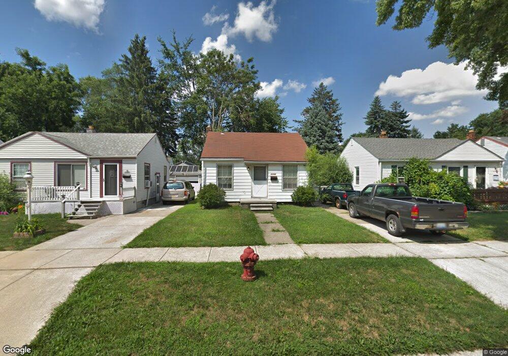
26366 Eton Ave Dearborn Heights, MI 48125
Estimated Value: $103,000 - $124,000
2
Beds
1
Bath
729
Sq Ft
$155/Sq Ft
Est. Value
About This Home
This home is located at 26366 Eton Ave, Dearborn Heights, MI 48125 and is currently estimated at $112,934, approximately $154 per square foot. 26366 Eton Ave is a home located in Wayne County with nearby schools including Quest Charter Academy, West Village Academy, and Peterson-Warren Academy.
Ownership History
Date
Name
Owned For
Owner Type
Purchase Details
Closed on
Apr 13, 2004
Sold by
Owen Melanie
Bought by
Sommer Kyle R
Current Estimated Value
Purchase Details
Closed on
Apr 17, 2002
Sold by
Baker Janice L
Bought by
Owen Melanie
Home Financials for this Owner
Home Financials are based on the most recent Mortgage that was taken out on this home.
Original Mortgage
$56,000
Interest Rate
6.7%
Mortgage Type
Purchase Money Mortgage
Create a Home Valuation Report for This Property
The Home Valuation Report is an in-depth analysis detailing your home's value as well as a comparison with similar homes in the area
Home Values in the Area
Average Home Value in this Area
Purchase History
| Date | Buyer | Sale Price | Title Company |
|---|---|---|---|
| Sommer Kyle R | $67,000 | Multiple | |
| Owen Melanie | $70,000 | -- | |
| Baker Janice L | -- | -- |
Source: Public Records
Mortgage History
| Date | Status | Borrower | Loan Amount |
|---|---|---|---|
| Previous Owner | Baker Janice L | $56,000 |
Source: Public Records
Tax History Compared to Growth
Tax History
| Year | Tax Paid | Tax Assessment Tax Assessment Total Assessment is a certain percentage of the fair market value that is determined by local assessors to be the total taxable value of land and additions on the property. | Land | Improvement |
|---|---|---|---|---|
| 2025 | $907 | $55,200 | $0 | $0 |
| 2024 | $907 | $45,300 | $0 | $0 |
| 2023 | $1,519 | $38,900 | $0 | $0 |
| 2022 | $1,233 | $32,800 | $0 | $0 |
| 2021 | $1,338 | $29,000 | $0 | $0 |
| 2019 | $1,344 | $22,900 | $0 | $0 |
| 2018 | $1,085 | $21,500 | $0 | $0 |
| 2017 | $555 | $21,000 | $0 | $0 |
| 2016 | $1,340 | $21,300 | $0 | $0 |
| 2015 | $1,980 | $19,800 | $0 | $0 |
| 2013 | $2,130 | $22,200 | $0 | $0 |
| 2010 | -- | $25,700 | $0 | $0 |
Source: Public Records
Map
Nearby Homes
- 26225 McDonald St
- 26532 Powers Ave
- 4863 Glenis St
- 26439 Hopkins St
- 26458 Hopkins St
- 26106 Powers Ave
- 26159 Stanford St
- 25895 Annapolis St
- 4110 John Daly St
- 25965 Currier St
- 26202 Colgate St
- 26773 Colgate St
- 26231 Andover St
- 5526 Sylvia St
- 26860 Andover St
- 25628 Powers Ave
- 27022 Colgate St
- 26916 Andover St
- 5970 John Daly St
- 26653 Ross St
- 26356 Eton Ave
- 26372 Eton Ave
- 26380 Eton Ave
- 26348 Eton Ave
- 26388 Eton Ave
- 26340 Eton Ave
- 26377 McDonald St
- 26363 McDonald St
- 26419 McDonald St
- 26396 Eton Ave
- 26332 Eton Ave
- 26349 McDonald St
- 26365 Eton Ave
- 26335 McDonald St
- 26435 McDonald St
- 26357 Eton Ave
- 26373 Eton Ave
- 26324 Eton Ave
- 26508 Eton Ave
- 26349 Eton Ave