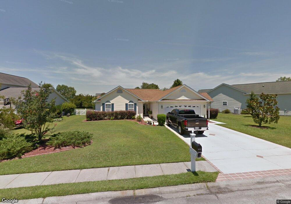
2637 Corn Pile Rd Myrtle Beach, SC 29588
Estimated Value: $303,000 - $336,000
3
Beds
2
Baths
1,667
Sq Ft
$192/Sq Ft
Est. Value
About This Home
This home is located at 2637 Corn Pile Rd, Myrtle Beach, SC 29588 and is currently estimated at $320,556, approximately $192 per square foot. 2637 Corn Pile Rd is a home located in Horry County with nearby schools including Forestbrook Elementary School, Forestbrook Middle School, and Socastee High School.
Ownership History
Date
Name
Owned For
Owner Type
Purchase Details
Closed on
Dec 22, 2003
Sold by
Hunters Ridge Of Myrtle Beach Inc
Bought by
Mueller Anthony J
Current Estimated Value
Home Financials for this Owner
Home Financials are based on the most recent Mortgage that was taken out on this home.
Original Mortgage
$110,800
Outstanding Balance
$50,724
Interest Rate
5.82%
Mortgage Type
Purchase Money Mortgage
Estimated Equity
$269,832
Create a Home Valuation Report for This Property
The Home Valuation Report is an in-depth analysis detailing your home's value as well as a comparison with similar homes in the area
Home Values in the Area
Average Home Value in this Area
Purchase History
| Date | Buyer | Sale Price | Title Company |
|---|---|---|---|
| Mueller Anthony J | $143,000 | -- |
Source: Public Records
Mortgage History
| Date | Status | Borrower | Loan Amount |
|---|---|---|---|
| Open | Mueller Anthony J | $110,800 |
Source: Public Records
Tax History Compared to Growth
Tax History
| Year | Tax Paid | Tax Assessment Tax Assessment Total Assessment is a certain percentage of the fair market value that is determined by local assessors to be the total taxable value of land and additions on the property. | Land | Improvement |
|---|---|---|---|---|
| 2024 | -- | $13,662 | $4,041 | $9,621 |
| 2023 | $0 | $7,200 | $1,127 | $6,073 |
| 2021 | $771 | $7,744 | $1,288 | $6,456 |
| 2020 | $671 | $7,744 | $1,288 | $6,456 |
| 2019 | $671 | $7,744 | $1,288 | $6,456 |
| 2018 | $0 | $6,260 | $972 | $5,288 |
| 2017 | $590 | $6,260 | $972 | $5,288 |
| 2016 | -- | $6,260 | $972 | $5,288 |
| 2015 | $590 | $6,261 | $973 | $5,288 |
| 2014 | $545 | $6,261 | $973 | $5,288 |
Source: Public Records
Map
Nearby Homes
- 2707 Canvasback Trail
- 2540 Bearstand Trail
- 2723 Canvasback Trail
- 2459 Hunters Trail
- 2425 Hunters Trail
- 781 Harrison Mill St
- 3845 Camden Dr
- 4121 Whatuthink Rd
- 3312 Piney Woods Way
- 837 Harrison Mill St
- 3217 Shadowpine Ct
- 852 Harrison Mill St
- 1176 Harbison Cir
- 3007 Visionary Dr
- 133 Marsh Rabbit Dr
- 1144 Harbison Cir
- 621 Cottontail Trail
- 1132 Harbison Cir
- 261 Marsh Tacky Loop
- 220 Forestbrook Cove Cir
- 2635 Corn Pile Rd
- 2641 Corn Pile Rd
- 2645 Corn Pile Rd
- 2703 Canvasback Trail Unit Hunters Ridge
- 2638 Corn Pile Rd
- 2647 Corn Pile Rd
- 2640 Corn Pile Rd
- 2636 Corn Pile Rd
- 2636 Corn Pile Rd Unit Lot 244 Corn Pile @
- 2634 Corn Pile Rd
- 2705 Canvasback Trail
- 2700 Canvasback Trail
- 2629 Corn Pile Rd
- 2646 Corn Pile Rd Unit Hunters Ridge
- 2646 Corn Pile Rd Unit The Landing @ Hunter
- 2651 Corn Pile Rd
- 2632 Corn Pile Rd
- LOT 222 Corn Pile Rd
- Lot 232 Corn Pile Rd
- LOT 222 Corn Pile Rd Unit LOT 222 HUNTERS RID