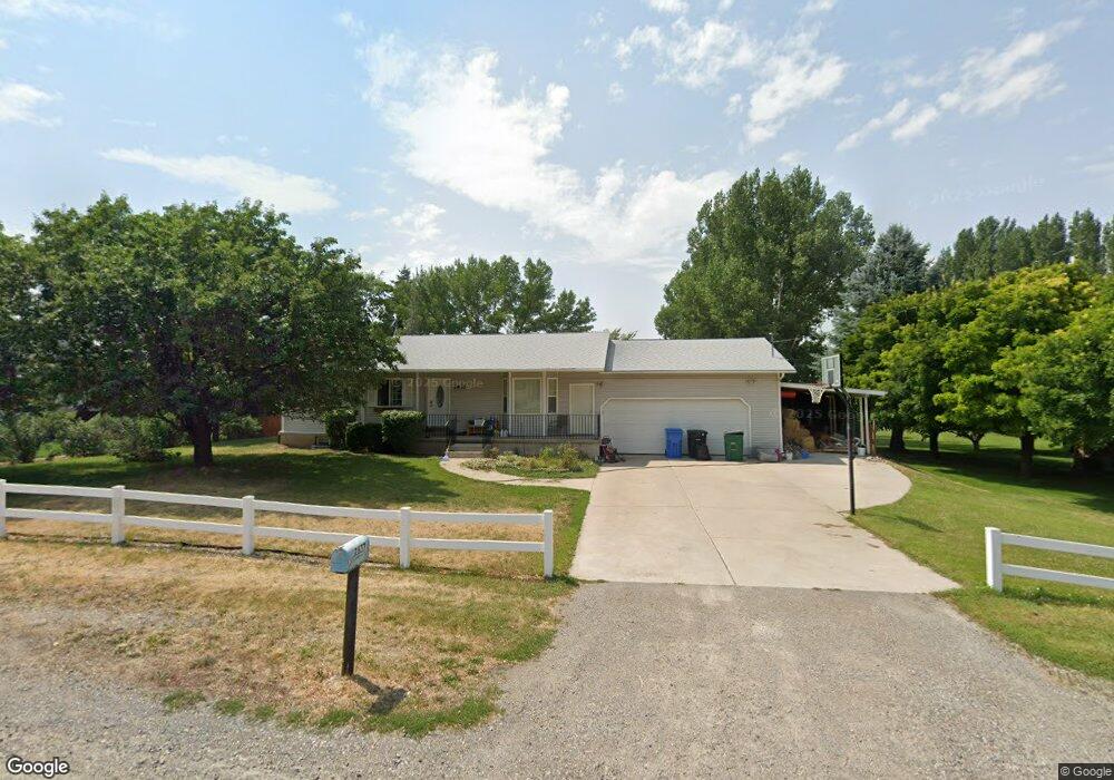
2637 N 1250 E North Logan, UT 84341
Estimated Value: $486,000 - $620,863
5
Beds
3
Baths
2,520
Sq Ft
$220/Sq Ft
Est. Value
About This Home
This home is located at 2637 N 1250 E, North Logan, UT 84341 and is currently estimated at $555,216, approximately $220 per square foot. 2637 N 1250 E is a home located in Cache County with nearby schools including North Park School, Cedar Ridge School, and Cedar Ridge Middle School.
Ownership History
Date
Name
Owned For
Owner Type
Purchase Details
Closed on
Jun 9, 2017
Sold by
Robinson Mont K and Robinson Lauri J
Bought by
Stevens Bryan and Stevens Michelle Muldowney
Current Estimated Value
Home Financials for this Owner
Home Financials are based on the most recent Mortgage that was taken out on this home.
Original Mortgage
$316,665
Outstanding Balance
$262,984
Interest Rate
4.05%
Mortgage Type
VA
Estimated Equity
$292,232
Create a Home Valuation Report for This Property
The Home Valuation Report is an in-depth analysis detailing your home's value as well as a comparison with similar homes in the area
Home Values in the Area
Average Home Value in this Area
Purchase History
| Date | Buyer | Sale Price | Title Company |
|---|---|---|---|
| Stevens Bryan | -- | Hickman Land Title Co |
Source: Public Records
Mortgage History
| Date | Status | Borrower | Loan Amount |
|---|---|---|---|
| Open | Stevens Bryan | $316,665 |
Source: Public Records
Tax History Compared to Growth
Tax History
| Year | Tax Paid | Tax Assessment Tax Assessment Total Assessment is a certain percentage of the fair market value that is determined by local assessors to be the total taxable value of land and additions on the property. | Land | Improvement |
|---|---|---|---|---|
| 2025 | $22 | $312,010 | $0 | $0 |
| 2024 | $2,214 | $288,415 | $0 | $0 |
| 2023 | $2,092 | $255,000 | $0 | $0 |
| 2022 | $2,189 | $255,000 | $0 | $0 |
| 2021 | $217 | $392,710 | $109,000 | $283,710 |
| 2020 | $1,885 | $319,117 | $109,000 | $210,117 |
| 2019 | $1,974 | $319,116 | $109,000 | $210,116 |
| 2018 | $1,707 | $267,710 | $85,000 | $182,710 |
| 2017 | $1,673 | $138,105 | $0 | $0 |
| 2016 | $1,700 | $138,105 | $0 | $0 |
| 2015 | $1,450 | $117,390 | $0 | $0 |
| 2014 | $1,416 | $117,390 | $0 | $0 |
| 2013 | -- | $117,665 | $0 | $0 |
Source: Public Records
Map
Nearby Homes
- 3057 N 1200 E
- 3073 N 1200 E Unit 3
- 1335 E 2300 N
- 1495 E 2300 N
- 1491 E 2300 N
- 945 N 1600 E
- 1593 N 110 W Unit 201
- 611 E 2450 N Unit 1
- 1593 N 110 W Unit 202
- 1593 N 110 W Unit 204
- 1593 N 110 W Unit 203
- 1200 W 1400 N
- 2950 N Mahogony Valley Rd E Unit 7
- 1598 N Sharptail Cir
- 1000 W 2500 N
- 105 E 3100 N
- 710 E 2475 N
- 2377 N 740 E
- 2377 N 740 E Unit 32
- 684 E 2475 N
- 2655 N 1250 E
- 2559 N 1250 E
- 2602 N 1250 E
- 2665 N 1250 E
- 2654 N 1250 E
- 2558 N 1200 E
- 2537 N 1250 E
- 2536 N 1200 E
- 2584 N 1250 E
- 2691 N 1250 E
- 3105 N 1200 E
- 1241 E 2500 N
- 2510 N 1250 E
- 2705 N 1250 E
- 1185 E 2560 N
- 409 E 2700 N
- 443 E 2700 N Unit 1
- 409 E 2700 N Unit 1
- 483 E 2700 N Unit 6
- 471 E 2700 N Unit 5